| Date | Time | Path | Observer | Av Type | Trigger Type | Trigger | Rel Size | Dest Size | Interface | SZ Vert | SZ Horiz | SZ Avg Slope (d) | SZ Aspect | SZ Elev (m) | Term Elev (m) | Vertical (m) | Crown W (m) | Crown hmax (cm) | Crown hmin (cm) | Crown havg (cm) | Term lpath | Term spath | Term Code | Term Moist | Debris Rail | Rail deb width (m) | Rail deb depth (m) | Debris hwy | Hwy deb width (m) | Hwy deb depth (m) | RADS Rating | Notes | Media | |
|---|---|---|---|---|---|---|---|---|---|---|---|---|---|---|---|---|---|---|---|---|---|---|---|---|---|---|---|---|---|---|---|---|---|---|
| 2026-04-06 | Ukn | Goat Lick | - | WS | Natural | - | R1 | D2 | O | T | R | - | W | 2255 | - | - | 40 | 175 | 75 | 125.00 | SZ | TP | - | W | No | 0 | 0 | No | 0 | 0 | 1 | Observed by M. Reavis (FAC) on 6 Apr. Could not view the runout but debris terminated well above Hwy. Few other details known and occurrence date is uncertain. |  |
|
| 2026-03-20 | 23:30:00 | Shed 7 West | Clark | WL | Natural | NC | R1 | D1.5 | O | T | L | 38 | E | 2012 | 1830 | 182 | - | - | - | - | SZ | - | - | W | No | 0 | 0 | No | 0 | 0 | 2 | Obs. on evening of 3/21, but likely ran during the night before when it was still above freezing above 6000'. |  |
|
| 2026-03-20 | 11:00:00 | Path 1163 | Clark | WL | Natural | - | R2 | D2.5 | O | T | C | 40 | S | 2195 | 1400 | 795 | - | - | - | - | MR | - | - | W | No | 0 | 0 | No | 0 | 0 | 2 | Obs on 3/20 around 1630. Date/Time of occurrence estimated. |  |
|
| 2026-03-20 | 11:00:00 | Shed 10 | Clark | WL | Natural | - | R2 | D2 | O | T | L | 40 | SE | 2135 | 1646 | 489 | - | - | - | - | TR | - | - | W | No | 0 | 0 | No | 0 | 0 | 2 | - | No Image | |
| 2026-03-19 | Ukn | Broken Bridge | Clark | WL | Natural | - | R1 | D2 | O | T | - | 40 | N | 2250 | 1830 | 420 | - | - | - | - | TK | - | - | W | No | 0 | 0 | No | 0 | 0 | 2 | Many D1 WL events, with at least a couple reaching D2 size. Activity began on 3/17 and continued through 3/19. | No Image | |
| 2026-03-18 | 15:30:00 | Path 1163 | Clark | WL | Natural | - | R1 | D2 | O | M | L | 45 | SE | 1830 | 1465 | 365 | - | - | - | - | TR | - | - | W | No | 0 | 0 | No | 0 | 0 | 2 | Ran in the looker's upper right couloir and debris ran to about 4800' |  |
|
| 2026-03-18 | 13:00:00 | Larry | Clark | WL | Natural | - | - | D2 | O | T | C | 40 | N | 1830 | 1465 | 365 | - | - | - | - | TK | - | - | W | No | 0 | 0 | No | 0 | 0 | 2 | Ran to about 4800' | No Image | |
| 2026-03-16 | 16:00:00 | Path 1163 | Clark | SS | Natural | - | R2 | D2 | I | T | C | 45 | S | 2165 | 1525 | 640 | 100 | 50 | 25 | 37.50 | TR | - | - | W | No | 0 | 0 | No | 0 | 0 | 3 | Initiated as a dry SS, then entrained wet loose snow on the way down | 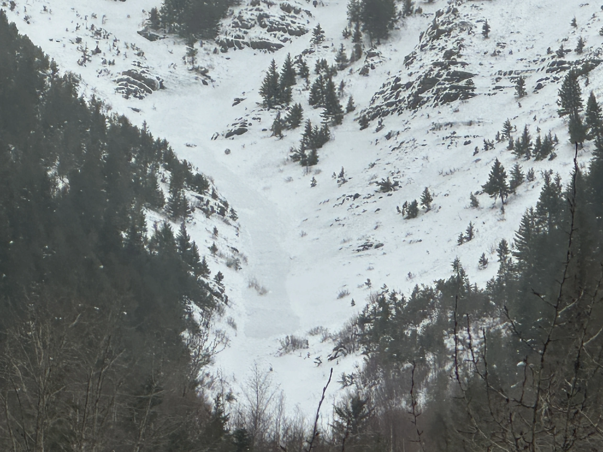 |
|
| 2026-03-13 | Ukn | Grizzly Gulch | - | HS | Natural | NC | R2 | D3 | O | T | R | 40 | E | 2255 | 2134 | 121 | 150 | 200 | 100 | 150.00 | BR | - | - | D | No | 0 | 0 | No | 0 | 0 | 2 | Obs by Mike Reavis from False Shields on 3/15. Estimating that it ran on 3/13 and failed on the Jan facet/crust layer. | 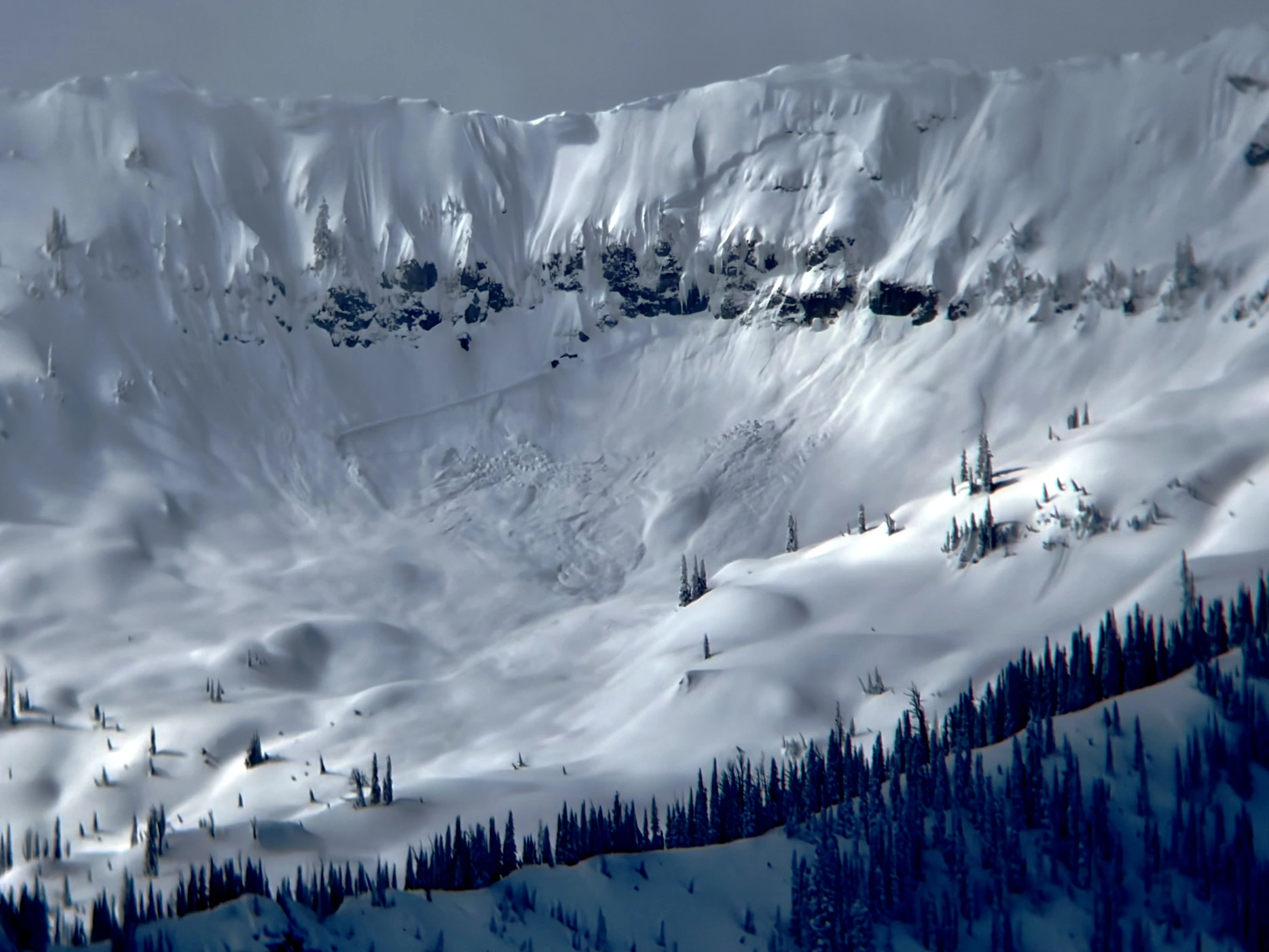 |
|
| 2026-03-12 | Ukn | Broken Bridge | Clark | HS | Natural | - | R2 | D2.5 | O | T | R | 40 | N | 2195 | - | - | 120 | 150 | 100 | 125.00 | U | - | - | - | No | 0 | 0 | No | 0 | 0 | 2 | Obs initially on 3/12, then again with better visibility on 3/14 (photo). Could not view the runout, so many details unknown. | 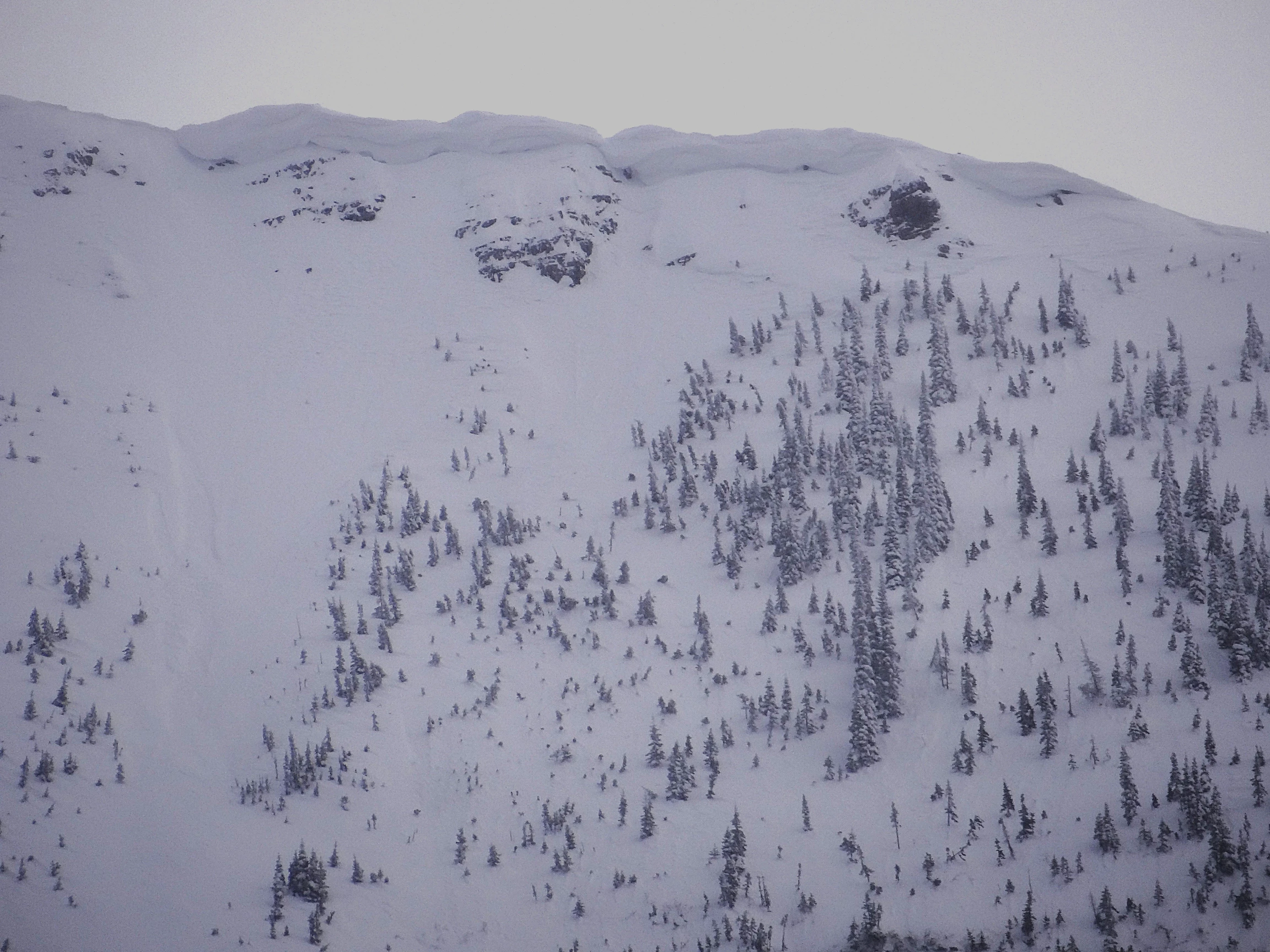 |
|
| 2026-03-12 | Ukn | Path 1163 | Clark | SS | Natural | - | U | D2 | S | T | C | 40 | SE | 2135 | 1525 | 610 | - | - | - | - | TK | - | - | - | No | 0 | 0 | No | 0 | 0 | 2 | Obs initially on 3/12, then again on 3/14 with a better view. Crown mostly filled in, but spotted a remaining bit of crown on 3/14. | 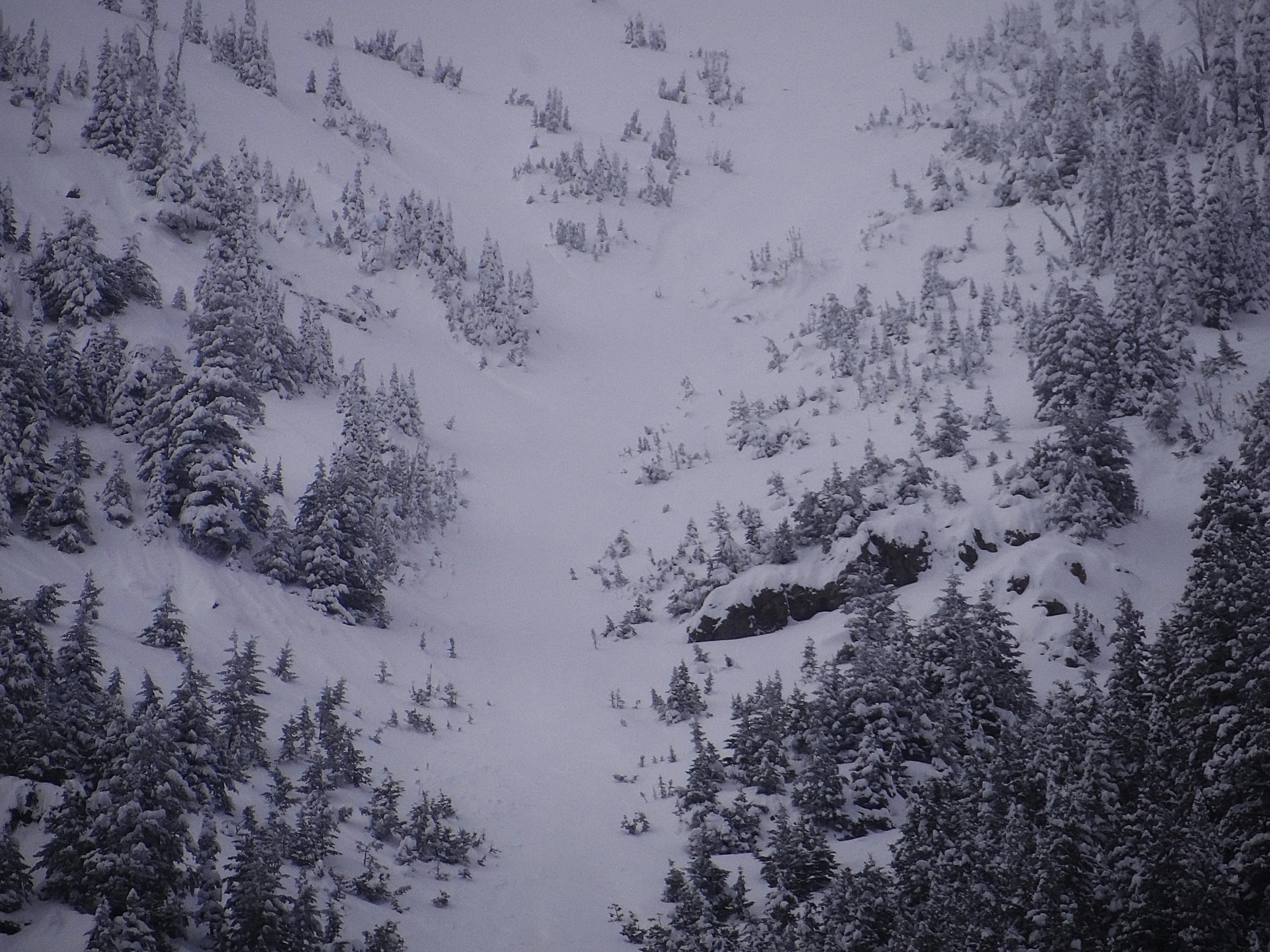 |
|
| 2026-03-12 | Ukn | Shed 7 West | Clark | SS | Natural | - | - | D2 | S | - | - | - | E | 1765 | - | - | - | - | - | - | TK | - | - | - | No | 0 | 0 | No | 0 | 0 | 2 | Saw the debris from this on 3/14 during our ski tour. No crown visible at all. New snow on debris leads us to believe it ran on 3/12. | 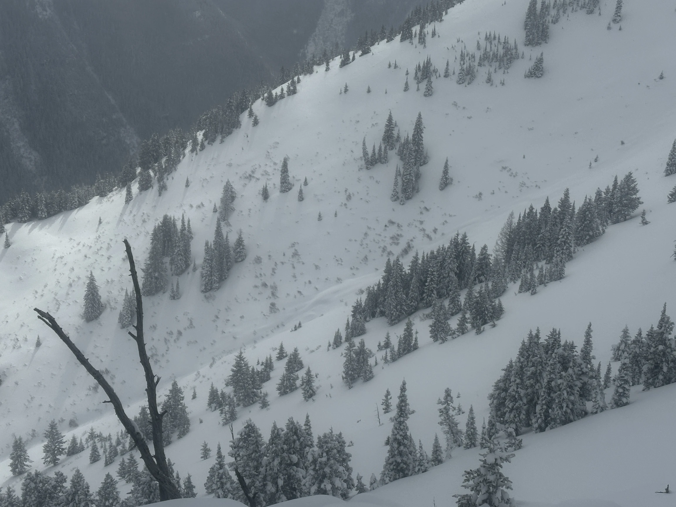 |
|
| 2026-02-17 | Ukn | Shed 10 | Clark | HS | Natural | - | R2 | D2 | O | U | L | - | E | 2195 | - | - | - | - | - | - | U | - | - | - | No | 0 | 0 | No | 0 | 0 | 1 | Obs by FAC forecaster Reavis on 2/19 |  |
|
| 2026-01-07 | Ukn | Broken Bridge | Clark | SS | Natural | - | R2 | D2 | I | T | C | - | N | 2195 | - | - | 60 | 60 | 20 | 40.00 | - | - | - | - | No | 0 | 0 | No | 0 | 0 | 1 | Obs on Jan 8th from the Shed 11 ridge. Could not view the runout and few details known | No Image | |
| 2025-12-10 | 05:00:00 | Test Slope 3 | Clark | SS | Natural | - | R3 | D1.5 | S | T | C | 38 | SE | 1700 | 1650 | 50 | 20 | 30 | 30 | 30.00 | - | BP | - | - | No | 0 | 0 | No | 0 | 0 | 1 | Obs on 12/12 but likely ran on the 10th during the warm storm. |  |
|
| 2025-12-09 | 03:45:00 | I Beam | Clark | SS | Natural | - | R2 | D2 | I | T | L | 40 | W | 2256 | - | - | - | 50 | 25 | 37.50 | - | - | - | - | No | 0 | 0 | No | 0 | 0 | 1 | Obs at 0945, occurrence time estimated. Few details, could not determine the runout |  |
|
| 2025-12-09 | 03:00:00 | Path 1163 Headwall | Clark | WL | Natural | - | R1 | D1.5 | O | T | L | 45 | SW | 1860 | 1585 | 275 | - | - | - | - | TR | MP | - | W | No | 0 | 0 | No | 0 | 0 | 1 | Obs at 0900, occurrence time estimated. | No Image | |
| 2025-12-09 | 03:00:00 | Java | Clark | SS | Natural | - | R2 | D2 | I | - | - | - | E | - | - | - | - | 60 | 30 | 45.00 | - | MP | - | - | No | 0 | 0 | No | 0 | 0 | 1 | Multiple D1-D2 size crowns in each of the three Java Mtn bowls. Could not determine the run outs. Obs at 1000, occurrence time estimated | No Image | |
| 2025-12-09 | 03:00:00 | Java Gauntlet | Clark | WL | Natural | - | R1 | D1 | G | T | L | 40 | E | 1265 | 1220 | 45 | - | - | - | - | BR | BP | - | W | No | 0 | 0 | No | 0 | 0 | 1 | Obs at 0900, lots of mud in the debris | No Image | |
| 2025-12-09 | 03:00:00 | Path 1163 | Clark | SS | Natural | - | R1 | D1.5 | I | T | C | 40 | S | 2134 | 1677 | 457 | 25 | 50 | 25 | 37.50 | TK | - | - | - | No | 0 | 0 | No | 0 | 0 | 1 | Obs at 1000, occurrence time estimated. | 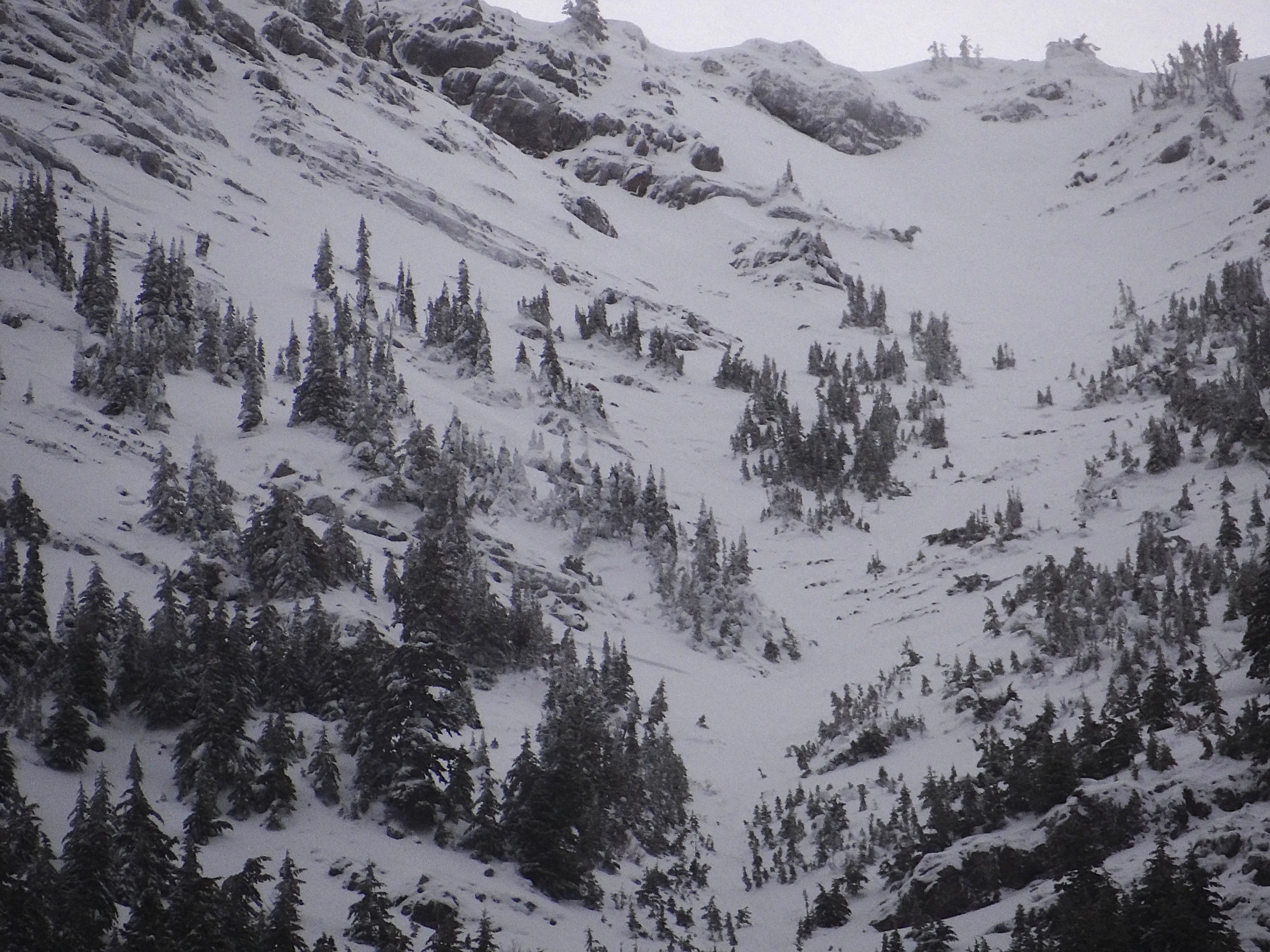 |
|
| 2025-03-27 | Ukn | Shed 7 West | Clark | WS | Natural | - | R2 | D2 | O | T | L | - | E | 2012 | 1700 | 312 | 40 | 150 | 50 | 100.00 | TK | - | - | W | No | 0 | 0 | No | 0 | 0 | 1 | Date estimated. Ran sometime after 1700 on 3/26. Obs on 4/1. looked like failure plane could have been a couple different weak layers in snowpack. | No Image | |
| 2025-03-24 | 14:00:00 | Infinity | Clark | WL | Natural | - | R1 | D1.5 | I | T | C | 40 | S | 1830 | 1525 | 305 | - | - | - | - | TK | - | - | W | No | 0 | 0 | No | 0 | 0 | 2 | Ran in the afternoon. | No Image | |
| 2025-03-24 | 14:00:00 | Shed 7 West | Clark | WL | Natural | - | R2 | D2 | I | T | C | - | E | 2040 | 1640 | 400 | - | - | - | - | TK | - | - | W | No | 0 | 0 | No | 0 | 0 | 2 | Ran this afternoon, Maybe cornice fall trigger? | No Image | |
| 2025-03-24 | 14:00:00 | Shed 10 | Clark | WL | Natural | - | R2 | D2 | I | T | C | 45 | SE | 2135 | 1615 | 520 | - | - | - | - | TK | - | - | W | No | 0 | 0 | No | 0 | 0 | 2 | Shed 10 Feeder. Ran sometime this afternoon. | No Image | |
| 2025-03-24 | 09:00:00 | Path 1163 | Clark | HS | Natural | - | R3 | D2.5 | I | M | R | 40 | SW | 2135 | 1400 | 735 | 120 | 150 | 50 | 100.00 | BR | - | - | W | No | 0 | 0 | No | 0 | 0 | 2 | Ran sometime between 0830 and 1030. | No Image | |
| 2025-03-24 | 08:00:00 | Path 1163 Headwall | Clark | WL | Natural | - | R2 | D2 | I | T | L | 40 | SW | 1830 | 1463 | 367 | - | - | - | - | BR | - | - | W | No | 0 | 0 | No | 0 | 0 | 2 | Ran from the uppermost gully in the lower headwall. | No Image | |
| 2025-03-24 | 08:00:00 | Broken Bridge | Clark | SS | Natural | - | R2 | D2 | I | T | L | 40 | N | 2165 | - | - | 50 | 40 | 30 | 35.00 | U | - | - | U | No | 0 | 0 | No | 0 | 0 | 2 | 2 crown, 1 up top under cornice, another several hundred feet below. Could not view runout. | No Image | |
| 2025-03-24 | 08:00:00 | Larry | Clark | WL | Natural | - | R2 | D2 | I | T | C | 40 | N | 1768 | 1463 | 305 | - | - | - | - | MR | - | - | W | No | 0 | 0 | No | 0 | 0 | 2 | Terminated ~600 vertical feet above highway. | No Image | |
| 2025-03-22 | Ukn | Shed 7 West | Clark | SS | Natural | - | R2 | D2 | I | M | C | - | E | 1980 | - | - | 80 | 75 | 30 | 52.50 | U | - | - | D | No | 0 | 0 | No | 0 | 0 | 2 | Suspect this ran during Mar 22 storm. Crown partially filled back in. | No Image | |
| 2025-02-28 | 17:00:00 | I Beam | Clark | WL | Natural | NU | R1 | D2 | O | T | C | 45 | W | 2225 | 1765 | 460 | - | - | - | - | MR | - | - | W | No | - | - | No | - | - | 2 | Looker's right path. Ran sometime between 1600 and 1730. RADS Level 2. | No Image | |
| 2025-02-28 | 13:00:00 | Path 1163 | Clark | WL | Natural | NU | R1 | D2 | O | T | R | 40 | S | 2195 | 1465 | 730 | - | - | - | - | BR | - | - | W | No | - | - | No | - | - | - | Time Estimated. | No Image | |
| 2025-02-28 | 13:00:00 | Shed 9 Low | Clark | WL | Natural | NU | R2 | D2 | O | - | - | 45 | SW | 1770 | 1555 | 215 | - | - | - | - | TR | - | - | W | No | - | - | No | - | - | 2 | Looker's right, lower headwall.Uppermost gully. Time estimated. RADS Level 2 | No Image | |
| 2025-02-28 | 13:00:00 | Shed 10 | Clark | WL | Natural | NU | R2 | D2 | O | T | C | 45 | SW | 1920 | 1585 | 335 | - | - | - | - | TR | - | - | W | No | - | - | No | - | - | 2 | Looker's right headwall, uppermost gully. Time estimated. RADS Level 2 | No Image | |
| 2025-02-24 | 01:00:00 | Broken Bridge | Clark | HS | Natural | NU | R2 | D2 | O | T | C | 40 | N | 2195 | - | - | 50 | 100 | 20 | 60.00 | U | - | - | U | No | - | - | No | - | - | 3 | Could not view the debris terminus. RADS Level 3 | No Image | |
| 2025-02-24 | 01:00:00 | Curly | Clark | HS | Natural | NU | R3 | D2.5 | O | T | C | 45 | N | 1800 | 1390 | 410 | - | - | - | - | BR | - | - | W | No | - | - | No | - | - | 3 | Initiated as a slab in SZ.Good view of crown on 2/28 on shed 8 ski tour. RADS Level 3 | No Image | |
| 2025-02-24 | 01:00:00 | I Beam | Clark | HS | Natural | NU | R3 | D2.5 | O | T | C | 40 | W | 2226 | 1525 | 701 | 145 | 100 | 25 | 62.50 | TK | - | - | W | No | - | - | No | - | - | 3 | I Beam Right, debris passed confluence and terminus elev estimated. RADS:3 | No Image | |
| 2025-02-24 | 01:00:00 | Infinity | Clark | SS | Natural | NU | R2 | D2 | I | T | R | 40 | SW | 1880 | 1615 | 265 | - | 50 | 15 | 32.50 | TK | - | - | U | No | - | - | No | - | - | 3 | Much of crown was filled in. Entrained wet snow on the way down. Investigated on 2/27. Failed w/in old wind slab. cut out 2nd slab that failed on Jan. FCs RADS:3 | No Image | |
| 2025-02-24 | 01:00:00 | Path 1163 | Clark | HS | Natural | NU | R3 | D3 | O | T | C | 40 | S | 2195 | 1370 | 825 | 150 | 150 | 50 | 100.00 | BR | - | - | W | No | - | - | No | - | - | 3 | Crown at very top of path. High wet snow entrainment. Visited debris on Mar 5. Ran to 4500' (83% to the rail) 20+ ft deep in places, 5-8'' trees snapped. RADS:3 | No Image | |
| 2025-02-24 | 01:00:00 | Shed 8 | Clark | HS | Natural | NU | R2 | D2 | O | T | R | 38 | S | 1920 | 1525 | 395 | 70 | 150 | 30 | 90.00 | MR | - | - | W | No | - | - | No | - | - | 3 | 400' Vert down track. RADS Level 3 | No Image | |
| 2025-02-24 | 01:00:00 | Shed 10 | Clark | SS | Natural | NU | R3 | D2 | I | T | C | 45 | SE | 2115 | 1615 | 500 | 65 | 75 | 25 | 50.00 | TK | - | - | W | No | - | - | No | - | - | 3 | Ran about 1/3 path, shallow crown mostly out of sight. (shed 10 feeder) RADS Level 3 | No Image | |
| 2025-02-23 | 15:00:00 | Larry | Clark | SS | Natural | NU | R2 | D2 | O | T | C | 40 | N | 1800 | 1400 | 400 | - | - | - | - | MR | - | - | W | No | - | - | No | - | - | 3 | Terminated on bench above Hwy. RADS Level 3 | No Image | |
| 2025-02-23 | 14:00:00 | Burn Out | Clark | WL | Natural | NU | R2 | D2 | O | M | R | 40 | E | 1480 | 1380 | 100 | - | - | - | - | BR | - | - | W | No | - | - | No | - | - | - | Debris terminated on top of wall 6' deep 30' wide, slide fence wires did not break- no signal detection. | No Image | |
| 2025-02-23 | 14:00:00 | Shed 4D | Clark | WL | Natural | NU | R1 | D1.5 | O | B | R | 45 | E | 1432 | 1370 | 62 | - | - | - | - | BR | - | - | W | No | - | - | No | - | - | 3 | Lower looker's right side of path in steep, rocky area, ran in the afternoon. Looked like a crown up high. RADS Level 3 | No Image | |
| 2025-02-23 | 10:00:00 | Blue Rock East | Clark | WL | Natural | - | R2 | D1.5 | O | T | C | 45 | SE | 1130 | 1067 | 63 | - | - | - | - | BR | - | - | W | No | 0 | 0 | Yes | 1 | 3 | 2 | Mult. Slides w/4 reaching the hwy. Debris just over the white line in eastbound lane. | No Image | |
| 2025-02-23 | 08:00:00 | Path 1163 | Clark | WL | Natural | NU | U | D2 | O | U | U | 40 | S | - | - | - | - | - | - | - | MR | - | - | M | No | - | - | No | - | - | 3 | Ran in main path to about 4900'. RADS Level 3 | No Image | |
| 2025-02-23 | 07:30:00 | Shed 12 | Clark | WL | Natural | NU | R4 | D2 | O | T | C | 45 | E | 1340 | 1189 | 151 | - | - | - | - | BR | - | - | W | No | - | - | No | - | - | - | 4+ events. Estimated time~ 3 AM. Obs at 1700. Debris deposited on Shed 12 Roof @ rail grade elevation. 1 meter width, 3 meter depth. | No Image | |
| 2025-02-22 | 14:00:00 | Umbrella | Clark | WL | Natural | NU | R2 | D1.5 | O | T | R | 45 | E | 1372 | 1354 | 18 | - | - | - | - | BR | - | - | W | Yes | 2 | 0.5 | No | - | - | - | Obs by Fernandez at 1400. Trains easily plowed through debris. | No Image | |
| 2025-02-05 | 02:00:00 | Infinity | Clark | SS | Natural | NU | R2 | D2 | I | T | C | 40 | S | 1890 | 1525 | 365 | - | 100 | 20 | 60.00 | TK | - | - | D | No | - | - | No | - | - | - | Estimated time of event. Obs @ 0900. Debris ran half-path to rail grade. | No Image | |
| 2025-02-05 | 02:00:00 | Path 1163 | Clark | SS | Natural | NU | R2 | D2 | I | T | R | 40 | S | 2195 | 1433 | 762 | 100 | 100 | 20 | 60.00 | BR | - | - | D | No | - | - | No | - | - | - | Obs on 2/7. Date/Time estimated. | No Image | |
| 2025-02-01 | Ukn | Shed 12 | Clark | WL | Natural | NU | R2 | D1.5 | O | T | C | 45 | E | 1340 | 1189 | 151 | - | - | - | - | BR | - | - | W | Yes | 12 | 2 | No | - | - | - | Date estimated. Debris terminated on Shed 12 roof @ track elevation. | No Image | |
| 2025-01-28 | Ukn | Path 1163 | Clark | WL | Natural | NU | R1 | D1.5 | O | T | C | 40 | S | 2134 | 1455 | 679 | - | - | - | - | BR | - | - | W | No | - | - | No | - | - | - | Date estimated. Obs. on 1/30/2025 | No Image | |
| 2025-01-15 | 14:00:00 | Path 1163 | Clark | WL | Natural | NU | R2 | D2 | O | T | C | - | S | 2134 | 1465 | 669 | - | - | - | - | BR | - | - | W | No | - | - | No | - | - | - | Time estimated obs. Jan 17th photos. | No Image | |
| 2025-01-15 | 14:00:00 | Shed 10 | Clark | WL | Natural | NU | R1 | D1.5 | O | T | R | 40 | SW | 1830 | 1525 | 305 | - | - | - | - | TR | - | - | W | No | - | - | No | - | - | - | Time Estimated. Obs on 1/17/2025. | No Image | |
| 2025-01-15 | 14:00:00 | Shed 10 | Clark | WS | Natural | NU | R1 | D1.5 | O | T | C | 40 | S | 2134 | 1677 | 457 | - | - | - | - | TR | - | - | W | No | - | - | No | - | - | - | Shed 10 Feeder. Time estimated. Obs. on 1/17/2025 | No Image | |
| 2025-01-06 | 15:00:00 | Path 1163 Headwall | Clark | L | Natural | NU | R1 | D1.5 | I | T | L | 45 | SW | 1830 | 1400 | 430 | - | - | - | - | BR | - | - | M | No | - | - | No | - | - | - | - | No Image | |
| 2025-01-04 | 01:00:00 | Infinity | Clark | SS | Natural | NU | U | D2 | I | - | - | - | S | 1860 | 1555 | 305 | - | - | - | - | TK | - | - | U | No | - | - | No | - | - | - | Details estimated. No crown visible... Only debris in track. From looker's left- largest gully. | No Image | |
| 2024-12-18 | Ukn | Grizzly Gulch | Clark | SS | Natural | NU | R2 | D2 | I | T | - | - | E | 2042 | 1735 | 307 | 100 | 20 | 10 | 15.00 | BR | - | - | M | No | - | - | No | - | - | - | 2 Events. Two avalanches released in multiple locations @ SZ elevation. | No Image | |
| 2024-12-18 | Ukn | Grizzly Gulch | Clark | SS | Natural | NU | R1 | D1 | I | T | - | - | - | 2040 | 1735 | 305 | - | - | - | - | MR | - | - | M | No | - | - | No | - | - | - | 4 Events, multiple release locations @ SZ elevation. | No Image | |
| 2024-03-18 | 19:30:00 | Path 1163 | Clark | WS | Natural | N | R2 | D2.5 | O | T | L | 40 | SE | 2070 | 1400 | 670 | 150 | 100 | 50 | 75.00 | BR | - | U | W | No | 0 | 0 | No | 0 | 0 | - | Ran sometime on Mar 18 during daylight hours. |  |
|
| 2024-03-17 | 19:50:00 | Shed 10 | Clark | WL | Natural | N | R2 | D1.5 | O | T | C | 40 | SE | 1980 | 1675 | 305 | 0 | 0 | 0 | 0.00 | TK | - | U | W | No | 0 | 0 | No | 0 | 0 | - | Ran sometime Mar 17 during daylight hours | No Image | |
| 2024-03-16 | 17:00:00 | I Beam | Clark | HS | Natural | NL | R2 | D2 | O | T | L | 40 | SW | 2165 | 1790 | 375 | 100 | 150 | 50 | 100.00 | TK | - | U | W | No | 0 | 0 | No | 0 | 0 | - | I Beam Left Ran sometime on Mar 16 during daylight hours. Possibly 2 separate events? | 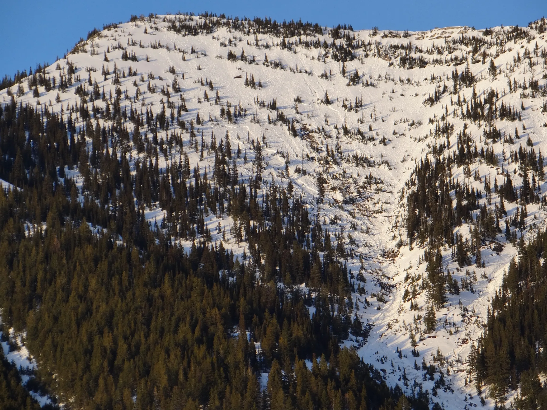 |
|
| 2024-03-16 | 17:00:00 | I Beam | Clark | HS | Natural | NL | R3 | D2 | O | T | L | 40 | SW | 2165 | 1765 | 400 | 75 | 150 | 50 | 100.00 | TK | - | U | W | No | 0 | 0 | No | 0 | 0 | - | I Beam Center Ran sometime on Mar. 16 during daylight hours. Another D2 event (maybe WS?) ran on Mar. 17 and occurred above the crown in photo | 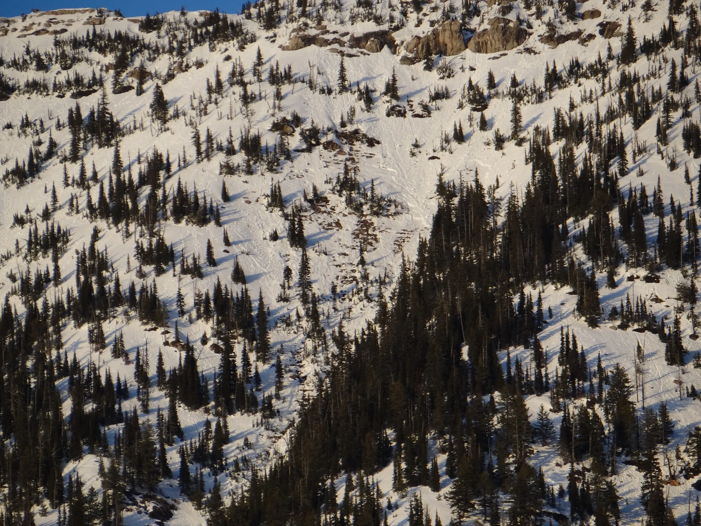 |
|
| 2024-03-16 | 17:00:00 | I Beam | Clark | HS | Natural | NL | R3 | D2.5 | O | T | L | 40 | SW | 2165 | 1700 | 465 | 100 | 150 | 50 | 100.00 | TK | - | U | W | No | 0 | 0 | No | 0 | 0 | - | I Beam Right Ran sometime on Mar 16 during daylight hours |  |
|
| 2024-03-15 | 17:00:00 | Mount Shields | Steiner | HS | Natural | N | R3 | D3 | O | T | L | 0 | SE | 2036 | 1638 | 398 | 250 | 90 | 60 | 75.00 | U | - | U | M | No | 0 | 0 | No | 0 | 0 | - | Triggered during clear day, intense solar and warming temperatures well above freezing. Crown extends across slope and along sub-ridge into Shields Creek basin. | No Image | |
| 2024-03-15 | 16:20:00 | Elk Mountain | Steiner | HS | Natural | NC | R3 | D2 | O | T | C | 40 | SE | 2156 | 0 | 2156 | 75 | 60 | 60 | 60.00 | U | - | U | U | No | 0 | 0 | No | 0 | 0 | - | Occurred on slope just below ridge between Elk Mountain an Little Dog Mountain. Outside Program Area. | No Image | |
| 2024-03-15 | 16:00:00 | Elk Mountain | Steiner | HS | Natural | NU | R3 | D3 | O | M | L | 0 | E | 1976 | 1605 | 371 | 120 | 180 | 90 | 135.00 | MR | - | 2F | M | No | 0 | 0 | No | 0 | 0 | - | East/ Southeast aspect. Below northeast ridge of Elk Mountain, Steep, rocky, and unsupported slope. | No Image | |
| 2024-02-29 | 10:30:00 | Shed 7 West | Clark | HS | Natural | NU | R2 | D2.5 | O | M | C | 40 | SE | 1980 | 1580 | 400 | 125 | 150 | 50 | 100.00 | TK | - | U | D | No | 0 | 0 | No | 0 | 0 | - | Likely ran early this morning. Reached to w/in 50 m of crown on Feb 29. Believe this failed on early Feb FCs on top Feb 3 MFC |  |
|
| 2024-02-29 | 10:00:00 | Broken Bridge | Clark | HS | Natural | NU | R3 | D2.5 | O | T | C | 45 | N | 0 | 0 | 0 | 100 | 200 | 50 | 125.00 | U | - | U | U | No | 0 | 0 | No | 0 | 0 | - | Likely ran early this morning. Upper crown was near 7000' elev. Runout UNK 2 D2.5 events in this path |  |
|
| 2024-02-29 | 10:00:00 | Path 1163 | Clark | HS | Natural | N | R3 | D2.5 | O | T | L | 45 | SE | 2134 | 1400 | 734 | 155 | 150 | 50 | 100.00 | MR | - | U | D | No | 0 | 0 | No | 0 | 0 | - | Likely ran early this morning |  |
|
| 2024-01-30 | 16:50:00 | Hanging Tree Main | Clark | HS | Natural | NU | R4 | D2.5 | O | T | C | 45 | W | 0 | 0 | 0 | 55 | 70 | 30 | 50.00 | U | - | U | U | No | 0 | 0 | No | 0 | 0 | - | Crown was obs at 6800' at the top of the path. Estimated it ran on Sunday, Jan. 28. Unk runout |  |
|
| 2024-01-30 | 14:00:00 | Hanging Tree Main | Clark | WS | Artificial : Human | AS | R1 | D1 | I | U | U | 0 | SW | 2073 | 2070 | 3 | 3 | 40 | 40 | 40.00 | U | TP | U | W | No | 0 | 0 | No | 0 | 0 | - | Located on ridge between Hanging Tree Main and IBeam. Triggered by us skinning up |  |
|
| 2024-01-29 | 15:00:00 | Path 1163 | Clark | WL | Natural | NU | R2 | D2.5 | O | T | C | 45 | S | 2195 | 1400 | 795 | 0 | 0 | 0 | 0.00 | BR | - | U | U | No | 0 | 0 | No | 0 | 0 | - | Ran sometime in last 24 hours | No Image | |
| 2024-01-29 | 15:00:00 | Shed 10 | Clark | WL | Natural | NU | R2 | D2 | O | T | C | 45 | SE | 2070 | 1615 | 455 | 0 | 0 | 0 | 0.00 | TR | - | U | U | No | 0 | 0 | No | 0 | 0 | - | Ran sometime in last 24 hours |  |
|
| 2024-01-29 | 14:15:00 | I Beam | Clark | HS | Natural | NU | R3 | D3 | O | T | L | 45 | SW | 2256 | 1700 | 556 | 245 | 100 | 50 | 75.00 | TK | - | U | U | No | 0 | 0 | No | 0 | 0 | - | Path: I-Beam Left (Main) Crown and run out estimated. D3 or D2.5? Ran sometime in last 24 hours |  |
|
| 2024-01-29 | 14:15:00 | I Beam | Clark | HS | Natural | NU | R3 | D2.5 | O | T | C | 45 | SW | 2225 | 1700 | 525 | 155 | 100 | 50 | 75.00 | TK | - | U | U | No | 0 | 0 | No | 0 | 0 | - | Path: I-Beam Center Crown and runout estimated. Ran in last 24 hours |  |
|
| 2024-01-29 | 14:15:00 | I Beam | Clark | HS | Natural | NU | R4 | D3 | O | T | C | 45 | W | 2225 | 1700 | 525 | 215 | 100 | 50 | 75.00 | TK | - | U | U | No | 0 | 0 | No | 0 | 0 | - | Path: I-Beam Right Crown dimensions and runout estimated. Ran in last 24 hours |  |
|
| 2024-01-29 | 14:00:00 | Goat Lick | Clark | HS | Natural | N | R2 | D2 | O | T | L | 45 | SW | 2165 | 1400 | 765 | 122 | 100 | 50 | 75.00 | TK | - | U | U | No | 0 | 0 | No | 0 | 0 | - | Path: Goat Lick Main Crown and runout dimensions estimated. Ran sometime in last 24 hours |  |
|
| 2024-01-29 | 14:00:00 | Goat Lick | Clark | HS | Natural | N | R3 | D2.5 | O | T | C | 45 | W | 2134 | 1400 | 734 | 182 | 100 | 50 | 75.00 | TK | - | U | U | No | 0 | 0 | No | 0 | 0 | - | Path: Goat Lick Center Crown dimensions and runout estimated. Maybe D3? Ran sometime in last 24 hours |  |
|
| 2024-01-29 | 14:00:00 | Goat Lick | Clark | HS | Natural | NU | R2 | D2.5 | O | T | R | 45 | W | 2285 | 1400 | 885 | 150 | 100 | 50 | 75.00 | TK | - | U | U | No | 0 | 0 | No | 0 | 0 | - | Path: Goat Lick High Crown dimensions and runout estimated. Maybe D3? Ran in last 24 hours | 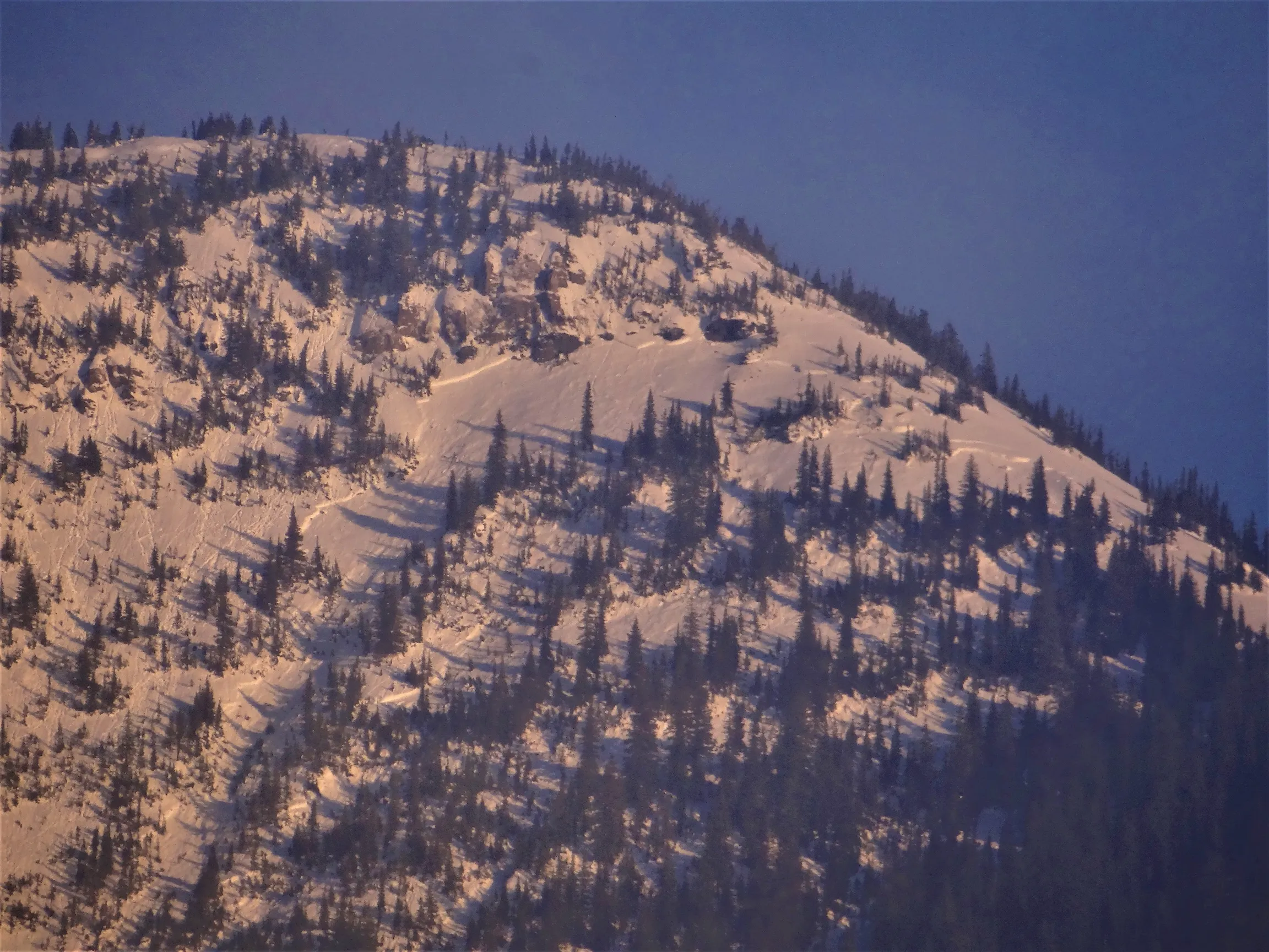 |
|
| 2024-01-19 | 16:30:00 | Umbrella | Clark | SS | Natural | NU | R2 | D1 | I | M | C | 45 | SE | 1400 | 1340 | 60 | 15 | 20 | 15 | 17.50 | BR | - | U | D | Yes | 0 | 0 | No | 0 | 0 | - | Buried 6 or 7 slide fence wires. Ran sometime in the night of Jan. 17th |  |
|
| 2024-01-18 | 10:30:00 | Mount Shields | Clark | U | Natural | N | R2 | D2 | U | M | R | 40 | E | 1980 | 0 | 1980 | 0 | 0 | 0 | 0.00 | U | - | U | D | No | 0 | 0 | No | 0 | 0 | - | Ran sometime last night during the storm. No other details known. Could not view runout or debris terminus | 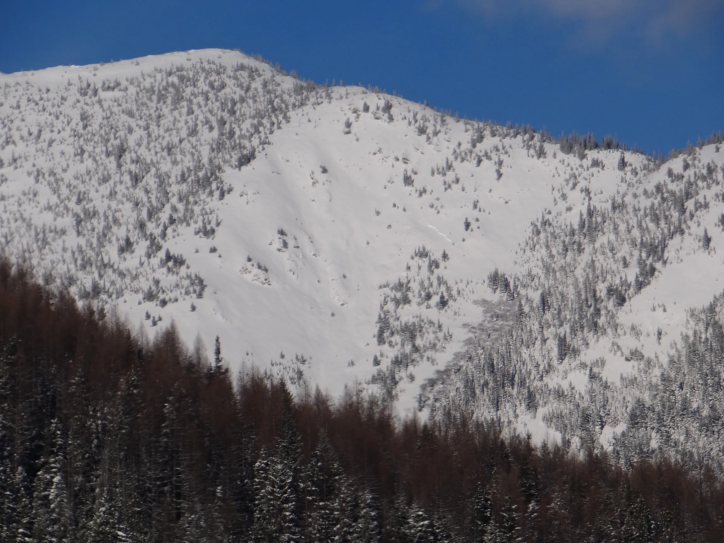 |
|
| 2024-01-18 | 10:00:00 | Shed 4D | Clark | SS | Natural | N | R1 | D1.5 | S | B | R | 45 | E | 1435 | 1380 | 55 | 30 | 20 | 10 | 15.00 | U | BP | U | D | No | 0 | 0 | No | 0 | 0 | - | Numerous D1 SS crowns on the scarp above the Shed and the cutbank w/ no shed. Ran last night during the storm | No Image | |
| 2024-01-18 | 09:50:00 | Shed 7 West | Clark | SS | Natural | N | U | D2 | I | M | R | 40 | SE | 1980 | 1830 | 150 | 0 | 0 | 0 | 0.00 | SZ | - | U | D | No | 0 | 0 | No | 0 | 0 | - | Remnants of a crown and debris, partially re-buried by recent snow. Terminus estimated. Few details known. Ran last night during the storm. | No Image | |
| 2024-01-18 | 09:45:00 | Path 1163 Headwall | Clark | U | Natural | N | U | D1.5 | S | T | L | 45 | SW | 1860 | 1585 | 275 | 0 | 0 | 0 | 0.00 | TK | - | U | D | No | 0 | 0 | No | 0 | 0 | - | Could only see debris pile. SZ elev estimated. Ran sometime last night during storm. | No Image | |
| 2024-01-18 | 09:45:00 | Path 1163 | Clark | SS | Natural | N | U | D2 | I | U | U | 0 | S | 0 | 0 | 0 | 0 | 0 | 0 | 0.00 | TK | - | U | D | No | 0 | 0 | No | 0 | 0 | - | D2 size debris about halfway down the path with some recent snowfall on top. Ran last night. No other details known | No Image | |
| 2024-01-12 | 09:15:00 | Shed 9 | Clark | HS | Natural | N | R2 | D2 | O | M | L | 35 | SE | 2012 | 1830 | 182 | 100 | 120 | 30 | 75.00 | TK | - | U | D | No | 0 | 0 | No | 0 | 0 | - | Viewed from Hwy and might be a larger avalanche than I can tell. Debris terminus estimated. Ran sometime in last 48 hours. Investigated on Jan 19. HS failing on FCs on top late Dec crust |  |
|
| 2024-01-12 | 09:00:00 | Path 1163 | Clark | SS | Natural | N | R1 | D2 | I | M | L | 0 | SE | 1980 | 1525 | 455 | 40 | 50 | 20 | 35.00 | TK | - | U | D | No | 0 | 0 | No | 0 | 0 | - | Multiple crowns in this path. Most D1-1.5, but a couple likely D2s. Ran sometime previous 48 hrs |  |
|
| 2024-01-12 | 09:00:00 | Shed 10 | Clark | SS | Natural | N | R1 | D2 | I | T | L | 0 | E | 2225 | 2100 | 125 | 50 | 50 | 20 | 35.00 | SZ | - | U | D | No | 0 | 0 | No | 0 | 0 | - | Multiple crowns here. Some reaching D2, many others smaller. Debris terminus unverified and estimated. Ran sometime in last 48 hours |  |
|
| 2024-01-11 | 14:30:00 | Java Gauntlet | Clark | SS | Natural | N | R2 | D1.5 | O | T | L | 45 | NE | 1250 | 1220 | 30 | 35 | 30 | 15 | 22.50 | U | BP | U | D | No | 0 | 0 | No | 0 | 0 | - | Obs from Hwy. Suspect it ran earlier that day or night before. | No Image | |
| 2024-01-10 | 08:30:00 | Shed 6 | Clark | SS | Natural | NU | R1 | D1.5 | O | B | L | 45 | E | 1402 | 1370 | 32 | 25 | 30 | 15 | 22.50 | U | BP | U | D | No | 0 | 0 | No | 0 | 0 | - | Obs at daybreak but ran sometime earlier in the night. Failed on depth hoar at the ground |   |
|
| 2023-04-10 | 15:25:00 | Curly | Clark | WL | Natural | NU | R2 | D2 | O | U | U | 0 | N | 1800 | 1330 | 470 | 0 | 0 | 0 | 0.00 | BR | - | U | W | No | 0 | 0 | No | 0 | 0 | - | Debris terminated at base of sloped terrain about 125m from the highway | No Image | |
| 2023-04-10 | 13:45:00 | Larry | Clark | WL | Natural | NU | R3 | D2 | O | U | U | 0 | N | 1900 | 1295 | 605 | 0 | 0 | 0 | 0.00 | U | - | U | W | No | 0 | 0 | No | 0 | 0 | - | Debris reached Canyon floor and about 45 m from the highway | No Image | |
| 2023-03-19 | 18:00:00 | Path 1163 | Clark | WL | Natural | N | R1 | D2 | O | T | R | 40 | SW | 2134 | 1400 | 734 | 0 | 0 | 0 | 0.00 | BR | - | U | W | No | 0 | 0 | No | 0 | 0 | - | No Image | ||
| 2023-03-18 | 18:00:00 | Path 1163 | Clark | WL | Natural | N | R1 | D2 | I | T | L | 40 | S | 1830 | 1400 | 430 | 0 | 0 | 0 | 0.00 | MR | - | U | W | No | 0 | 0 | No | 0 | 0 | - | 4 new avalanches in this path since Mar 17 | No Image | |
| 2023-03-17 | 15:30:00 | Path 1163 | Clark | WL | Natural | NU | R1 | D1.5 | I | T | L | 40 | S | 2152 | 1818 | 334 | 0 | 0 | 0 | 0.00 | TK | - | U | W | No | 0 | 0 | No | 0 | 0 | - | No Image | ||
| 2023-03-17 | 15:30:00 | Shed 10 | Clark | WL | Natural | N | R3 | D1.5 | I | T | C | 40 | SW | 1848 | 1545 | 303 | 0 | 0 | 0 | 0.00 | TR | - | U | W | No | 0 | 0 | No | 0 | 0 | - | No Image | ||
| 2023-03-14 | 13:00:00 | Burn Out | Clark | WL | Natural | NU | R1 | D2 | O | M | C | 40 | SE | 1463 | 1372 | 91 | 0 | 0 | 0 | 0.00 | BR | - | U | W | No | 0 | 0 | No | 0 | 0 | - | Triggered by rain... Estimated release time: 0100. Terminated on top of retaining wall. | No Image | |
| 2023-03-14 | 09:00:00 | Curly | Clark | WL | Natural | N | U | D2 | U | U | U | 0 | N | 0 | 0 | 0 | 0 | 0 | 0 | 0.00 | BR | - | U | W | No | 0 | 0 | No | 0 | 0 | - | Ran to about 4500' elevation | No Image | |
| 2023-03-12 | 17:30:00 | Jakes (MP 1161.9) | Clark | WL | Natural | N | R4 | D2 | O | T | C | 45 | S | 1525 | 1280 | 245 | 0 | 0 | 0 | 0.00 | BR | - | U | W | No | 0 | 0 | No | 0 | 0 | - | Almost reached the grade | No Image | |
| 2023-03-12 | 17:00:00 | Burn Out | Clark | WL | Natural | NU | R1 | D1 | I | T | R | 40 | SE | 1463 | 1372 | 91 | 0 | 0 | 0 | 0.00 | BR | - | U | W | No | 0 | 0 | No | 0 | 0 | - | No Image | ||
| 2023-03-12 | 17:00:00 | Shed 12 | Clark | WL | Natural | N | R2 | D1.5 | I | T | R | 40 | S | 1310 | 1190 | 120 | 0 | 0 | 0 | 0.00 | BR | - | U | W | No | 0 | 0 | No | 0 | 0 | - | Three (3) separate avalanches. Pretty exciting. | No Image | |
| 2023-03-11 | 16:00:00 | Path 1163 | Clark | WL | Natural | N | R1 | D1.5 | I | U | U | 45 | S | 1980 | 1435 | 545 | 0 | 0 | 0 | 0.00 | BR | - | U | W | No | 0 | 0 | No | 0 | 0 | - | Estimating five (5) different WL avalanches in this observation. | No Image | |
| 2023-02-24 | 12:20:00 | Snowshed Headwall | Clark | U | Natural | NU | U | D2.5 | U | M | L | 0 | SE | 0 | 0 | 0 | 0 | 0 | 0 | 0.00 | U | - | U | U | No | 0 | 0 | No | 0 | 0 | - | SE face of Snowshed Mountain. Ran on the 20th or 21st of February | No Image | |
| 2023-02-22 | 08:00:00 | Shed 10 | Clark | SS | Natural | N | U | D2 | U | U | U | 40 | N | 0 | 1636 | -1636 | 0 | 0 | 0 | 0.00 | TK | - | U | D | No | 0 | 0 | No | 0 | 0 | - | Released from West facing feeder path. | No Image | |
| 2023-02-21 | 15:30:00 | Shed 10 | Clark | SS | Natural | N | U | D1.5 | U | T | C | 40 | N | 0 | 1667 | -1667 | 0 | 0 | 0 | 0.00 | TK | - | U | D | No | 0 | 0 | No | 0 | 0 | - | Released in the Looker's Right feeder path. | No Image | |
| 2023-02-21 | 08:45:00 | Infinity | Clark | SS | Natural | N | R2 | D2 | U | U | U | 40 | SE | 1848 | 1364 | 484 | 30 | 60 | 30 | 45.00 | MR | - | U | D | No | 0 | 0 | No | 0 | 0 | - | Estimated time of release: 0400 | No Image | |
| 2023-02-21 | 08:30:00 | Path 1163 | Clark | SS | Natural | N | U | D2 | U | U | U | 40 | SE | 0 | 1394 | -1394 | 0 | 0 | 0 | 0.00 | TK | - | U | D | No | 0 | 0 | No | 0 | 0 | - | Estimated time of release: 0400 | No Image | |
| 2023-01-28 | 11:20:00 | Shed 10 | Clark | U | Natural | N | U | D2 | I | T | C | 40 | SE | 0 | 1606 | -1606 | 0 | 0 | 0 | 0.00 | TK | - | U | D | No | 0 | 0 | No | 0 | 0 | - | Terminus debris only attribute visible during observation. | No Image | |
| 2023-01-28 | 11:15:00 | Path 1163 | Clark | U | Natural | N | U | D2 | U | U | U | 0 | N | 0 | 1455 | -1455 | 0 | 0 | 0 | 0.00 | TK | - | U | D | No | 0 | 0 | No | 0 | 0 | - | Could not observe avalanche crown nor starting zone... Obscured | No Image | |
| 2022-12-27 | 13:30:00 | Shed 4D | Clark | WL | Natural | N | R1 | D1.5 | O | M | L | 40 | N | 1592 | 0 | 1592 | 1433 | 0 | 0 | 0.00 | BR | - | - | W | No | 0 | 0 | No | 0 | 0 | - | No Image | ||
| 2022-12-27 | 13:30:00 | Shed 6 | Clark | HS | Natural | N | R2 | D1.5 | G | B | L | 40 | SE | 1465 | 1401 | 64 | 50 | 100 | 50 | 75.00 | - | BP | U | W | No | 0 | 0 | No | 0 | 0 | - | On steep cut bank above Shed 6 | No Image | |
| 2022-12-27 | 08:45:00 | Path 1163 | Clark | WL | Natural | N | R2 | D2.5 | O | M | L | 40 | SE | 1910 | 1274 | 636 | 0 | 0 | 0 | 0.00 | BR | - | U | W | No | 0 | 0 | No | 0 | 0 | - | No Image | ||
| 2022-12-27 | 08:45:00 | Shed 10 | Clark | WL | Natural | N | R1 | D1.5 | O | M | R | 40 | S | 1752 | 1400 | 352 | 0 | 0 | 0 | 0.00 | TR | - | U | W | No | 0 | 0 | No | 0 | 0 | - | No Image | ||
| 2022-12-27 | 04:30:00 | Path 1163 | Clark | WL | Natural | N | R1 | D2.5 | G | U | U | 0 | SE | 1670 | 1370 | 300 | 0 | 0 | 0 | 0.00 | TK | - | U | W | No | 0 | 0 | No | 0 | 0 | - | No Image | ||
| 2022-12-27 | 04:30:00 | Second Slide | Clark | WL | Natural | N | R1 | D1.5 | O | U | U | 0 | SW | 1693 | 1439 | 254 | 0 | 0 | 0 | 0.00 | TK | - | U | W | No | 0 | 0 | No | 0 | 0 | - | No Image | ||
| 2022-12-26 | 09:00:00 | Path 1163 | Clark | WL | Natural | N | R1 | D2 | I | U | U | 0 | SE | 2135 | 1472 | 663 | 0 | 0 | 0 | 0.00 | U | - | U | U | No | 0 | 0 | No | 0 | 0 | - | No Image | ||
| 2022-12-26 | 09:00:00 | Shed 7 West | Clark | SS | Natural | NC | R2 | D2.5 | I | U | L | 40 | E | 2044 | 1632 | 412 | 136 | 50 | 50 | 50.00 | TK | - | U | M | No | 0 | 0 | No | 0 | 0 | - | No Image | ||
| 2022-12-24 | 22:00:00 | Path 1163 Headwall | Clark | SS | Natural | N | R1 | D2 | I | U | U | 45 | S | 1703 | 1486 | 217 | 128 | 50 | 50 | 50.00 | TK | - | U | U | No | 0 | 0 | No | 0 | 0 | - | No Image | ||
| 2022-12-24 | 22:00:00 | Jakes (MP 1161.9) | Clark | WL | Natural | N | R1 | D2 | I | U | U | 0 | S | 1484 | 1362 | 122 | 0 | 0 | 0 | 0.00 | TK | - | U | W | No | 0 | 0 | No | 0 | 0 | - | No Image | ||
| 2022-12-21 | 08:30:00 | 1155 Cutbank | Clark | SS | Natural | N | R2 | D2.5 | U | T | C | 0 | SE | 2261 | 1465 | 796 | 0 | 90 | 30 | 60.00 | TR | - | U | D | No | 0 | 0 | No | 0 | 0 | - | Terminated 3/4 distance to rail grade | No Image | |
| 2022-12-21 | 08:30:00 | Shed 7 West | Clark | HS | Natural | N | R2 | D2.5 | O | M | R | 0 | W | 1974 | 1401 | 573 | 245 | 100 | 30 | 65.00 | TK | - | U | D | No | 0 | 0 | No | 0 | 0 | - | Debris terminated at shed roof. | No Image | |
| 2022-12-21 | 08:30:00 | Shed 10 | Clark | SS | Natural | N | R2 | D2 | O | T | C | 0 | SE | 2166 | 1529 | 637 | 187 | 200 | 100 | 150.00 | TK | - | - | D | No | 0 | 0 | No | 0 | 0 | - | Avalanche crown located in the Shed 10 Feeder path... Looker's Left | No Image | |
| 2022-12-20 | Ukn | Infinity | Clark | SS | Natural | N | R2 | D2 | U | U | L | 0 | S | 1775 | 1468 | 307 | 75 | 30 | 30 | 30.00 | TK | - | U | D | No | 0 | 0 | No | 0 | 0 | - | - | No Image | |
| 2022-12-20 | Ukn | Path 1163 | Clark | SS | Natural | N | R2 | D2.5 | U | U | U | 0 | SE | 2167 | 1393 | 774 | 187 | 100 | 30 | 65.00 | TK | - | U | D | No | 0 | 0 | No | 0 | 0 | - | - | No Image | |
| 2022-03-27 | 14:35:00 | Path 1163 | Clark | WL | Natural | N | R1 | D2 | O | T | L | 40 | SE | 2135 | 1400 | 735 | 0 | 0 | 0 | 0.00 | MR | - | U | W | No | 0 | 0 | No | 0 | 0 | - | Obs. on Mar. 28th from Hwy. | No Image | |
| 2022-03-27 | 14:00:00 | I Beam | Clark | WS | Natural | NU | R3 | D3 | O | T | L | 40 | SW | 2195 | 0 | 2195 | 100 | 150 | 45 | 97.50 | U | - | U | W | No | 0 | 0 | No | 0 | 0 | - | Obs. from Hwy on 3/28. Debris terminus unknown but did not reach the Hwy | No Image | |
| 2022-03-27 | 13:00:00 | Shed 7 West | Clark | C | Natural | NU | R1 | D2 | O | T | L | 38 | E | 2012 | 1585 | 427 | 0 | 0 | 0 | 0.00 | TK | - | U | W | No | 0 | 0 | No | 0 | 0 | - | Obs on 3/28 and ran 1/2 path to rail | No Image | |
| 2022-03-23 | 18:00:00 | Mount Cameahwait, SE Ridge | Clark | HS | Natural | NC | R3 | D3 | O | T | C | 40 | SE | 2195 | 1790 | 405 | 245 | 150 | 40 | 95.00 | MR | - | U | U | No | 0 | 0 | No | 0 | 0 | - | Obs on Mar. 24th from Hwy. Could not see runout from Hwy so runout details are estimated. | No Image | |
| 2022-03-23 | 13:30:00 | Path 1163 Headwall | Clark | WL | Natural | NU | R1 | D1.5 | O | T | U | 0 | SW | 1830 | 1460 | 370 | 0 | 0 | 0 | 0.00 | TR | - | U | W | No | 0 | 0 | No | 0 | 0 | - | No Image | ||
| 2022-03-23 | 13:30:00 | Shed 10 | Clark | WL | Natural | N | R2 | D2 | O | T | C | 40 | SE | 2075 | 1646 | 429 | 0 | 0 | 0 | 0.00 | TK | - | U | W | No | 0 | 0 | No | 0 | 0 | - | Obs on Mar. 24th from Hwy | No Image | |
| 2022-03-17 | 19:02:00 | Path 1163 | Clark | WL | Natural | NU | R1 | D1.5 | S | M | L | 40 | SE | 1830 | 1550 | 280 | 0 | 0 | 0 | 0.00 | TK | - | U | W | No | 0 | 0 | No | 0 | 0 | - | No Image | ||
| 2022-03-02 | 11:35:00 | Infinity | Clark | WL | Natural | N | R2 | D1.5 | I | T | C | 40 | S | 1800 | 1400 | 400 | 0 | 0 | 0 | 0.00 | TR | - | U | U | No | 0 | 0 | No | 0 | 0 | - | One of the last avalanches observed during the Feb 28-Mar 2 cycle. | No Image | |
| 2022-03-01 | 14:41:00 | Fry Pan | Clark | WL | Natural | NU | R2 | D2 | I | T | C | 0 | NE | 1850 | 1460 | 390 | 0 | 0 | 0 | 0.00 | MR | - | U | U | No | 0 | 0 | No | 0 | 0 | - | SZ elevation estimated | No Image | |
| 2022-03-01 | 12:20:00 | Shed 9 Low | Clark | WL | Natural | NU | R2 | D2 | I | T | C | 40 | SW | 1710 | 1400 | 310 | 0 | 0 | 0 | 0.00 | MR | - | U | W | No | 0 | 0 | No | 0 | 0 | - | No Image | ||
| 2022-03-01 | 07:50:00 | Curly | Clark | WL | Natural | NU | R3 | D2 | I | T | U | 40 | N | 1860 | 1385 | 475 | 0 | 0 | 0 | 0.00 | BR | - | U | W | No | 0 | 0 | No | 0 | 0 | - | Start zone obscured by fog. Details lacking. |  |
|
| 2022-03-01 | 07:50:00 | Larry | Clark | WL | Natural | NU | R3 | D2 | I | T | U | 40 | N | 1860 | 1300 | 560 | 0 | 0 | 0 | 0.00 | BR | - | U | W | No | 0 | 0 | No | 0 | 0 | - | Start zone obscured by fog, details lacking. Debris terminated 30 meters from the highway | 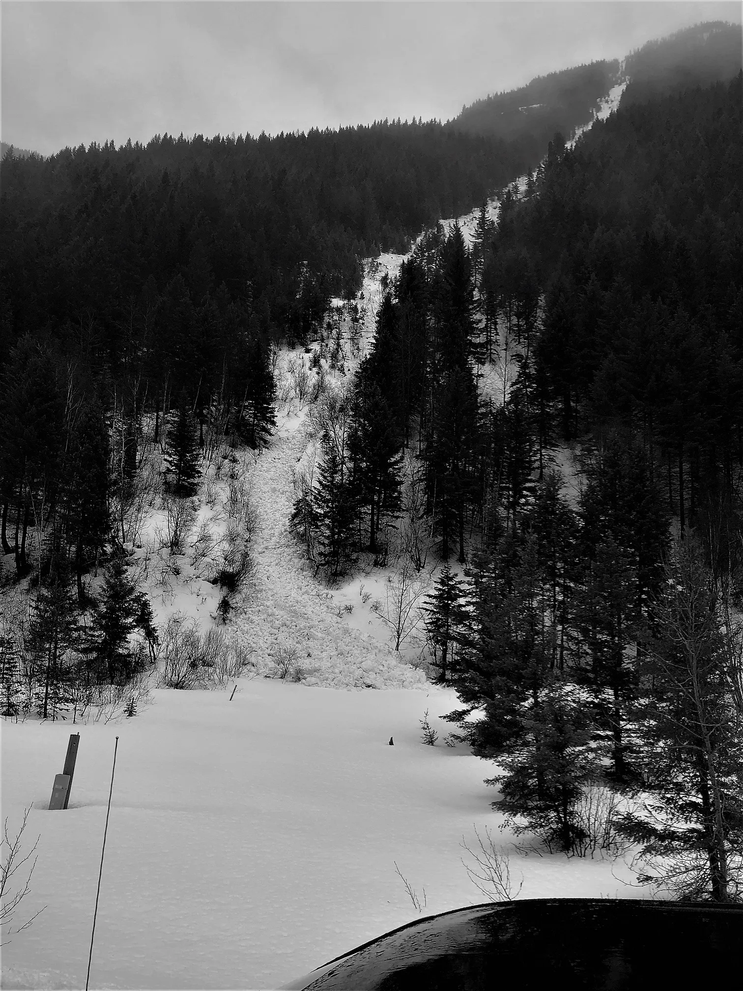 |
|
| 2022-03-01 | 07:35:00 | Path 1163 Headwall | Clark | WL | Natural | NU | R3 | D1.5 | I | T | U | 40 | SW | 1740 | 1400 | 340 | 0 | 0 | 0 | 0.00 | MR | - | U | W | No | 0 | 0 | No | 0 | 0 | - | Multiple D1-1.5 wet loose on the headwall. All debris stopping on the 4600' bench | No Image | |
| 2022-03-01 | 07:35:00 | Path 1163 | Clark | U | Natural | NU | U | D2.5 | I | T | U | 0 | S | 0 | 1400 | -1400 | 0 | 0 | 0 | 0.00 | MR | - | U | W | No | 0 | 0 | No | 0 | 0 | - | Path obscured by fog, no other details known. Unsure, but suspect this initiated as a soft slab, but entrained wet snow on the way down. |  |
|
| 2022-03-01 | 07:35:00 | Shed 10 | Clark | U | Natural | NU | U | D2 | I | T | C | 40 | SE | 2040 | 1585 | 455 | 0 | 0 | 0 | 0.00 | TK | - | U | W | No | 0 | 0 | No | 0 | 0 | - | This is in the Shed 10 Main Feeder path. View of SZ obscured, but could see avalanche initiate near top of the path | No Image | |
| 2022-03-01 | 05:04:00 | Shed 7 West | Clark | SS | Natural | NC | R2 | D2 | I | T | L | 38 | E | 2015 | 1760 | 255 | 0 | 0 | 0 | 0.00 | TK | - | U | U | No | 0 | 0 | No | 0 | 0 | - | Slab not observed until March 17th during a ski tour and could barely make out remnants of the crown. But this cornice fall was noted on March 1st, | No Image | |
| 2022-03-01 | 05:00:00 | Path 1183 | Clark | SS | Natural | NU | R3 | D2.5 | I | T | R | 38 | NE | 1737 | 1067 | 670 | 215 | 100 | 35 | 67.50 | BR | - | 1F | W | No | 0 | 0 | No | 0 | 0 | - | 1st observed on Mar. 2nd. then investigated the starting zone on Mar.7th. First initiated as a storm slab that failed at the new/old snow interface. Debris entrained a lot of wet snow on the way down and it was wet debris at the terminus which reached about 100 yards from the rail. |  |
|
| 2022-02-28 | 07:50:00 | Jakes (MP 1161.9) | Clark | WL | Natural | NU | R2 | D1.5 | I | T | C | 40 | S | 1525 | 1372 | 153 | 0 | 0 | 0 | 0.00 | MR | - | U | M | No | 0 | 0 | No | 0 | 0 | - | Debris terminus elevation estimated | No Image | |
| 2022-02-28 | 07:40:00 | Path 1163 Headwall | Clark | WL | Natural | NU | R1 | D1 | I | T | C | 40 | SW | 1770 | 1450 | 320 | 0 | 0 | 0 | 0.00 | MR | - | U | M | No | 0 | 0 | No | 0 | 0 | - | Elevation data estimated. All that was clearly visible was D1-size debris piles on the 4600' bench. Two, D1-size debris piles visible. 2nd one may have run from the main path? | No Image | |
| 2022-02-20 | 09:45:00 | Path 1163 Headwall | Clark | U | Natural | NU | U | D1.5 | S | T | C | 0 | SW | 0 | 1460 | -1460 | 0 | 0 | 0 | 0.00 | TK | - | U | D | No | 0 | 0 | No | 0 | 0 | - | Limited visibility and new snow made observations difficult. Unsure if this was a slab or loose. | No Image | |
| 2022-02-20 | 09:45:00 | Path 1163 | Clark | L | Natural | NU | R1 | D1.5 | S | T | L | 0 | SE | 2165 | 1465 | 700 | 0 | 0 | 0 | 0.00 | TK | - | U | D | No | 0 | 0 | No | 0 | 0 | - | Small dry loose from all the way at the top of the path. | No Image | |
| 2022-02-10 | 14:49:00 | Path 1163 | Clark | WL | Natural | NU | R1 | D2 | O | M | L | 0 | SW | 0 | 1400 | -1400 | 0 | 0 | 0 | 0.00 | TR | - | U | W | No | 0 | 0 | No | 0 | 0 | - | Initiated in a gully looker's right about halfway up the path. Debris flowed out into the main path and terminated at the 4600' bench | No Image | |
| 2022-02-10 | 14:47:00 | Umbrella | Clark | WL | Natural | NU | R2 | D1 | O | T | C | 45 | E | 1388 | 1355 | 33 | 0 | 0 | 0 | 0.00 | U | BP | U | W | No | 0 | 0 | No | 0 | 0 | - | Debris terminated just above the rail grade. | No Image | |
| 2022-02-02 | 03:30:00 | Path 1163 | Clark | SS | Natural | NU | R2 | D2 | I | T | R | 38 | SW | 2165 | 1400 | 765 | 45 | 50 | 25 | 37.50 | TR | - | U | D | No | 0 | 0 | No | 0 | 0 | - | A more recent avalanche. Best estimate is that it ran last night after the wind-loading from the recent NE winds |  |
|
| 2022-01-31 | 11:30:00 | Path 1163 | Clark | SS | Natural | NU | R2 | D2 | I | T | L | 38 | SE | 2190 | 1400 | 790 | 80 | 50 | 25 | 37.50 | U | - | U | U | No | 0 | 0 | No | 0 | 0 | - | Only crown visible and mostly filled back in with wind-blown snow. Runout uncertain but estimating the usual bench at 4600' Suspect this ran on Jan 31 when winds were blowing from SW. | 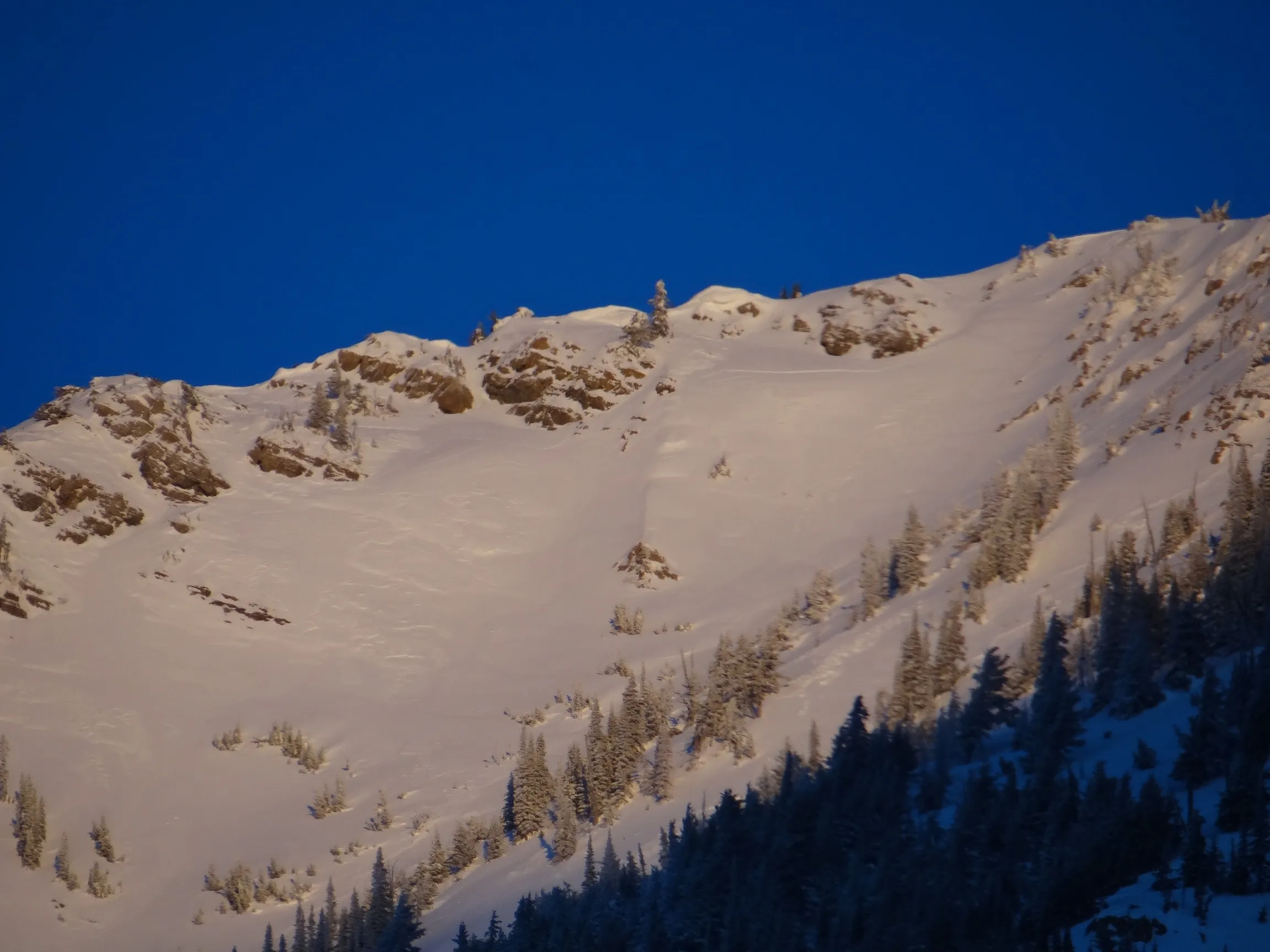 |
|
| 2022-01-13 | 16:00:00 | Path 1163 Headwall | Clark | WL | Natural | NU | R3 | D1.5 | O | T | C | 0 | SW | 1740 | 1400 | 340 | 0 | 0 | 0 | 0.00 | TR | - | U | W | No | 0 | 0 | No | 0 | 0 | - | No Image | ||
| 2022-01-13 | 16:00:00 | Path 1163 | Clark | WL | Natural | NU | R2 | D1.5 | I | U | C | 0 | S | 0 | 1400 | -1400 | 0 | 0 | 0 | 0.00 | TR | - | U | W | No | 0 | 0 | No | 0 | 0 | - | Unknown exactly where this avalanche started, but somewhere in the main path | No Image | |
| 2022-01-13 | 15:00:00 | Shed 7- West Portal (MP 1160.7) | Clark | WL | Natural | NU | U | D1.5 | I | U | U | 0 | SE | 1524 | 1340 | 184 | 0 | 0 | 0 | 0.00 | U | BP | U | W | Yes | 15 | 2 | No | 0 | 0 | - | Buried Main 1 and stopped an east-bound train. Front-end loader used to clear debris. Start zone not visible. due to trees. | 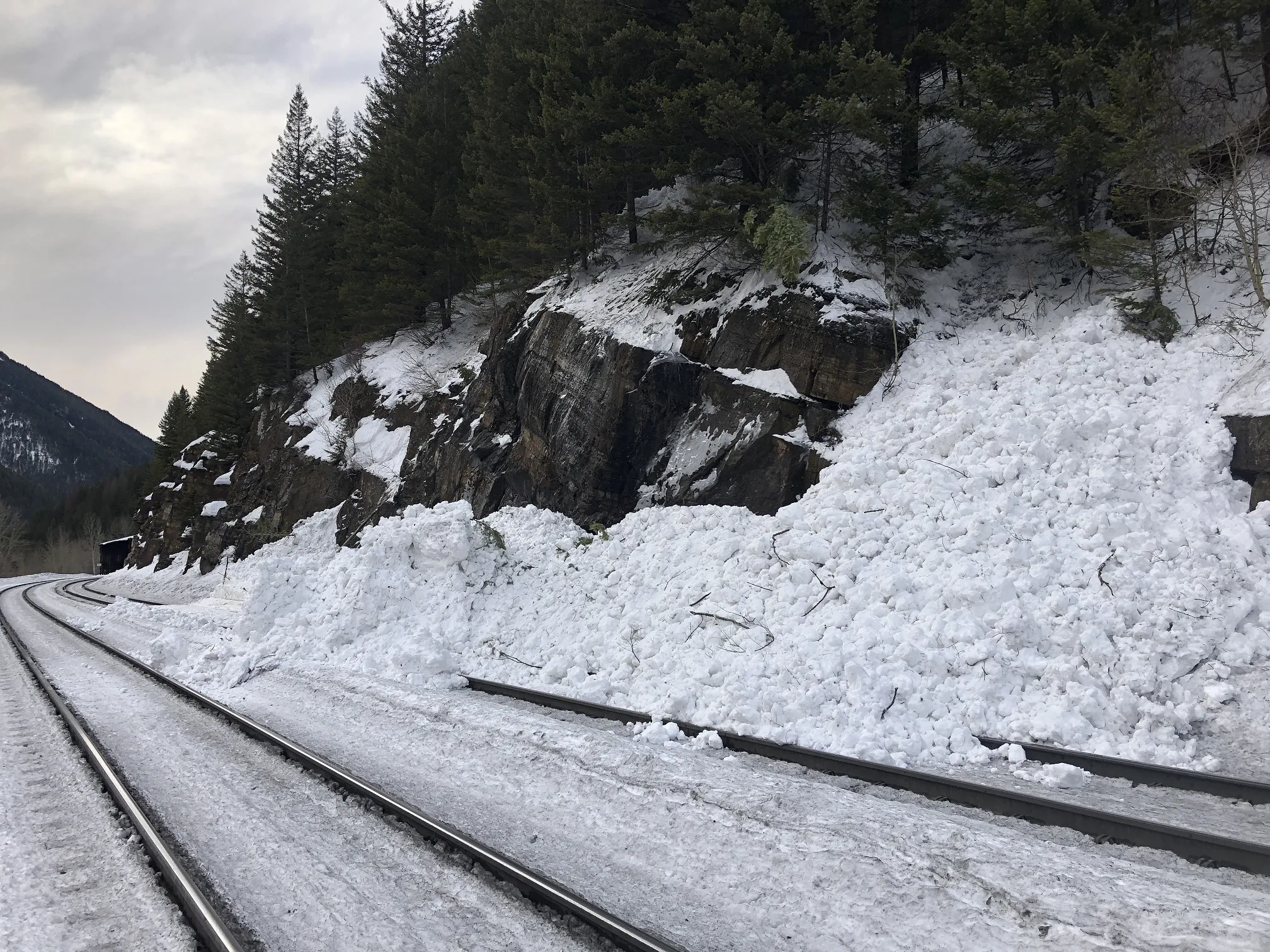 |
|
| 2022-01-08 | 01:30:00 | Path 1163 Headwall | Clark | SS | Natural | NU | U | D2 | U | T | C | 0 | N | 1890 | 1400 | 490 | 0 | 0 | 0 | 0.00 | TR | - | U | U | No | 0 | 0 | No | 0 | 0 | - | Obs from Hwy. no crown visible, just debris pile | No Image | |
| 2022-01-08 | 01:30:00 | Curly | Clark | SS | Natural | NU | U | D2 | U | U | U | 0 | N | 0 | 1370 | -1370 | 0 | 0 | 0 | 0.00 | BR | - | U | U | No | 0 | 0 | No | 0 | 0 | - | Only data is the debris pile size and location | No Image | |
| 2022-01-08 | 00:30:00 | Second Slide | Clark | SS | Natural | NU | R4 | D2 | O | T | C | 0 | SE | 1646 | 1297 | 349 | 100 | 130 | 25 | 77.50 | BR | - | U | U | Yes | 20 | 4 | No | 0 | 0 | - | Slide fence indication and then reported by Helper Engine crew (photo) |  |
|
| 2022-01-07 | 15:30:00 | Path 1163 | Clark | SS | Natural | NU | U | D2 | U | U | U | 0 | S | 0 | 1402 | -1402 | 0 | 0 | 0 | 0.00 | TR | - | U | U | No | 0 | 0 | No | 0 | 0 | - | Obs from Hwy when visibility was poor. Could only see the debris pile. No other details known (AC, 1/7/21 @1800) | No Image | |
| 2021-12-27 | 04:30:00 | Second Slide | Clark | WL | Natural | NU | R1 | D1.5 | O | U | U | 0 | N | 0 | 0 | 0 | 0 | 0 | 0 | 0.00 | U | - | U | U | No | 0 | 0 | No | 0 | 0 | - | No Image | ||
| 2021-12-26 | 06:00:00 | Infinity | Clark | SS | Natural | NU | R2 | D2 | I | T | C | 0 | S | 1830 | 1400 | 430 | 50 | 75 | 25 | 50.00 | TK | - | U | U | No | 0 | 0 | No | 0 | 0 | - | Observed from Hwy 2 at sunset 12/26. This ran about 3/4 path. Assuming it is wind slab formed from the recent NE winds. |  |
|
| 2021-12-22 | 13:00:00 | Shed 7 West | Clark | SS | Natural | NC | R1 | D1.5 | S | T | C | 0 | N | 2058 | 2000 | 58 | 20 | 75 | 15 | 45.00 | U | TP | U | U | No | 0 | 0 | No | 0 | 0 | - | Observed 2 avalanches of this type right next to each other on the ridge. |  |
|
| 2021-12-16 | 12:15:00 | Test Slope 3 | Clark | SS | Artificial : Human | AS | R3 | D1.5 | I | T | C | 0 | SE | 1700 | 1650 | 50 | 10 | 30 | 10 | 20.00 | U | BP | U | D | No | 0 | 0 | No | 0 | 0 | - |  |
||
| 2021-03-11 | 14:30:00 | Mount Cameahwait, SE Ridge | Clark | HS | Natural | NC | R2 | D2.5 | O | T | R | 0 | E | 2348 | 2040 | 308 | 100 | 200 | 50 | 125.00 | TR | - | U | U | No | 0 | 0 | No | 0 | 0 | - | Obs from Hwy 2 on Mar 11. This was new since Mar. and suspect it ran sometime in the previous 24 hours. |  |
|
| 2021-03-04 | 16:30:00 | I Beam | Clark | HS | Natural | NU | R4 | D3 | O | T | C | 0 | SW | 2256 | 1400 | 856 | 200 | 200 | 80 | 140.00 | TR | - | U | W | No | 0 | 0 | No | 0 | 0 | - | Likely started as dry slab but then entrained wet snow on the way down. Debris terminated about 2000 lineal feet from US Hwy 2, or about 3/4 path. Suspect mid-Jan. FC as failure layer. Extensive vegetation damage in the path. |  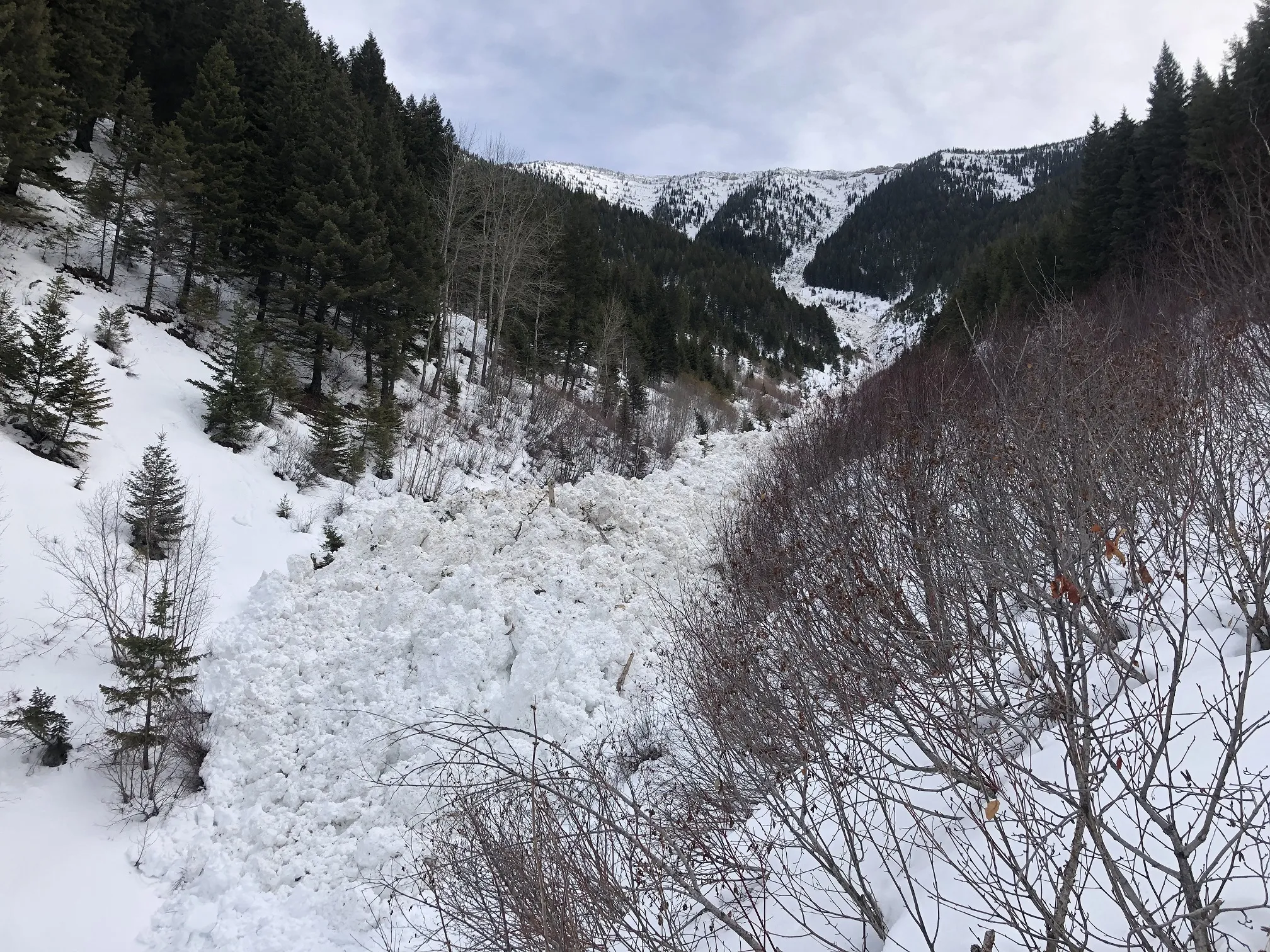 |
|
| 2021-03-04 | 16:00:00 | Path 1163 Headwall | Clark | WL | Natural | NU | R2 | D2 | O | T | L | 0 | SW | 1830 | 1400 | 430 | 0 | 0 | 0 | 0.00 | TR | - | U | W | No | 0 | 0 | No | 0 | 0 | - | Debris ran to usual low-angled bench, terminating about 2/3rds distance down the path. Also observed several other D1 wet loose in the Program Area during Mar 1-6 warm period. All associated debris terminated above the rail. | No Image | |
| 2021-03-01 | 16:00:00 | Jakes (MP 1161.9) | Clark | HS | Natural | NL | R1 | D2 | O | M | C | 0 | S | 1464 | 1342 | 122 | 20 | 40 | 20 | 30.00 | TR | - | U | U | No | 0 | 0 | No | 0 | 0 | - | Small slab triggered by wet loose avalanche. Debris ran 3/4 path terminating above the rail. | No Image | |
| 2021-02-24 | 12:42:00 | Shed 7 East | Clark | HS | Artificial : Explosive | AH | R4 | D3 | O | T | C | 0 | SE | 1860 | 1310 | 550 | 300 | 250 | 100 | 175.00 | BR | - | 3F | D | Yes | 100 | 3 | No | 0 | 0 | - | Triggered by one 5# charge. Debris ran over shed, under power lines, and terminated just above Bear Creek and ~300 lineal feet from US Hwy 2. Powder cloud went over Hwy. Extensive vegetation damage in path. Investigation on Feb 25 confirmed that mid-Jan. FC was the failure layer. | 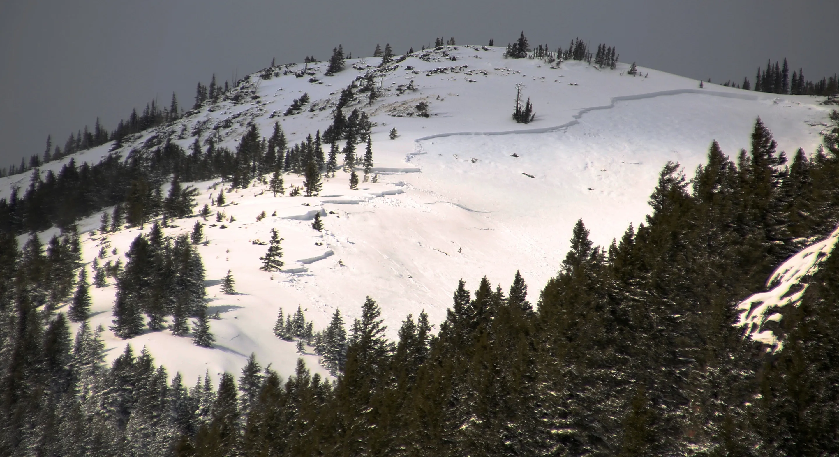 |
|
| 2021-02-24 | 12:30:00 | Shed 9 | Clark | HS | Artificial : Explosive | AH | R3 | D3 | O | T | L | 0 | SE | 2045 | 1340 | 705 | 300 | 250 | 150 | 200.00 | MR | - | 2F | D | No | 0 | 0 | No | 0 | 0 | - | Debris terminated about 100' from the top of the Shed. Suspect mid-Jan. FC as failure layer. Triggered by 1 Avy Guard charge (7#). Extensive vegetation damage in the path. | No Image | |
| 2021-02-24 | 12:03:00 | Path 1163 | Clark | HS | Artificial : Explosive | AH | R3 | D3 | U | T | C | 0 | S | 2195 | 1280 | 915 | 250 | 200 | 130 | 165.00 | TR | - | 1F | U | No | 0 | 0 | No | 0 | 0 | - | Debris stopped right above slide fence. Triggered by 2 Avy Guard charges (7# each). Suspect mid-Jan FC as failure layer. Some vegetation damage in the path. | 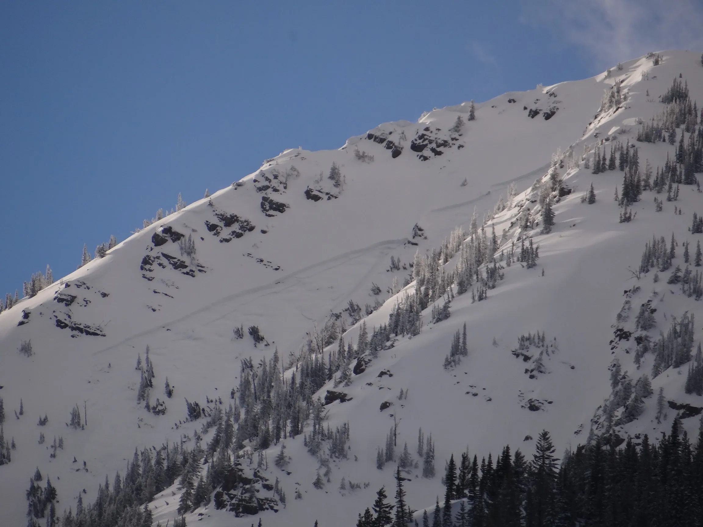 |
|
| 2021-02-23 | 11:03:00 | Shed 7 West | Clark | HS | Natural | NC | R3 | D3 | O | T | C | 0 | E | 2042 | 1310 | 732 | 500 | 300 | 100 | 200.00 | BR | - | 3F | D | Yes | 80 | 2 | No | 0 | 0 | - | Reported by track inspector shortly after 1100. Debris over top of the Shed and beyond, but East end not breached. Also caught on Umbrella Fence camera. Investigation on Feb 25 confirmed failure layer was FC above Jan. 13 crust. Extensive vegetation damage in the runout. |  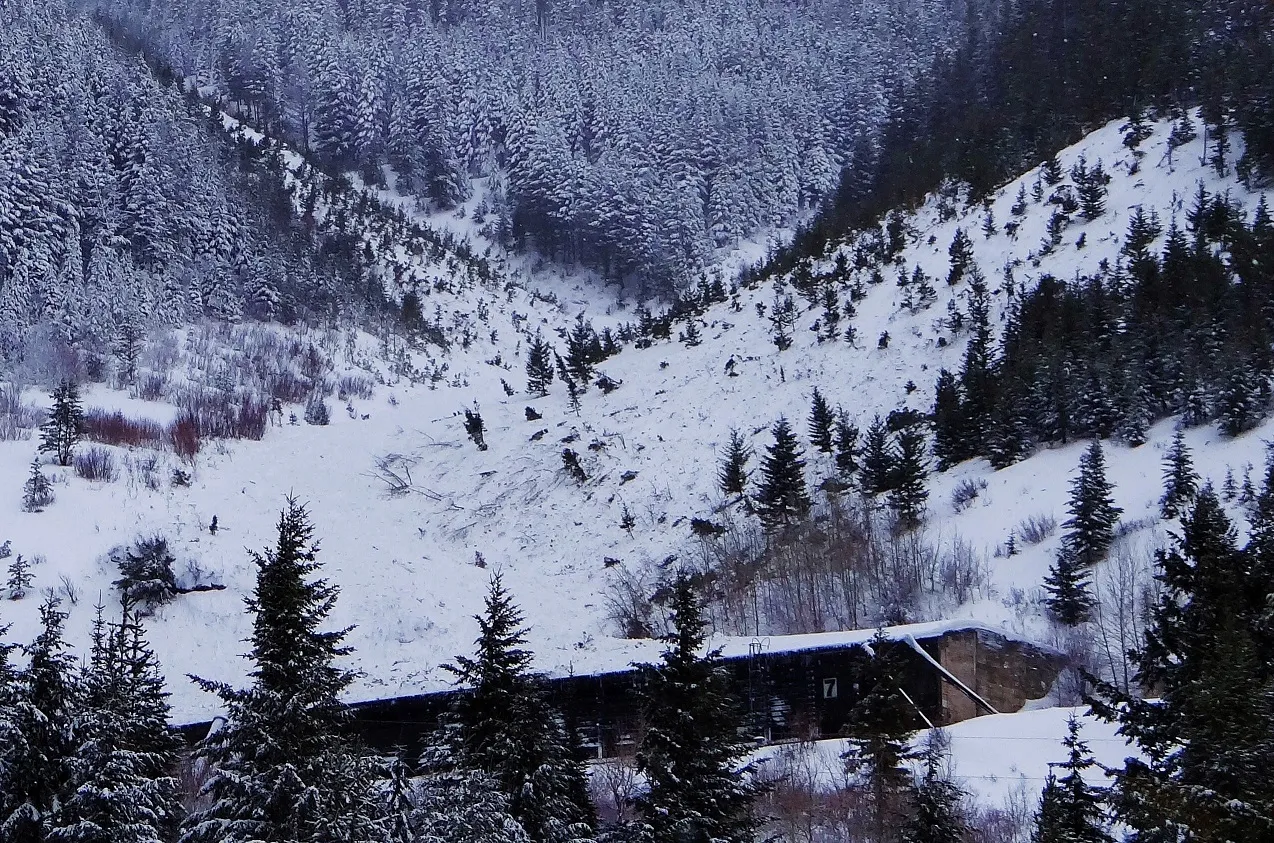 |
|
| 2021-02-23 | 08:30:00 | Path 1163 | Clark | SS | Natural | NU | U | D2 | U | U | U | 0 | S | 0 | 0 | 0 | 0 | 0 | 0 | 0.00 | U | - | U | U | No | 0 | 0 | No | 0 | 0 | - | No other details known other than suspecting it was a soft slab, about D2-sized, and ran about 2/3rds path | No Image | |
| 2021-02-22 | 14:20:00 | Java Gauntlet | Clark | SS | Natural | N | R3 | D2.5 | O | M | L | 40 | E | 1280 | 1220 | 60 | 100 | 150 | 30 | 90.00 | U | BP | U | U | Yes | 50 | 2 | No | 0 | 0 | - | Debris stopped at slide fence with no debris actually burying the rail. Deepest part of debris was about 2 m. | 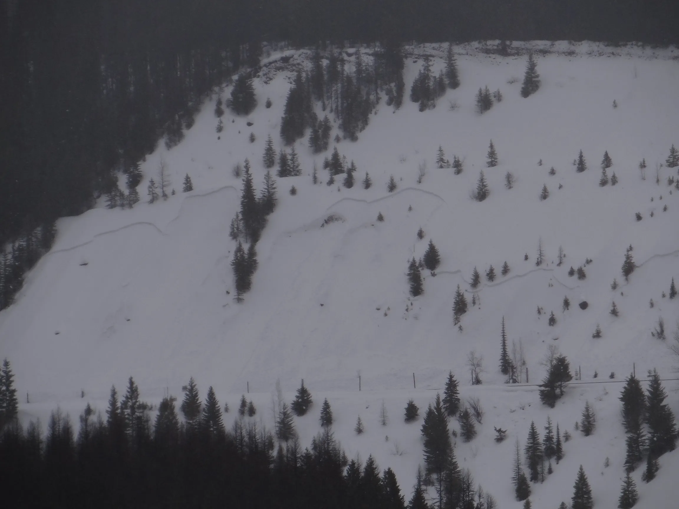 |
|
| 2021-02-21 | 20:30:00 | Second Slide | Clark | SS | Natural | NU | U | D2 | U | M | C | 0 | S | 1525 | 1310 | 215 | 0 | 0 | 0 | 0.00 | BR | - | - | D | Yes | 10 | 1.5 | No | 0 | 0 | - | Many details lacking for this avalanche. Possibly a wildlife trigger or just heavy wind-loading? Suspect failure layer was the mid-Jan FC. Appeared to have originated in thicker trees about mid-path. Never could see a crown in SZ. Moving debris popped out 2nd smaller crown (1'thick x 20' wide) right above rail which increased D-size. |  |
|
| 2021-02-11 | 16:56:00 | Goat Lick | Clark | SS | Natural | NU | R2 | D2.5 | O | T | R | 0 | W | 2285 | 0 | 2285 | 250 | 150 | 75 | 112.50 | U | - | U | U | No | 0 | 0 | No | 0 | 0 | - | Obs on 2/11 and thinking it ran sometime in last 24 hrs. Did not see this crown on Tue 2/9. Unknown debris terminus but did reach Hwy 2. Suspect weak layer around the Jan. 13 crust. |  |
|
| 2021-02-07 | 13:25:00 | Java | Clark | SS | Natural | N | R2 | D3 | O | T | L | 0 | NE | 2015 | 0 | 2015 | 650 | 100 | 50 | 75.00 | U | - | U | U | No | 0 | 0 | No | 0 | 0 | - | Observed on 2/7 at 1600 from Hwy 2. Likely ran in the past 24 hours. Visibility limited, debris terminus elevation unknown, and other dimensions are rough estimates. Better vis on 2/9 (photo) |  |
|
| 2021-02-06 | 22:08:00 | Grizzly Gulch | Clark | SS | Natural | NU | R2 | D2.5 | O | T | C | 0 | E | 2040 | 1670 | 370 | 200 | 100 | 50 | 75.00 | U | - | U | U | No | 0 | 0 | No | 0 | 0 | - | Obs on 2/9 suspect buried surface hoar as weak layer. |  |
|
| 2021-02-06 | 22:04:00 | Goat Lick | Clark | SS | Natural | NU | R1 | D2 | O | T | C | 0 | SW | 0 | 0 | 0 | 0 | 0 | 0 | 0.00 | U | - | U | U | No | 0 | 0 | No | 0 | 0 | - | Obs on 2/9 (photo) details unknown but appears about D2 size |  |
|
| 2021-02-03 | 13:20:00 | Larry | Clark | U | Natural | NU | U | D2 | U | T | U | 0 | N | 1890 | 1525 | 365 | 0 | 0 | 0 | 0.00 | TK | - | U | U | No | 0 | 0 | No | 0 | 0 | - | Viewed from across the Canyon and from Hwy. Unknown when it ran. Obs on the 3rd. | No Image | |
| 2021-01-13 | 04:45:00 | Broken Bridge | Clark | SS | Natural | NU | U | D2 | S | T | R | 0 | N | 2135 | 1830 | 305 | 0 | 0 | 0 | 0.00 | TK | - | U | U | No | 0 | 0 | No | 0 | 0 | - | Observed from Hwy 2 and not many details known. Visibility limited but a crown was visible and a D2-sized debris pile down in the runout. | No Image | |
| 2021-01-13 | 04:45:00 | Java | Clark | SS | Natural | NU | R3 | D2 | I | U | U | 0 | N | 1951 | 0 | 1951 | 200 | 50 | 30 | 40.00 | U | - | U | U | No | 0 | 0 | No | 0 | 0 | - | Could not view the terminus so runout unknown. Crown dimensions are rough estimates |  |
|
| 2021-01-13 | 04:43:00 | Infinity | Clark | WL | Natural | NU | R1 | D2 | S | T | C | 0 | S | 1830 | 1585 | 245 | 0 | 0 | 0 | 0.00 | TK | - | U | W | No | 0 | 0 | No | 0 | 0 | - | No Image | ||
| 2021-01-13 | 04:41:00 | Shed 10 | Clark | WL | Natural | NU | R2 | D2 | S | T | C | 0 | SE | 1890 | 1675 | 215 | 0 | 0 | 0 | 0.00 | TK | - | U | W | No | 0 | 0 | No | 0 | 0 | - | May have started as a loose dry or even a slab? But no crown visible in the start zone. | No Image | |
| 2021-01-13 | 04:37:00 | Path 1163 | Clark | WL | Natural | NU | R2 | D1.5 | S | M | U | 0 | S | 1800 | 1400 | 400 | 0 | 0 | 0 | 0.00 | TR | - | U | U | No | 0 | 0 | No | 0 | 0 | - | Same photo for the slab | No Image | |
| 2021-01-13 | 04:32:00 | Mount Cameahwait, SE Ridge | Clark | SS | Natural | NU | R3 | D2 | I | M | C | 0 | E | 2255 | 2070 | 185 | 100 | 30 | 30 | 30.00 | TR | - | U | U | No | 0 | 0 | No | 0 | 0 | - | Obs from Hwy 2 morning of Jan 14th. Crown dimensions are rough estimates. | 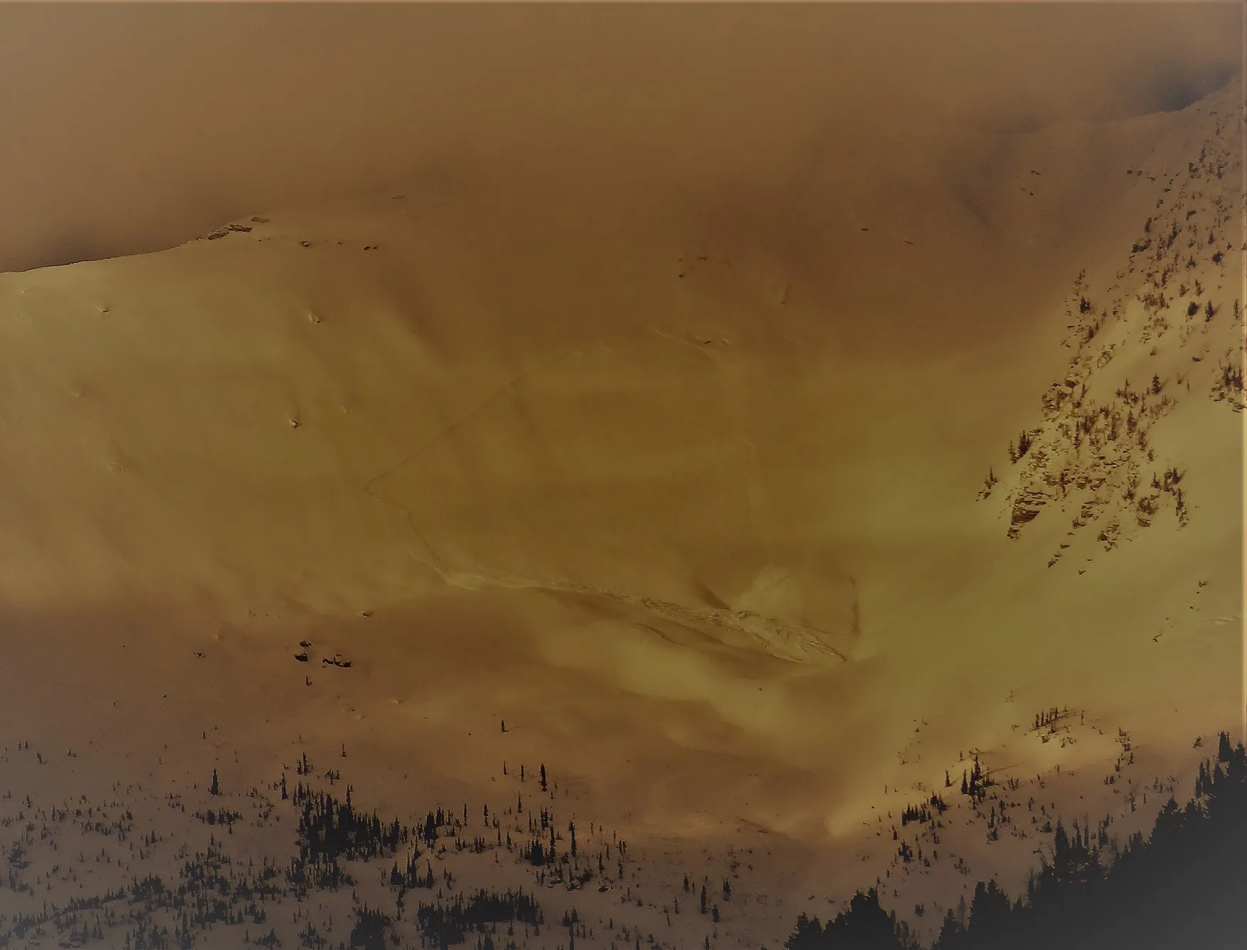 |
|
| 2021-01-13 | 04:32:00 | Path 1163 | Clark | SS | Natural | NU | R2 | D2 | S | T | L | 0 | SE | 1950 | 1400 | 550 | 100 | 30 | 30 | 30.00 | TR | - | U | W | No | 0 | 0 | No | 0 | 0 | - | Crown was partly filled back in but was likely a D2. Other WL and entrainment in the same path made debris at the terminus larger. The track just above the terminus debris pile was gouged out. | 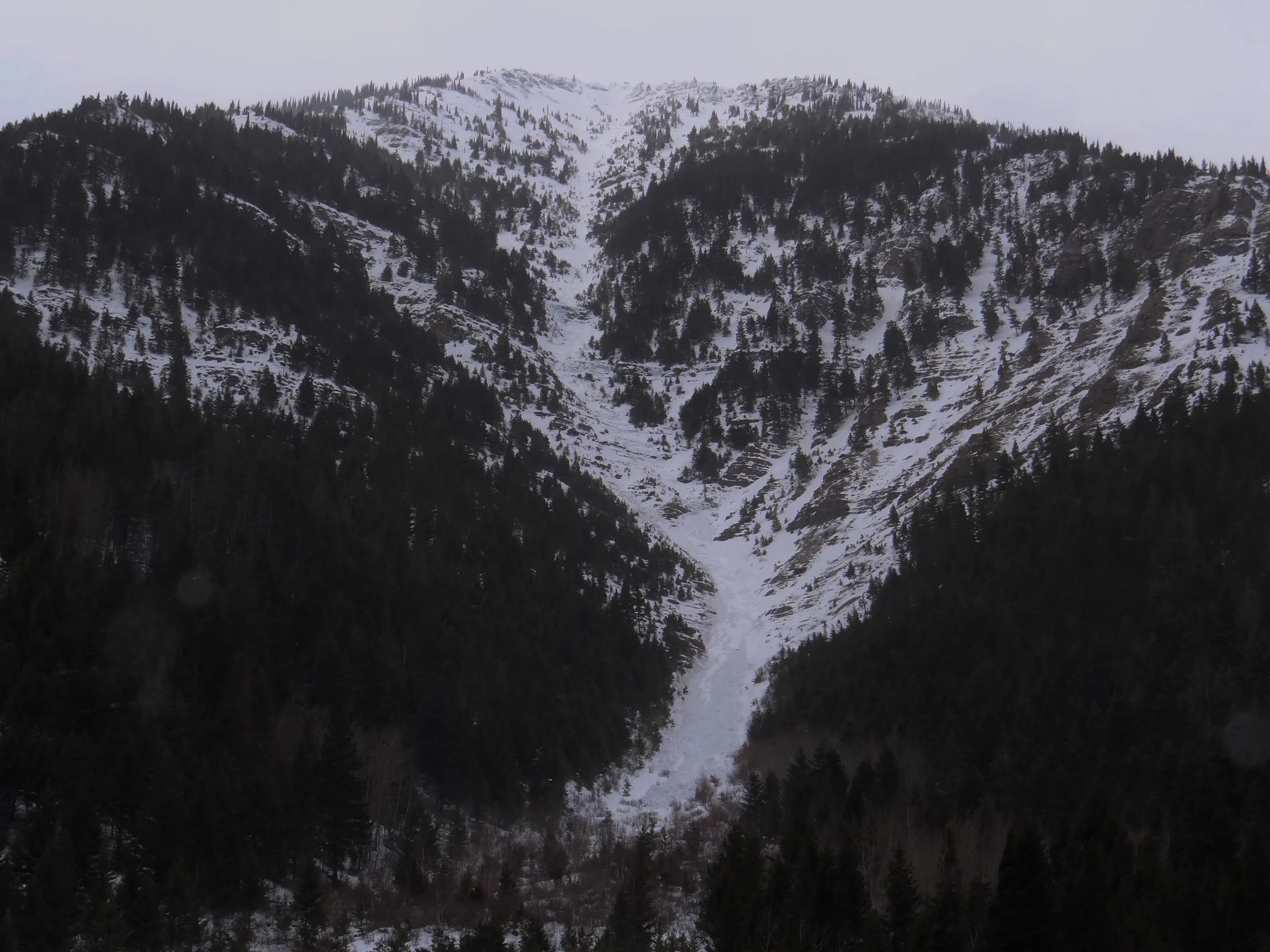 |
|
| 2021-01-13 | 04:00:00 | Grizzly Gulch | Clark | WL | Natural | NU | R2 | D2 | S | T | U | 0 | E | 1980 | 1700 | 280 | 0 | 0 | 0 | 0.00 | TK | - | U | W | No | 0 | 0 | No | 0 | 0 | - | Observed on Jan. 28th but ran on Jan. 13th. About 10 avalanches on the east face above the creek. | 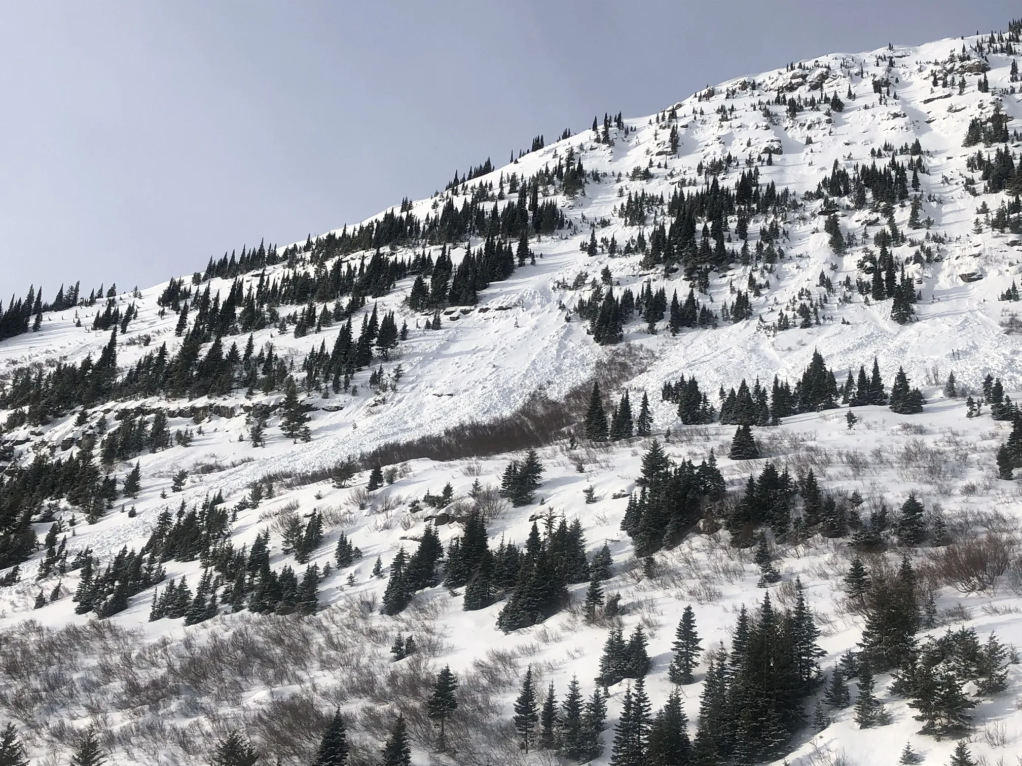 |
|
| 2021-01-05 | 13:30:00 | Test Slope 2 | Clark | SS | Artificial : Human | AS | R2 | D1 | I | T | C | 0 | SE | 1710 | 1695 | 15 | 5 | 20 | 5 | 12.50 | U | TP | U | D | No | 0 | 0 | No | 0 | 0 | - | 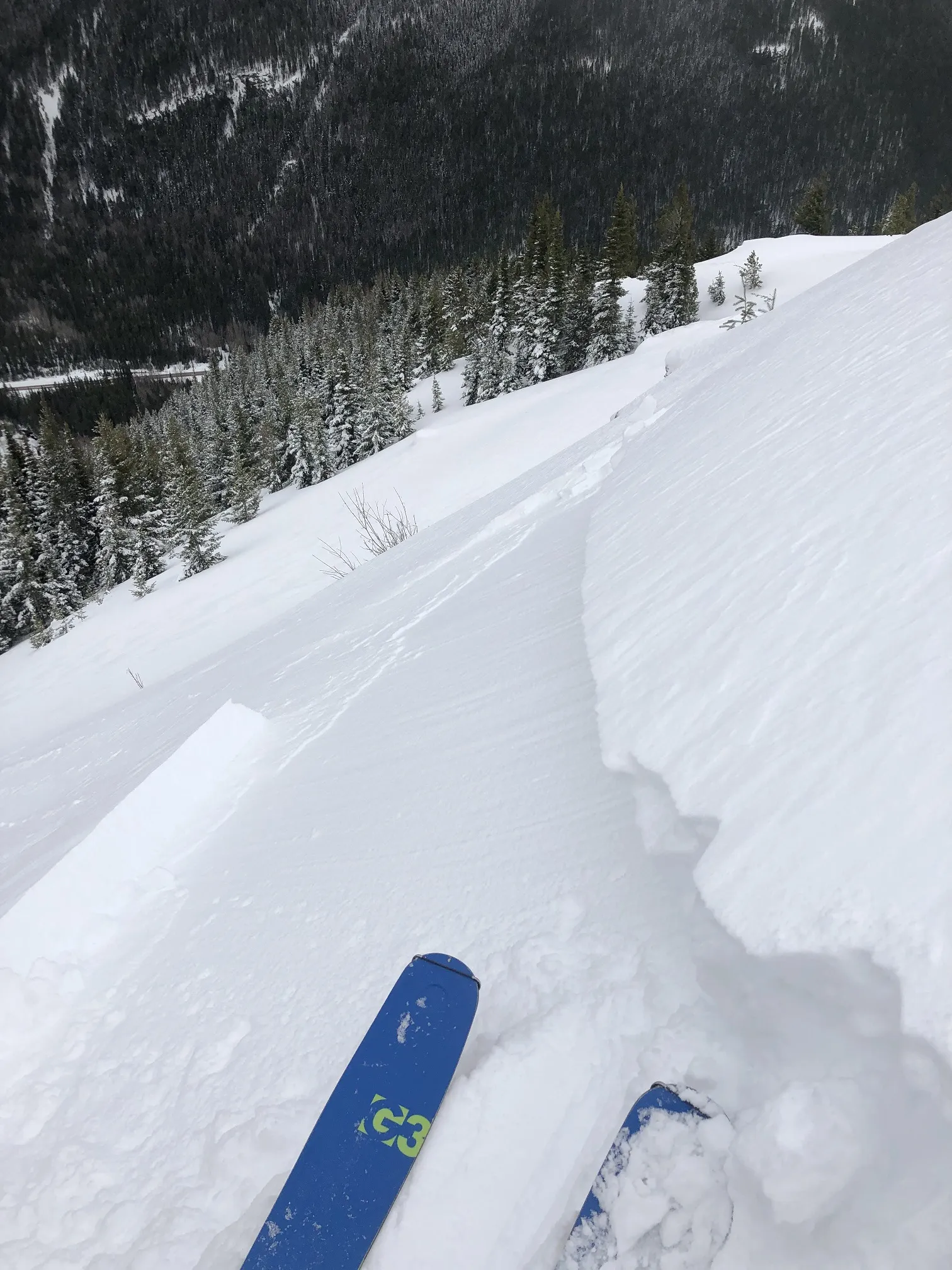 |
||
| 2020-04-23 | 16:30:00 | Curly | Clark | WL | Natural | NU | U | D1.5 | O | T | C | 0 | 1800 | 1450 | 350 | 0 | 0 | 0 | 0.00 | TR | - | U | W | No | 0 | 0 | No | 0 | 0 | - | Obs on 4/23 but likely ran a couple days earlier. Debris terminated about 200 feet above Hwy 2. | No Image | ||
| 2020-04-23 | 16:30:00 | Larry | Clark | WL | Natural | N | U | D2 | O | T | C | 0 | 1800 | 1370 | 430 | 0 | 0 | 0 | 0.00 | TR | - | U | W | No | 0 | 0 | No | 0 | 0 | - | Obs on 4/23 but likely ran a day or two earlier. Debris terminated about 200 feet above Hwy 2. | No Image | ||
| 2020-04-09 | 15:08:00 | Infinity | Clark | WL | Natural | NU | R1 | D1 | I | T | C | 0 | 1830 | 1525 | 305 | 0 | 0 | 0 | 0.00 | TK | - | U | W | No | 0 | 0 | No | 0 | 0 | - | Obs Apr 9 but ran sometime in past 2 days. SZ and terminus elev. are estimates. Debris terminated above rail. | No Image | ||
| 2020-04-09 | 15:06:00 | Grizzly Gulch | Clark | WL | Natural | NU | R1 | D1.5 | I | T | L | 0 | 1980 | 1675 | 305 | 0 | 0 | 0 | 0.00 | TR | - | U | W | No | 0 | 0 | No | 0 | 0 | - | Obs Apr 9 but ran sometime in past 2 days. SZ and terminus elev. are estimates. Observed multiple WL in Grizzly today. Debris terminated above rail. | No Image | ||
| 2020-04-09 | 15:03:00 | Shed 10 | Clark | WL | Natural | NU | R1 | D2 | I | T | C | 0 | 2020 | 1400 | 620 | 0 | 0 | 0 | 0.00 | TR | - | U | W | No | 0 | 0 | No | 0 | 0 | - | Obs Apr 9 but ran sometime in past 2 days. SZ and terminus elevations are estimated. Debris terminated above rail. | No Image | ||
| 2020-04-09 | 15:01:00 | Path 1163 | Clark | WL | Natural | NU | R2 | D2 | I | T | C | 0 | 2165 | 1400 | 765 | 0 | 0 | 0 | 0.00 | TR | - | U | U | No | 0 | 0 | No | 0 | 0 | - | Obs today but several different slides ran sometime in past 2 days. Debris terminated above rail. | No Image | ||
| 2020-04-09 | 14:59:00 | Shed 11 | Clark | WL | Natural | NU | R3 | D2 | I | M | C | 0 | 1890 | 1400 | 490 | 0 | 0 | 0 | 0.00 | TR | - | U | W | No | 0 | 0 | No | 0 | 0 | - | Obs Apr 9th but ran sometime in past 2 days. Debris terminated above rail. | No Image | ||
| 2020-04-06 | 14:57:00 | Path 1163 | Clark | WL | Natural | NU | R2 | D1.5 | I | T | C | 0 | 2165 | 1400 | 765 | 0 | 0 | 0 | 0.00 | TR | - | U | W | No | 0 | 0 | No | 0 | 0 | - | Debris terminated above rail | No Image | ||
| 2020-04-06 | 14:54:00 | Shed 12 | Clark | WL | Natural | NU | R1 | D1.5 | I | T | C | 0 | 1325 | 1190 | 135 | 0 | 0 | 0 | 0.00 | BR | - | U | M | No | 0 | 0 | No | 0 | 0 | - | Just reached top of Shed 12. | No Image | ||
| 2020-04-04 | 17:33:00 | Shed 10 | Clark | WL | Natural | NU | R1 | D1.5 | S | M | R | 0 | 1700 | 1400 | 300 | 0 | 0 | 0 | 0.00 | TK | - | U | W | No | 0 | 0 | No | 0 | 0 | - | Multiple WL ran on the lower looker's right headwall (east wall, SW aspect). Debris terminated above the rail. | No Image | ||
| 2020-04-04 | 17:31:00 | Path 1163 Headwall | Clark | WL | Natural | NU | R2 | D1.5 | S | T | C | 0 | 1700 | 1400 | 300 | 0 | 0 | 0 | 0.00 | TR | - | U | W | No | 0 | 0 | No | 0 | 0 | - | Multiple WL all across the the headwall. Debris terminated above rail grade. | No Image | ||
| 2020-03-16 | 13:52:00 | Path 1163 Headwall | Clark | WL | Natural | NU | R2 | D1.5 | I | T | C | 0 | 1740 | 1400 | 340 | 0 | 0 | 0 | 0.00 | TR | - | U | W | No | 0 | 0 | No | 0 | 0 | - | Multiple WL ran on Mar 15 and 16, plus a couple more on 17 during warm afternoon hours. D1-D1.5. Debris terminated above the rail. | No Image | ||
| 2020-03-11 | 10:30:00 | Umbrella | Clark | WL | Natural | NU | R1 | D1 | I | M | C | 0 | SE | 1400 | 1355 | 45 | 0 | 0 | 0 | 0.00 | U | BP | U | W | Yes | 7 | 0.7 | No | 0 | 0 | - | Reported by a westbound train at 1145. Debris pile ranged from 0.2-1.0 m deep and was about 5 m wide (photo). | 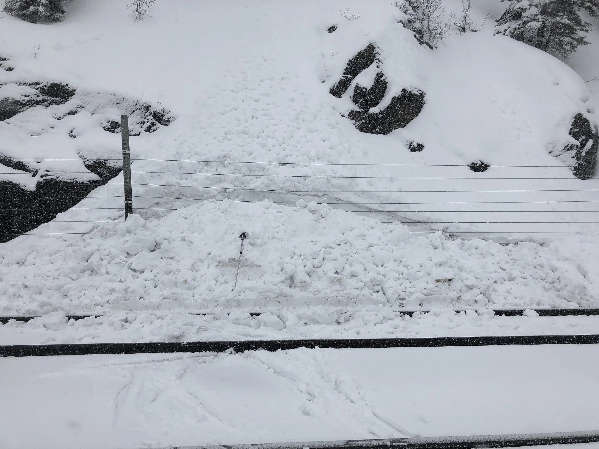 |
|
| 2020-02-28 | 16:00:00 | Infinity | Clark | WL | Natural | NU | U | D1.5 | O | T | C | 0 | 1830 | 1410 | 420 | 0 | 0 | 0 | 0.00 | TK | - | U | W | No | 0 | 0 | No | 0 | 0 | - | Ran Friday 2/28 afternoon. Debris terminated above rail. | No Image | ||
| 2020-02-28 | 16:00:00 | Path 1163 | Clark | WL | Natural | NU | R1 | D1.5 | O | U | U | 0 | 0 | 1370 | -1370 | 0 | 0 | 0 | 0.00 | TR | - | U | W | No | 0 | 0 | No | 0 | 0 | - | Multiple D1-1.5 wet loose ran on Friday afternoon 2/28. Debris terminated above rail. | No Image | ||
| 2020-02-01 | 14:30:00 | Mount Cameahwait, SE Ridge | Clark | SS | Natural | NU | R2 | D2 | I | M | R | 0 | 2256 | 2134 | 122 | 100 | 50 | 20 | 35.00 | TK | - | U | U | No | 0 | 0 | No | 0 | 0 | - | Obs from Hwy 2 on 2/2. Crown partially filled in and suspect in ran the day before. | No Image | ||
| 2020-02-01 | 10:00:00 | Mount Cameahwait, North Face | Clark | HS | Natural | NU | R4 | D3.5 | O | T | C | 0 | 2318 | 1585 | 733 | 365 | 200 | 100 | 150.00 | U | - | U | U | No | 0 | 0 | No | 0 | 0 | - | Could not view the full runout so vertical run is estimated. Large, deep persistent slab failed on the NE face of Cameahwait above the head of Essex Ck sometime this morning. Crown is visible from Essex and did not see it early this morning but noticed it today around 1300. Looks like it failed near the ground on the Nov facets. HS-R4-D3.5-O (photos) | 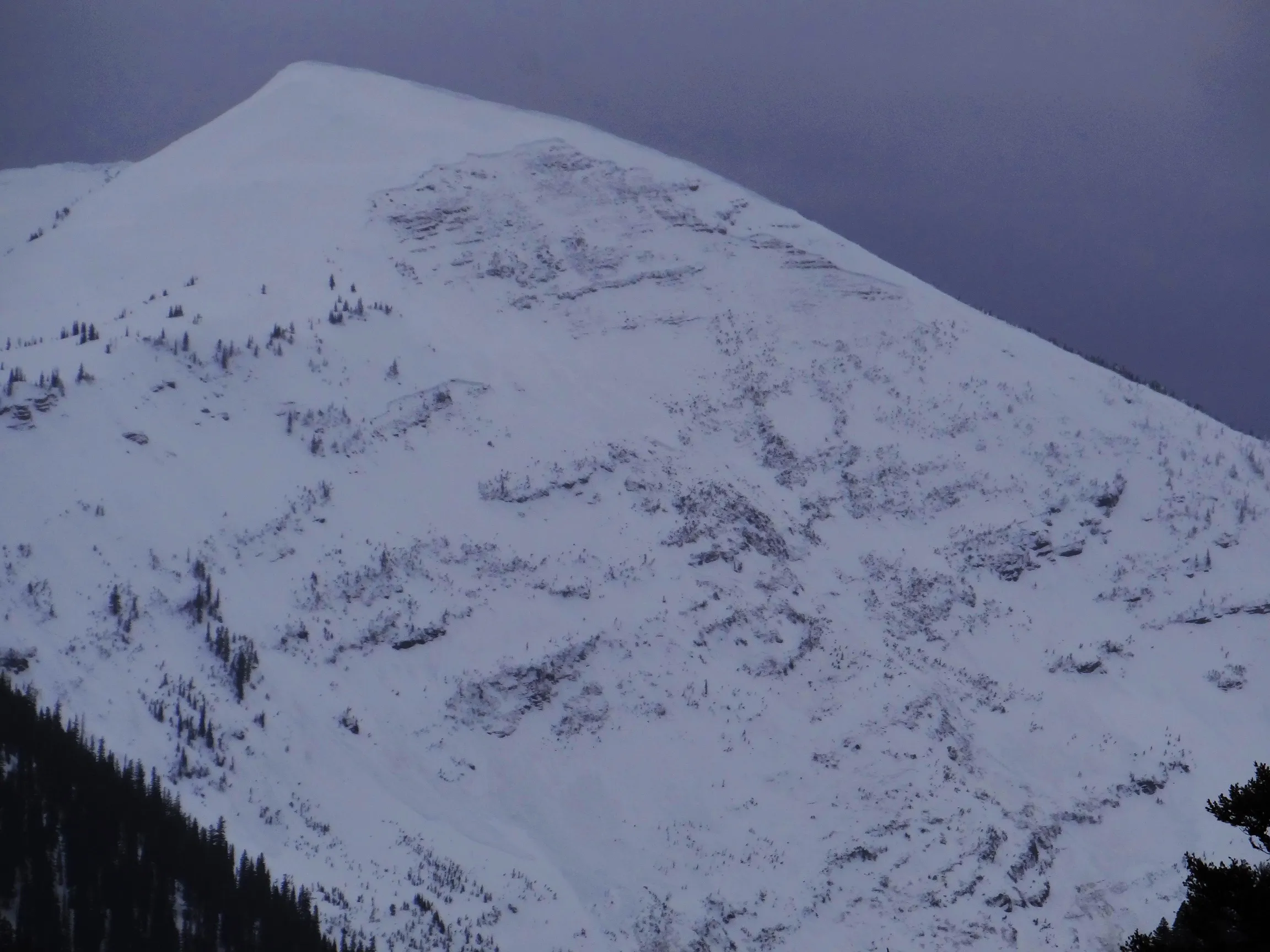 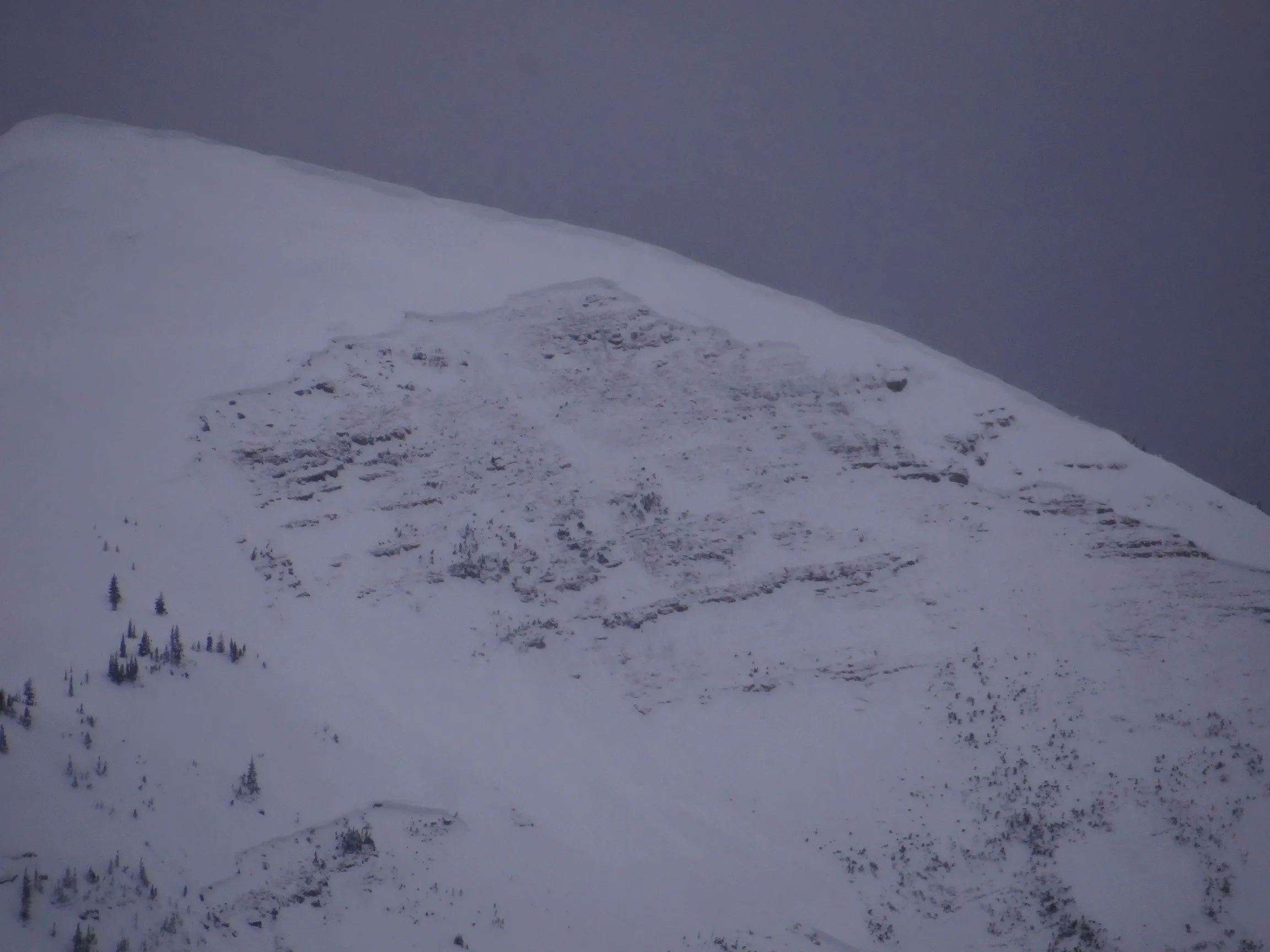 |
||
| 2020-02-01 | 08:05:00 | Path 1163 | Clark | SS | Natural | NU | R1 | D2 | O | T | U | 0 | 2134 | 1524 | 610 | 0 | 0 | 0 | 0.00 | TK | - | U | U | No | 0 | 0 | No | 0 | 0 | - | Ran sometime since yesterday afternoon. Thinking it was a wind slab. No crown visible due to additional loading. Debris terminated above rail. | No Image | ||
| 2020-01-13 | 13:36:00 | Infinity | Clark | SS | Natural | NC | R1 | D1.5 | U | T | L | 0 | 1890 | 1600 | 290 | 15 | 30 | 15 | 22.50 | TK | - | U | U | No | 0 | 0 | No | 0 | 0 | - | Observed at 1100 on Jan 15th but believed this slid sometime Mon or Tue, 13th or 14th? Debris terminated well above rail grade. | No Image | ||
| 2020-01-12 | 21:30:00 | Mount Cameahwait, SE Ridge | Clark | HS | Natural | NC | R3 | D3 | O | T | L | 0 | 2345 | 1980 | 365 | 150 | 150 | 50 | 100.00 | TR | - | U | U | No | 0 | 0 | No | 0 | 0 | - | Observed from Hwy 2 on Jan 15th at 1100 but suspect it ran sometime on the 12th/13th. Looks like a possible cornice trigger and likely that it stepped down to some persistent weak layer. Debris ran at least to 6500 ft (estimated) until it disappears out bottom of photo. | 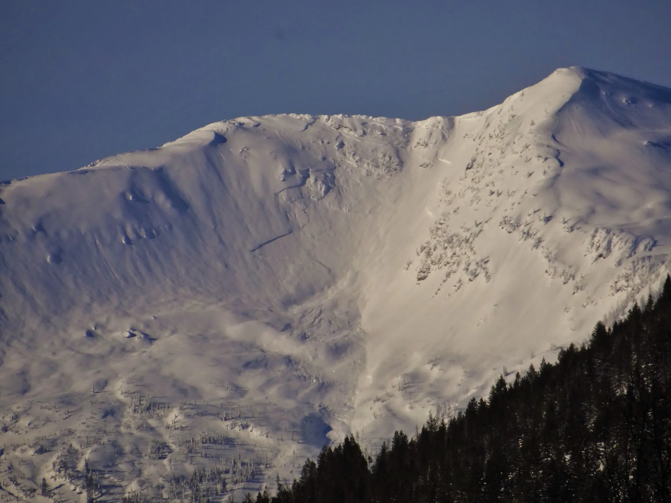 |
||
| 2020-01-12 | 21:30:00 | Shed 11 | Clark | SS | Natural | NU | R3 | D2 | U | T | C | 0 | 1875 | 1575 | 300 | 40 | 30 | 30 | 30.00 | TK | - | U | U | No | 0 | 0 | No | 0 | 0 | - | Very faint signs of a previous avalanche in the gut of Shed 11 right below the weather station. Details provided are very rough estimates. But make out old chunks of slab and saw other clues like bent over trees, slight gulley in the track and debris on uphill side of trees. Think this thing ran Saturday night, 11th but really not sure. Visibility was very limited from the Canyon floor all weekend and this week. Debris terminated well above rail grade. | No Image | ||
| 2020-01-12 | 21:30:00 | Shed 11 | Clark | SS | Natural | NU | R1 | D1.5 | O | M | L | 0 | 1830 | 1785 | 45 | 20 | 50 | 20 | 35.00 | SZ | - | U | U | No | 0 | 0 | No | 0 | 0 | - | Small slope just off the SW ridge of Running Rabbit. Again thinking this ran Saturday night and was able to piece together size by looking at old debris piles below and piled up on uphill sides of trees. Was able to investigate a section of the crown that wasn't buried. Appeared failure layer was the New Year's buried NSF layer. Debris terminated well above rail grade. | No Image | ||
| 2020-01-11 | 12:00:00 | Shed 7 West | Clark | SS | Natural | NU | R1 | D1.5 | I | T | C | 0 | 2042 | 0 | 2042 | 1972 | 20 | 15 | 17.50 | SZ | - | U | U | No | 0 | 0 | No | 0 | 0 | - | No Image | |||
| 2020-01-08 | 15:26:00 | Shed 7 West | Clark | SS | Natural | N | R3 | D2.5 | O | T | C | 0 | 1950 | 1524 | 426 | 150 | 100 | 30 | 65.00 | TK | - | U | U | No | 0 | 0 | No | 0 | 0 | - | Observed on Jan 8th at around 1300. Likely ran yesterday or last night. Also speculating this ran on deeper persistent weak layer. Perhaps surface hoar from end of Dec. Debris ran 2/3 path terminating above the rail. Returned on the 11th and took photo from above of looker's L part of crown. | 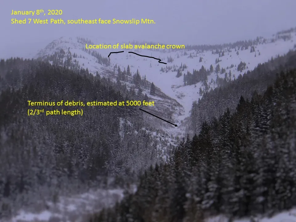  |
||
| 2020-01-08 | 15:22:00 | Path 1163 | Clark | HS | Natural | N | R2 | D2.5 | O | T | L | 0 | 2190 | 1465 | 725 | 100 | 150 | 25 | 87.50 | TR | - | U | U | No | 0 | 0 | No | 0 | 0 | - | Observed on Jan 8th at 1130. Likely ran yesterday or last night. Appears that it ran on a deeper persistent weak layer with crown heights varying with wind-loading. Debris ran 2/3 path, terminating above the rail. |  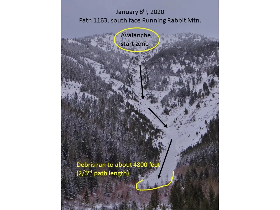  |
||
| 2020-01-07 | 10:00:00 | Path 1163 | Clark | SS | Natural | NU | U | D2 | U | U | U | 0 | 0 | 0 | 0 | 0 | 0 | 0 | 0.00 | TR | - | U | U | No | 0 | 0 | No | 0 | 0 | - | Not many details known for this avalanche other than it appeared to be a D2 soft slab that ran earlier today (AM Jan 7th). Associated debris ran 2/3rds path terminating above the rail grade. | No Image | ||
| 2020-01-01 | 13:00:00 | Shed 5 | Clark | SS | Natural | NU | R2 | D2 | O | T | R | 0 | 1770 | 1555 | 215 | 50 | 60 | 15 | 37.50 | TK | - | U | D | No | 0 | 0 | No | 0 | 0 | - | Observed while skiing down along side of the Shed 5 Path. Debris looked very new. Suspect this also ran on near surface facets on top of the Christmas crust that was buried by 25-50 cm of snow over past 24 hours. Debris ran 1/2 path, terminating above the rail grade. |  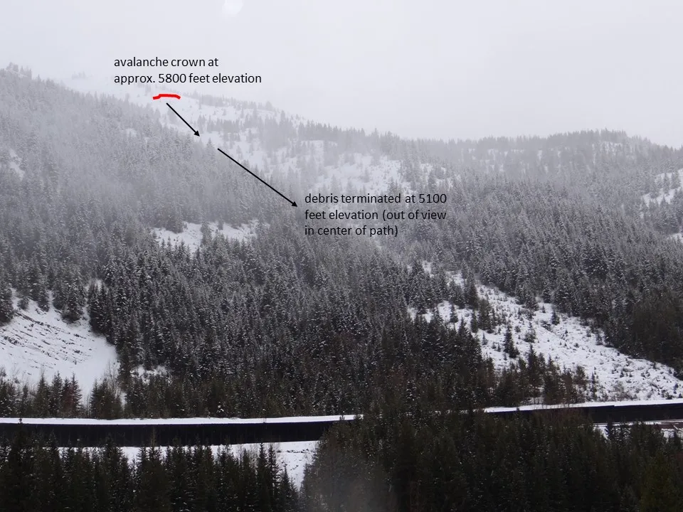 |
||
| 2020-01-01 | 11:30:00 | Test Slope 3 | Clark | SS | Artificial : Human | AS | R3 | D1.5 | O | U | C | 37 | 1720 | 1660 | 60 | 30 | 30 | 15 | 22.50 | U | BP | U | D | No | 0 | 0 | No | 0 | 0 | - | Intentionally triggered from above. Failed on near-surface facets on top of the Christmas crust that were newly buried by last night's storm. Debris terminated well above the rail. | 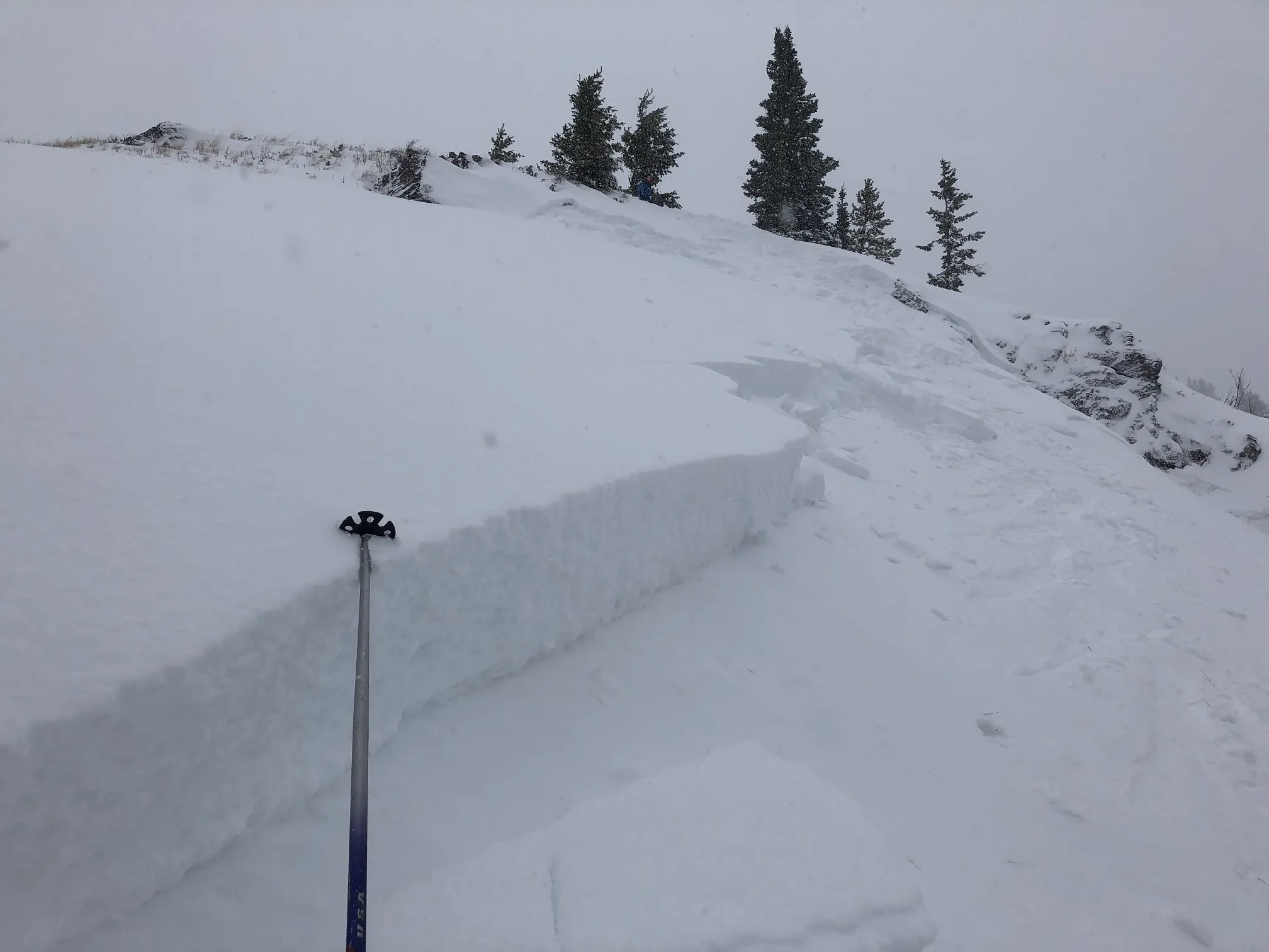 |
||
| 2019-12-20 | 14:46:00 | Broken Bridge | Clark | HS | Natural | NC | R3 | D3 | O | T | C | 0 | 2226 | 1830 | 396 | 200 | 200 | 75 | 137.50 | TK | - | U | U | No | 0 | 0 | No | 0 | 0 | - | Observed from Hwy 2 and later (Dec 23) from Shed 11. Looks to be cornice triggered and failed on facets near the base of the pack. Maybe failed last night, Dec 19/20? Crown looks a little re-loaded with new snow. | 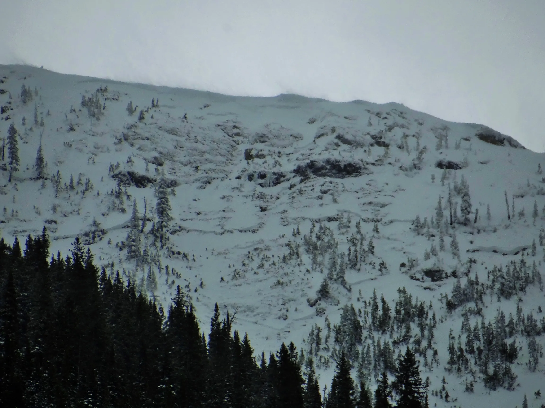 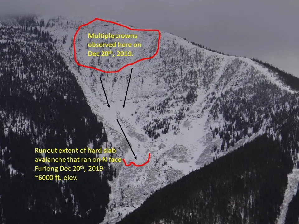 |
||
| 2019-12-20 | 14:34:00 | Path 1163 | Clark | SS | Natural | NU | R2 | D2 | I | T | C | 0 | 2150 | 1525 | 625 | 50 | 50 | 20 | 35.00 | TK | - | U | U | No | 0 | 0 | No | 0 | 0 | - | Ran sometime mid-day Dec. 20, 2019. Debris ran 2/3rds path terminating above the rail. | 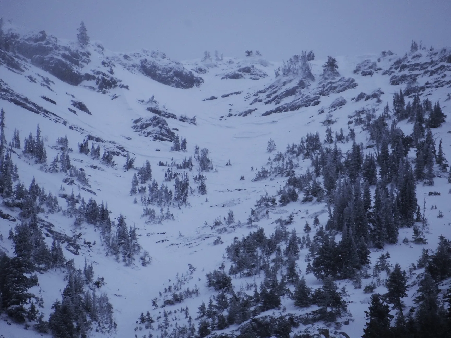 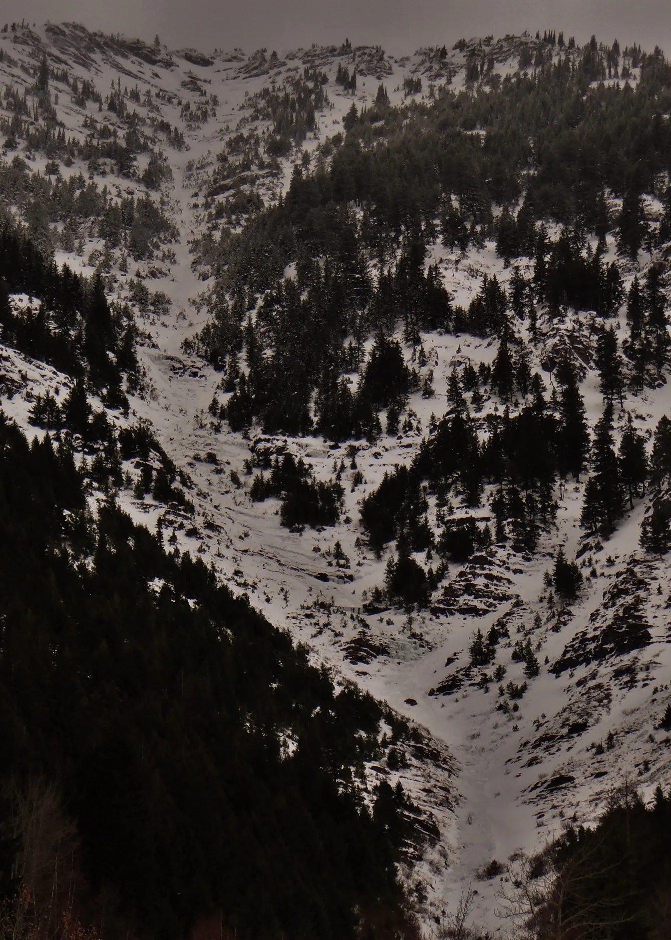 |
||
| 2019-12-13 | 11:00:00 | Shed 7 West | Clark | SS | Natural | NC | R1 | D1.5 | S | T | C | 0 | 2030 | 1900 | 130 | 40 | 25 | 12 | 18.50 | U | TP | U | D | No | 0 | 0 | No | 0 | 0 | - | Observed from Shed 6/7 ridge. Slab dimensions and elevations are estimates. Debris terminated well above rail grade. | No Image | ||
| 2019-03-21 | 19:00:00 | I Beam | Clark | WL | Natural | NU | R1 | D2 | O | T | L | 0 | 2225 | 1525 | 700 | 0 | 0 | 0 | 0.00 | TR | - | U | W | No | 0 | 0 | No | 0 | 0 | - | Multiple wet loose ran in the afternoon hours. | 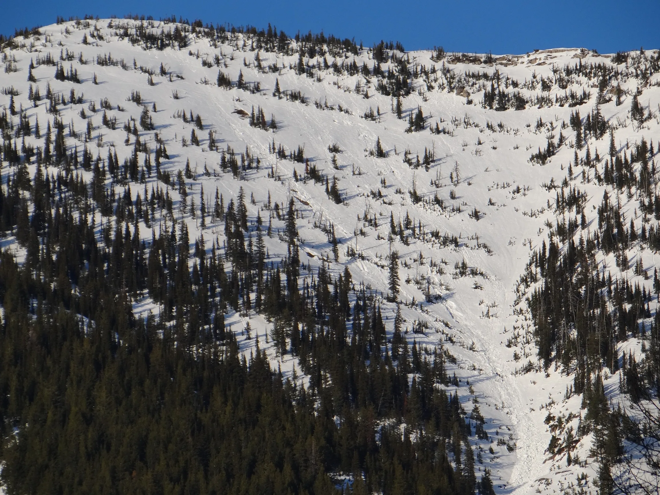 |
||
| 2019-03-21 | 14:00:00 | Grizzly Gulch | Clark | WL | Natural | NU | R1 | D2 | O | T | R | 0 | 1900 | 1460 | 440 | 0 | 0 | 0 | 0.00 | BR | - | U | W | No | 0 | 0 | No | 0 | 0 | - | 3 easternmost gullies on the looker's right headwall slid early afternoon on 3/21. Assume debris piled up down in Grizzly Ck. | No Image | ||
| 2019-03-21 | 14:00:00 | Path 1163 | Clark | WL | Natural | NU | R2 | D2.5 | O | T | L | 0 | 2130 | 1460 | 670 | 0 | 0 | 0 | 0.00 | TR | - | U | W | No | 0 | 0 | No | 0 | 0 | - | Ran early afternoon 3/21 from looker's left headwall. Multiple point releases and maybe some narrow slabs? Debris stopped above rail. | 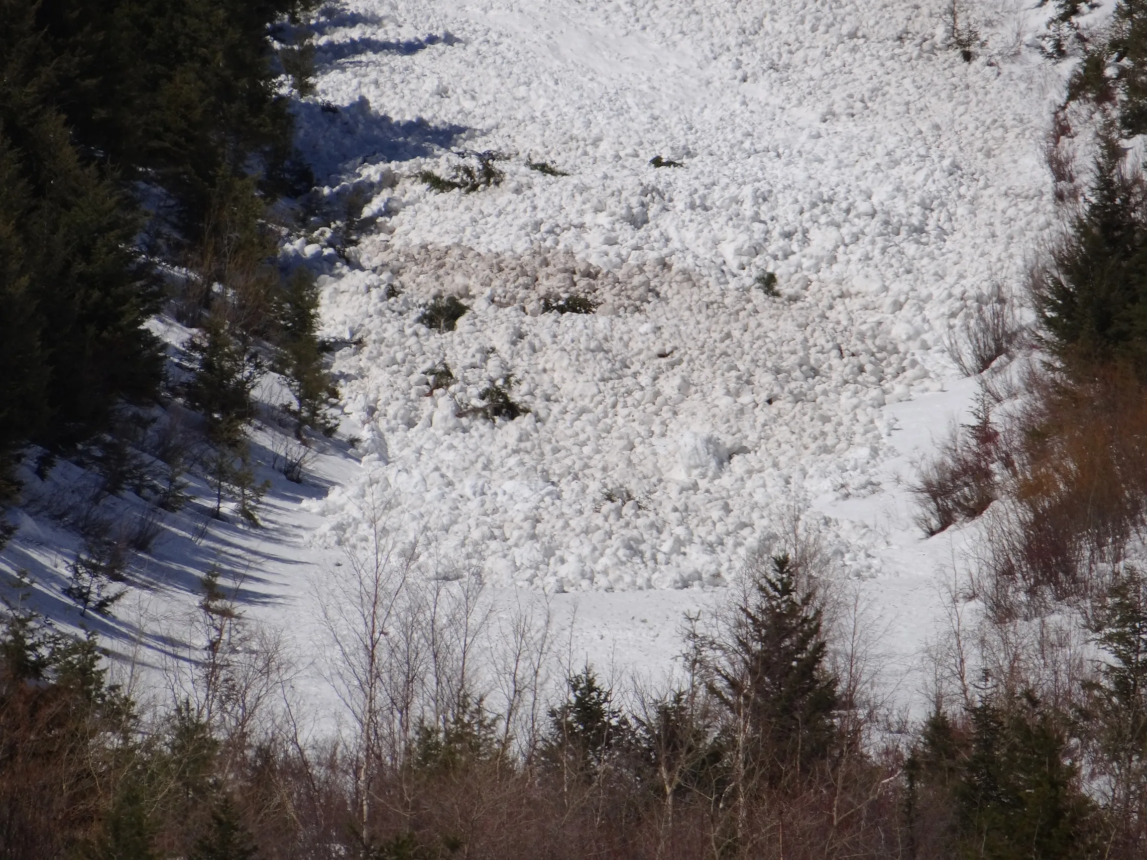 |
||
| 2019-03-21 | 14:00:00 | Shed 10 | Clark | WL | Natural | NU | R1 | D2 | O | T | R | 0 | 1830 | 1430 | 400 | 0 | 0 | 0 | 0.00 | TR | - | U | W | No | 0 | 0 | No | 0 | 0 | - | Ran early afternoon on 3/21 on looker's right face. Also another avalanche of same size in the next door gully | No Image | ||
| 2019-03-21 | 14:00:00 | Shed 10 | Clark | WL | Natural | NU | R2 | D2.5 | O | T | C | 0 | 2070 | 1430 | 640 | 0 | 0 | 0 | 0.00 | TR | - | U | W | No | 0 | 0 | No | 0 | 0 | - | Ran early afternoon on 3/21 in Feeder path. Debris stopped above rail. | No Image | ||
| 2019-03-20 | 19:40:00 | Goat Lick | Clark | WS | Natural | NL | R1 | D2.5 | O | T | L | 0 | 2015 | 1400 | 615 | 0 | 0 | 0 | 0.00 | MR | - | U | W | No | 0 | 0 | No | 0 | 0 | - | Ran 3/20 PM hours. Looker's left. Debris extent estimated. | 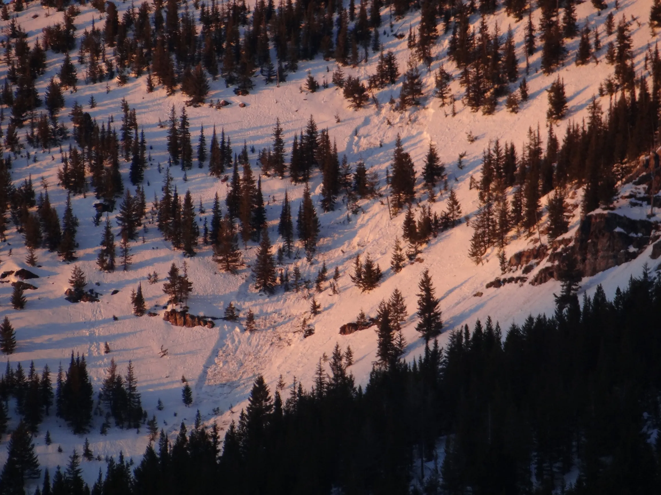 |
||
| 2019-03-20 | 16:00:00 | Grizzly Gulch | Clark | WS | Natural | NL | R1 | D2.5 | O | M | R | 0 | 1770 | 1460 | 310 | 0 | 0 | 0 | 0.00 | BR | - | U | W | No | 0 | 0 | No | 0 | 0 | - | Ran 3/20 PM hours on looker's right headwall. Wet loose triggered slab. Assume debris piled up Grizzly Ck | 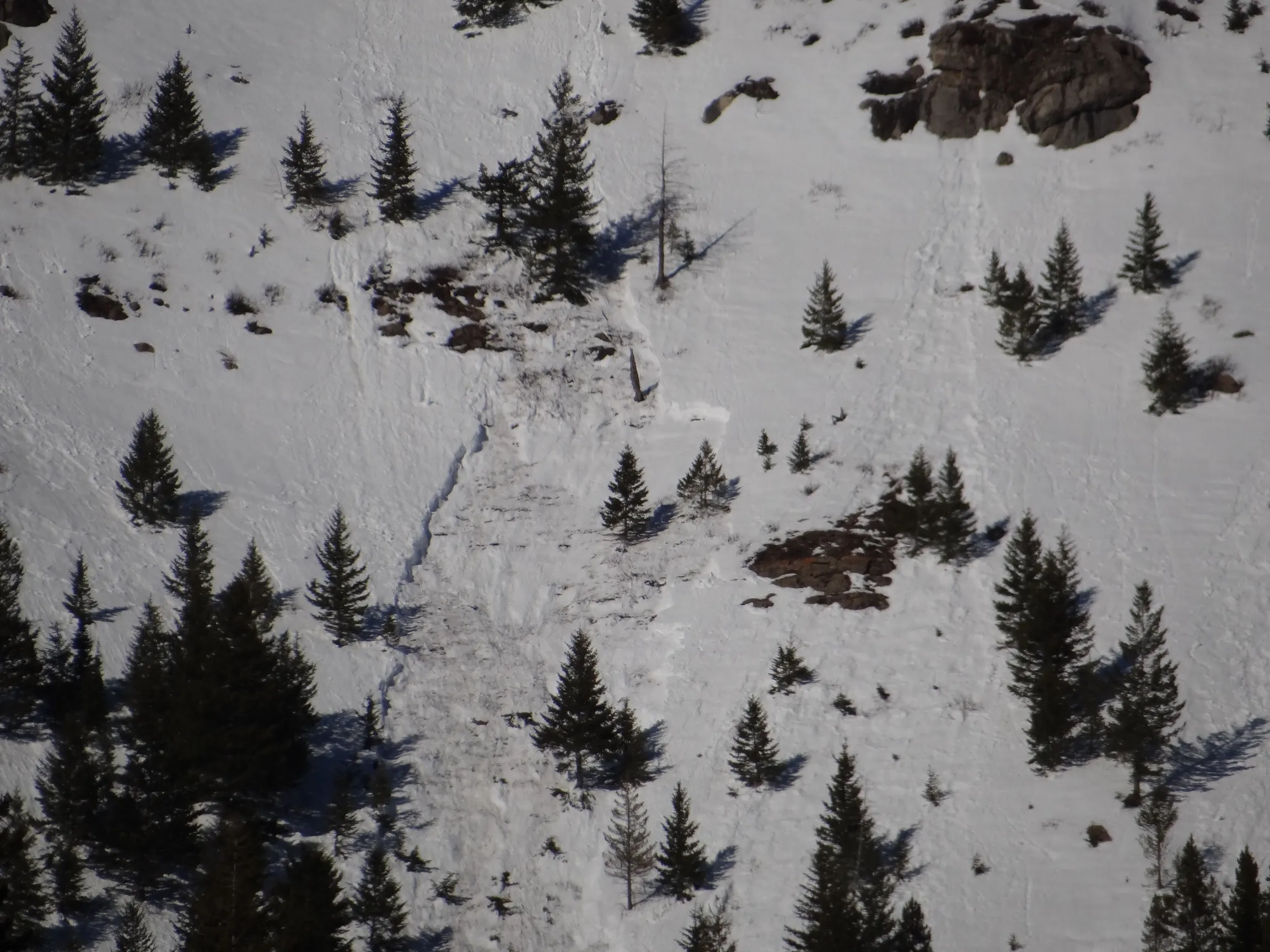 |
||
| 2019-03-20 | 16:00:00 | Infinity | Clark | WL | Natural | NU | R2 | D2 | O | T | C | 0 | 1770 | 1370 | 400 | 0 | 0 | 0 | 0.00 | U | - | U | W | No | 0 | 0 | No | 0 | 0 | - | Ran 3/20 PM hours. Multiple point releases across the path. Debris stopped within 200 yards of rail. | 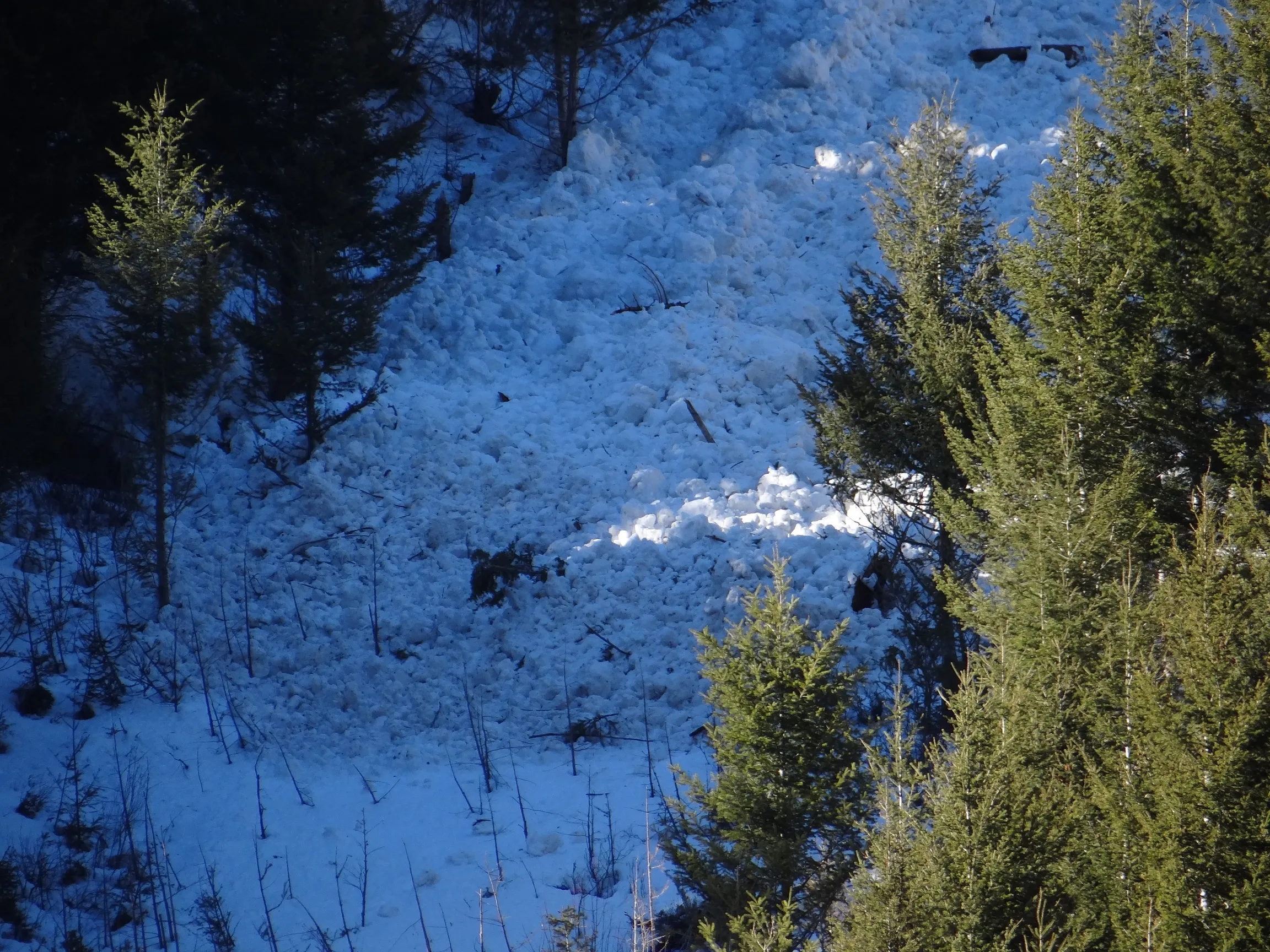 |
||
| 2019-03-20 | 16:00:00 | Shed 10 | Clark | WS | Natural | NL | R2 | D3 | O | M | R | 0 | 1830 | 1400 | 430 | 0 | 0 | 0 | 0.00 | U | - | U | W | No | 0 | 0 | No | 0 | 0 | - | Ran 3/20 PM hours. Shed 10 looker's right headwall. Wet loose triggered wet slab that propagated across this rock buttress. Debris stopped above rail. |  |
||
| 2019-03-20 | 15:30:00 | Mount Shields | Clark | WL | Natural | NU | R1 | D2 | O | T | C | 0 | 2070 | 1700 | 370 | 0 | 0 | 0 | 0.00 | BR | - | U | U | No | 0 | 0 | No | 0 | 0 | - | Ran 3/20 PM hours on SE face. Wet loose gouging to the ground. |  |
||
| 2019-03-20 | 13:00:00 | Path 1163 | Clark | WS | Natural | NL | R2 | D2.5 | O | M | R | 0 | 1770 | 1460 | 310 | 0 | 0 | 0 | 0.00 | TR | - | U | W | No | 0 | 0 | No | 0 | 0 | - | Ran PM hours 3/20. Wet loose triggered wet slab on lower, looker's right headwall. Debris stopped above rail. |  |
||
| 2019-03-20 | 10:30:00 | Shed 10.7 | Clark | WL | Natural | NU | R3 | D2.5 | O | T | C | 0 | N | 2075 | 1310 | 765 | 0 | 0 | 0 | 0.00 | BR | - | U | W | No | 0 | 0 | No | 0 | 0 | - | Ran 3/19 PM hours. Debris stopped approx. 100 m above Shed. Maybe some wet slabs in the path? |  |
|
| 2019-03-20 | 10:30:00 | Shed 11 | Clark | WS | Natural | NL | R3 | D3 | O | T | R | 0 | 1860 | 1430 | 430 | 0 | 0 | 0 | 0.00 | MR | - | U | W | No | 0 | 0 | No | 0 | 0 | - | Ran 3/19 PM hours. Debris stopped about 500 yards above rail. |  |
||
| 2019-03-20 | 10:00:00 | I Beam | Clark | WL | Natural | NU | R2 | D2.5 | O | T | R | 0 | 2195 | 1645 | 550 | 0 | 0 | 0 | 0.00 | TK | - | U | W | No | 0 | 0 | No | 0 | 0 | - | Gouged to the ground. Ran 3/19 PM hours. |  |
||
| 2019-03-19 | 15:00:00 | Infinity | Clark | WS | Natural | NU | R2 | D2.5 | O | T | C | 0 | 1830 | 1370 | 460 | 0 | 0 | 0 | 0.00 | TR | - | U | U | No | 0 | 0 | No | 0 | 0 | - | Ran Tue, 3/19 afternoon. Some small slabs and several additional wet loose. Debris stopped above rail. |  |
||
| 2019-03-19 | 15:00:00 | Path 1163 | Clark | WS | Natural | NU | R3 | D2.5 | O | T | C | 0 | 2134 | 1400 | 734 | 0 | 0 | 0 | 0.00 | TR | - | U | W | No | 0 | 0 | No | 0 | 0 | - | Multiple wet loose point releases with some narrow wet slabs as well. Debris terminated above rail. | 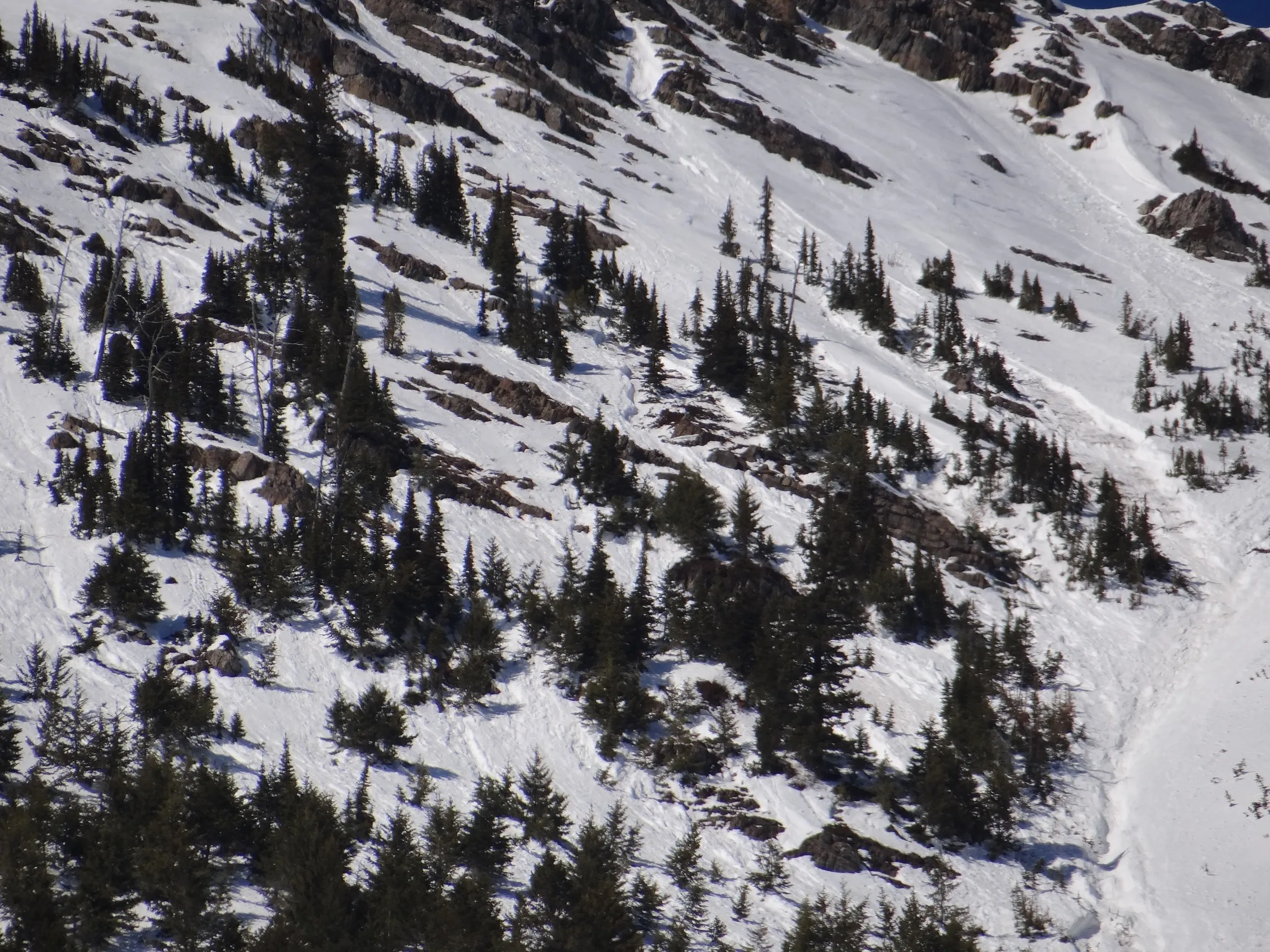 |
||
| 2019-03-19 | 15:00:00 | Shed 10 | Clark | WL | Natural | NU | R3 | D2.5 | O | T | C | 0 | 2070 | 1460 | 610 | 0 | 0 | 0 | 0.00 | TR | - | U | W | No | 0 | 0 | No | 0 | 0 | - | Shed 10 Feeder again. Ran 3/19 in afternoon. | No Image | ||
| 2019-03-19 | 09:23:00 | Shed 8 | Clark | WL | Natural | NU | R1 | D1.5 | O | U | U | 0 | 1646 | 1463 | 183 | 0 | 0 | 0 | 0.00 | U | MP | U | W | No | 0 | 0 | No | 0 | 0 | - | Looker's R headwall. Debris stopped above rail. | No Image | ||
| 2019-03-19 | 09:21:00 | Infinity | Clark | WS | Natural | N | R2 | D2 | O | T | C | 0 | 1830 | 1370 | 460 | 0 | 0 | 0 | 0.00 | TR | - | U | W | No | 0 | 0 | No | 0 | 0 | - | Small wet slabs w/ multiple wet loose. Debris terminated above rail. | No Image | ||
| 2019-03-19 | 09:20:00 | Shed 10 | Clark | WL | Natural | NU | R2 | D2 | O | T | C | 0 | 2073 | 1463 | 610 | 0 | 0 | 0 | 0.00 | TR | - | U | W | No | 0 | 0 | No | 0 | 0 | - | Shed 10 Feeder. Ran 3/18 PM hours. Debris terminated above rail. | 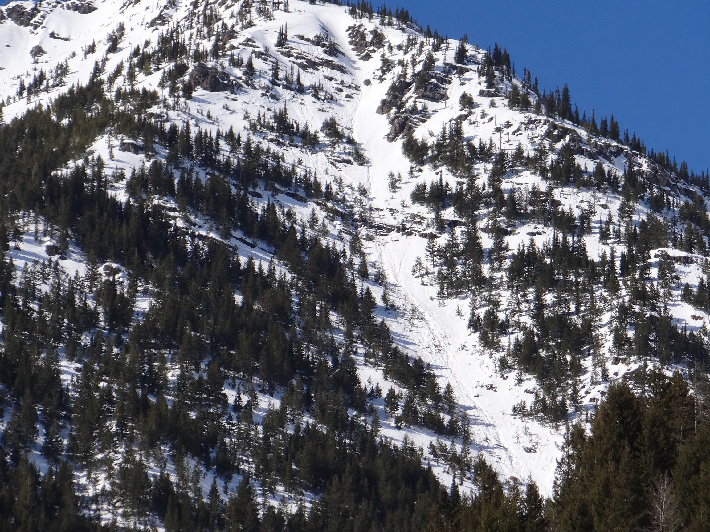 |
||
| 2019-03-18 | 12:36:00 | Shed 9 Low | Clark | WL | Natural | NU | R2 | D2 | O | T | C | 0 | 1646 | 1463 | 183 | 0 | 0 | 0 | 0.00 | U | BP | U | W | No | 0 | 0 | No | 0 | 0 | - | Ran on 3/18 on looker's R low headwall. Debris terminated above rail | No Image | ||
| 2019-03-18 | 11:15:00 | Path 1163 | Clark | WL | Natural | NU | R2 | D2 | O | U | U | 0 | 0 | 0 | 0 | 0 | 0 | 0 | 0.00 | U | - | U | U | No | 0 | 0 | No | 0 | 0 | - | Multiple point releases. Likely ran PM 3/17. Debris running 2/3rd path terminating above the rail. | No Image | ||
| 2019-03-18 | 11:05:00 | Shed 10 | Clark | WL | Natural | NU | U | U | U | U | U | 0 | 0 | 0 | 0 | 0 | 0 | 0 | 0.00 | U | - | U | U | No | 0 | 0 | No | 0 | 0 | - | Multiple point releases likely ran PM 3/17. D1s and D2s terminating well above rail grade | No Image | ||
| 2019-03-18 | 11:00:00 | Jakes (MP 1161.9) | Clark | WL | Natural | NU | R4 | D2.5 | O | T | C | 0 | S | 1524 | 1280 | 244 | 0 | 0 | 0 | 0.00 | BR | - | U | W | Yes | 4 | 0.2 | No | 0 | 0 | - | Likely ran PM 3/17. Two small fingers of debris just reached Main 1 (photo). | 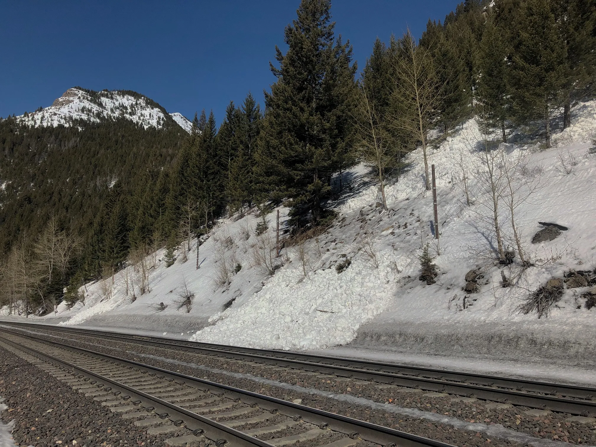 |
|
| 2019-03-18 | 10:55:00 | Infinity | Clark | WL | Natural | NU | R2 | D2 | O | U | U | 0 | 1829 | 1372 | 457 | 0 | 0 | 0 | 0.00 | TR | - | U | U | No | 0 | 0 | No | 0 | 0 | - | Likely ran PM 3/17. Debris terminating 3/4 path above rail grade | No Image | ||
| 2019-03-18 | 10:45:00 | Burn Out | Clark | WL | Natural | NU | R1 | D1.5 | O | M | C | 0 | 1493 | 1372 | 121 | 0 | 0 | 0 | 0.00 | U | - | U | W | No | 0 | 0 | No | 0 | 0 | - | Likely ran PM 3/17. Debris terminated on top of old retaining wall. | No Image | ||
| 2019-03-11 | 15:25:00 | Jakes (MP 1161.9) | Clark | WL | Natural | NU | R2 | D1.5 | O | T | U | 0 | 0 | 0 | 0 | 0 | 0 | 0 | 0.00 | TK | - | U | U | No | 0 | 0 | No | 0 | 0 | - | Obs on Mar 13, likely ran Mar 10th or 11th when it was warm and sunny. Debris ran 3/4 path terminating above rail grade. | No Image | ||
| 2019-02-14 | 12:27:00 | Burn Out | Clark | SS | Artificial : Explosive | AX | R1 | D1 | I | T | C | 38 | 1493 | 1485 | 8 | 4 | 30 | 20 | 25.00 | SZ | - | - | D | No | 0 | 0 | No | 0 | 0 | - | The one slab avalanche triggered out of six Daisy Bell shots during the Feb. 14th mitigation mission. Very small slab with debris termination well above the rail grade. | No Image | ||
| 2019-02-13 | 13:00:00 | 1160 Cutbank | Clark | SS | Natural | NU | R5 | D2 | I | T | C | 0 | N | 1400 | 1370 | 30 | 150 | 40 | 25 | 32.50 | U | BP | U | D | Yes | 60 | 2 | No | 0 | 0 | - | Debris was 6-8 feet deep and about 200 feet wide on Main 1. Front end loader needed to clear it. Path pretty much ran wall to wall. |  |
|
| 2019-02-13 | 10:00:00 | Path 1163 Headwall | Clark | SS | Natural | NU | R2 | D2 | I | M | R | 0 | 1700 | 1460 | 240 | 75 | 75 | 25 | 50.00 | TK | - | U | U | No | 0 | 0 | No | 0 | 0 | - | Observed in the afternoon from Hwy. Also from heli the next day 2/14. Debris ran 2/3rds path terminating above the rail. |  |
||
| 2019-02-13 | 10:00:00 | Grizzly Gulch | Clark | SS | Natural | NC | R1 | D2 | I | T | L | 0 | 2070 | 1700 | 370 | 75 | 100 | 50 | 75.00 | TK | - | U | U | No | 0 | 0 | No | 0 | 0 | - | Observed from heli on 2/14. Obvious cornice fall trigger. Storm slab. | No Image | ||
| 2019-02-13 | 08:41:00 | Hanging Tree North | Clark | SS | Natural | NU | R1 | D1.5 | I | B | L | 0 | N | 1250 | 1220 | 30 | 30 | 40 | 25 | 32.50 | U | BP | U | U | No | 0 | 0 | Yes | 0 | 0 | - | Buried inside lane on Hwy 2. |  |
|
| 2019-02-13 | 08:10:00 | Burn Out | Clark | SS | Natural | NU | R2 | D2 | I | B | R | 0 | N | 1460 | 1370 | 90 | 50 | 75 | 25 | 50.00 | U | BP | U | U | Yes | 0 | 0 | No | 0 | 0 | - | Most debris stopped on top of retaining wall but some reached rail on Main 1. |  |
|
| 2019-02-13 | 08:05:00 | Umbrella | Clark | SS | Natural | NU | R3 | D1.5 | I | T | L | 0 | 1400 | 1340 | 60 | 70 | 25 | 25 | 25.00 | U | BP | U | U | No | 0 | 0 | No | 0 | 0 | - | No debris on rail. | No Image | ||
| 2019-02-13 | 08:00:00 | Infinity | Clark | U | Natural | NU | U | D2.5 | U | U | U | 0 | 0 | 1400 | -1400 | 0 | 0 | 0 | 0.00 | U | - | U | U | No | 0 | 0 | No | 0 | 0 | - | Ran overnight during the storm. Debris ran 3/4 path terminating above the rail. No crown visible so not much information. | No Image | ||
| 2019-02-05 | 10:40:00 | Infinity | Clark | SS | Natural | NU | R2 | D2 | U | T | U | 0 | 1890 | 1400 | 490 | 50 | 150 | 50 | 100.00 | MR | - | U | U | No | 0 | 0 | No | 0 | 0 | - | Obs at 1040, but ran a few hours earlier that morning. Debris made it 3/4 path and did not reach rail. Uncertain what weak layer/failure plane was but suspect Jan 17 buried surface hoar. Recent N-NE winds had formed thick slab in this path. | 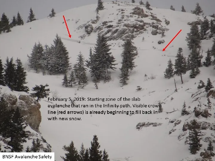 |
||
| 2019-02-02 | 17:00:00 | Umbrella | Clark | WL | Natural | NU | R1 | D1.5 | O | M | R | 0 | N | 1392 | 1355 | 37 | 0 | 0 | 0 | 0.00 | U | BP | U | W | Yes | 1.5 | 8 | No | 0 | 0 | - | Likely ran during the warm weather on Sat Feb 2. Debris reached the rail (1.5 m deep x 8 m wide) but was plowed through and unreported until Tue Feb 5th. Visited the site on Feb 5th. |  |
|
| 2019-01-28 | 09:55:00 | Path 1163 | Clark | SS | Natural | N | R1 | D2 | S | T | C | 0 | 2195 | 1402 | 793 | 40 | 100 | 50 | 75.00 | TR | - | U | U | No | 0 | 0 | No | 0 | 0 | - | Storm slab ran sometime last night, crown partially filled in. Debris did not reach grade, ran little over 2/3rds path. |  |
||
| 2019-01-07 | 11:00:00 | Shed 7 West | Clark | SS | Natural | NC | R2 | D1.5 | I | T | C | 0 | 2040 | 1800 | 240 | 30 | 100 | 50 | 75.00 | SZ | - | U | U | No | 0 | 0 | No | 0 | 0 | - | Obs from road on Tue 1/8. Storm slab from 1/7. | No Image | ||
| 2019-01-06 | 13:10:00 | Grizzly Gulch | Clark | HS | Artificial : Human | AS | R2 | D2 | O | T | U | 0 | 2256 | 2150 | 106 | 60 | 150 | 100 | 125.00 | U | - | U | U | No | 0 | 0 | No | 0 | 0 | - | Reported by skier to FAC. They remotely triggered from ridge above. Perhaps failed on Dec facets? |  |
||
| 2019-01-03 | 11:00:00 | Shed 10 | Clark | HS | Natural | N | R2 | D2 | O | T | L | 0 | 2070 | 1585 | 485 | 50 | 200 | 50 | 125.00 | TR | - | U | U | No | 0 | 0 | No | 0 | 0 | - | Shed 10 Feeder. Probably ran earlier this morning and failed on Dec facets. |  |
||
| 2019-01-02 | 13:00:00 | Shed 7 West | Clark | SS | Natural | NC | R1 | D1.5 | S | T | C | 0 | 2015 | 1800 | 215 | 20 | 75 | 15 | 45.00 | SZ | - | U | D | No | 0 | 0 | No | 0 | 0 | - | Small storm slab | No Image | ||
| 2018-12-31 | 13:32:00 | Path 1163 | Clark | HS | Natural | NU | R1 | D2 | O | T | C | 0 | 0 | 0 | 0 | 0 | 0 | 0 | 0.00 | TK | - | U | U | No | 0 | 0 | No | 0 | 0 | - | Suspect this failed on the early Dec. facets. Looked like it ran 2/3rds path. |  |
||
| 2018-12-13 | 12:05:00 | Test Slope 3 | Steiner | HS | Artificial : Human | AF | R3 | D1.5 | O | T | L | 37 | 1721 | 1690 | 31 | 90 | 50 | 20 | 35.00 | U | BP | U | D | No | 0 | 0 | No | 0 | 0 | - |    |
|||
| 2018-04-11 | 16:16:00 | Curly | Steiner | U | Natural | N | U | D1.5 | U | U | U | 0 | 0 | 1297 | -1297 | 0 | 0 | 0 | 0.00 | BR | - | U | W | No | 0 | 0 | No | 0 | 0 | - | Northerly aspect. No crown line observed. | 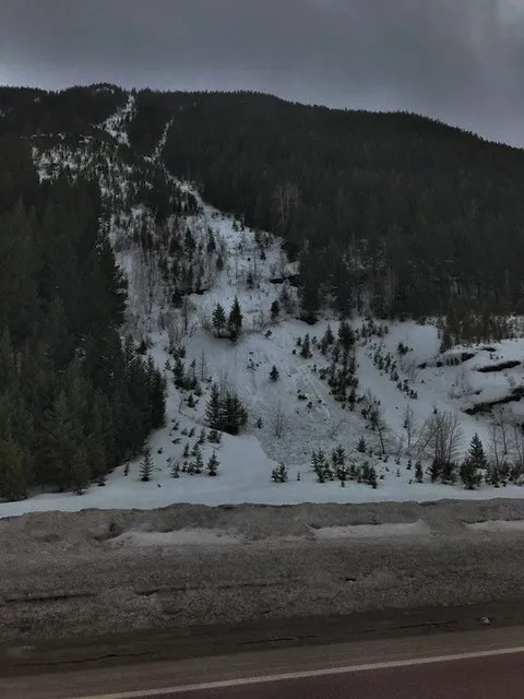 |
||
| 2018-04-11 | 16:00:00 | Path 1163 Headwall | Steiner | WL | Natural | N | R1 | D1.5 | I | M | R | 0 | 1709 | 1491 | 218 | 0 | 0 | 0 | 0.00 | TK | - | U | W | No | 0 | 0 | No | 0 | 0 | - | No Image | |||
| 2018-04-11 | 13:47:00 | Essex Mountain | Steiner | SS | Natural | N | R2 | D2 | I | M | R | 0 | 1909 | 0 | 1909 | 0 | 0 | 0 | 0.00 | U | - | U | U | No | 0 | 0 | No | 0 | 0 | - | Essex Mountain... Easterly aspect. Terminus elevation unknown. |  |
||
| 2018-04-11 | 13:00:00 | Java | Steiner | SS | Natural | N | R3 | D2 | I | M | L | 0 | 1909 | 0 | 1909 | 320 | 75 | 30 | 52.50 | U | - | U | W | No | 0 | 0 | No | 0 | 0 | - | Java Mountain: Easterly aspect. Terminus elevation Unknown. Likely a wet slab. |  |
||
| 2018-04-11 | 11:45:00 | Larry | Steiner | WL | Natural | NU | R2 | D1.5 | U | T | U | 0 | 1873 | 1291 | 582 | 0 | 0 | 0 | 0.00 | BR | - | U | W | No | 0 | 0 | No | 0 | 0 | - |  |
|||
| 2018-04-11 | 11:40:00 | Infinity | Steiner | WL | Natural | NC | R2 | D2 | U | T | L | 40 | 1894 | 1364 | 530 | 0 | 0 | 0 | 0.00 | TR | - | U | W | No | 0 | 0 | No | 0 | 0 | - | 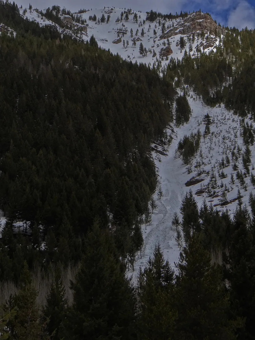 |
|||
| 2018-04-08 | 12:12:00 | Path 1163 | Steiner | U | Natural | N | R2 | D1.5 | U | U | U | 0 | 0 | 1758 | -1758 | 0 | 0 | 0 | 0.00 | TK | - | U | M | No | 0 | 0 | No | 0 | 0 | - | No Image | |||
| 2018-04-08 | 12:07:00 | Larry | Steiner | U | Natural | NU | R2 | D1.5 | U | U | U | 0 | 0 | 0 | 0 | 0 | 0 | 0 | 0.00 | TK | - | U | M | No | 0 | 0 | No | 0 | 0 | - | Ran 3/4 Path. | No Image | ||
| 2018-03-12 | 15:07:00 | Path 1163 | Steiner | L | Natural | N | R2 | D2 | U | M | L | 0 | 0 | 0 | 0 | 0 | 0 | 0 | 0.00 | TK | - | U | W | No | 0 | 0 | No | 0 | 0 | - | No Image | |||
| 2018-02-19 | 13:40:00 | Path 1163 | Steiner | SS | Natural | NU | R2 | D2 | I | T | R | 0 | 2121 | 1394 | 727 | 40 | 45 | 45 | 45.00 | TK | - | U | D | No | 0 | 0 | No | 0 | 0 | - | Debris terminated approximately 2/3rds path. | No Image | ||
| 2018-02-19 | 13:40:00 | Second Slide | Steiner | SS | Natural | NU | R2 | D1.5 | I | M | R | 0 | 1818 | 1394 | 424 | 0 | 0 | 0 | 0.00 | TK | - | U | D | No | 0 | 0 | No | 0 | 0 | - | No Image | |||
| 2018-02-12 | 15:36:00 | Path 1163 | Steiner | SS | Natural | N | R2 | D2.5 | I | T | R | 38 | 2182 | 1406 | 776 | 150 | 75 | 75 | 75.00 | TK | - | U | D | No | 0 | 0 | No | 0 | 0 | - | Ran nearly 7/8 distance to the rail grade. | 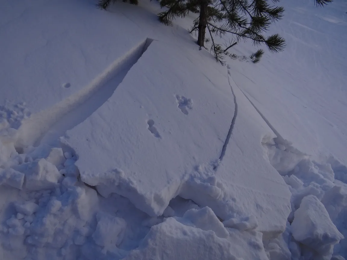  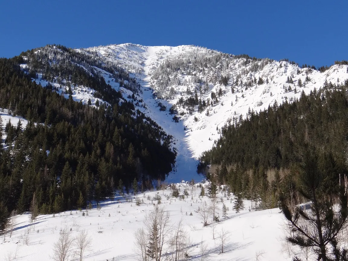 |
||
| 2018-02-09 | 15:17:00 | Infinity | Clark | SS | Natural | N | R2 | D2 | U | T | C | 40 | N | 1867 | 1394 | 473 | 50 | 60 | 60 | 60.00 | TK | - | 1F | M | No | 0 | 0 | No | 0 | 0 | - | Ran 2/3rds path to the rail grade. | 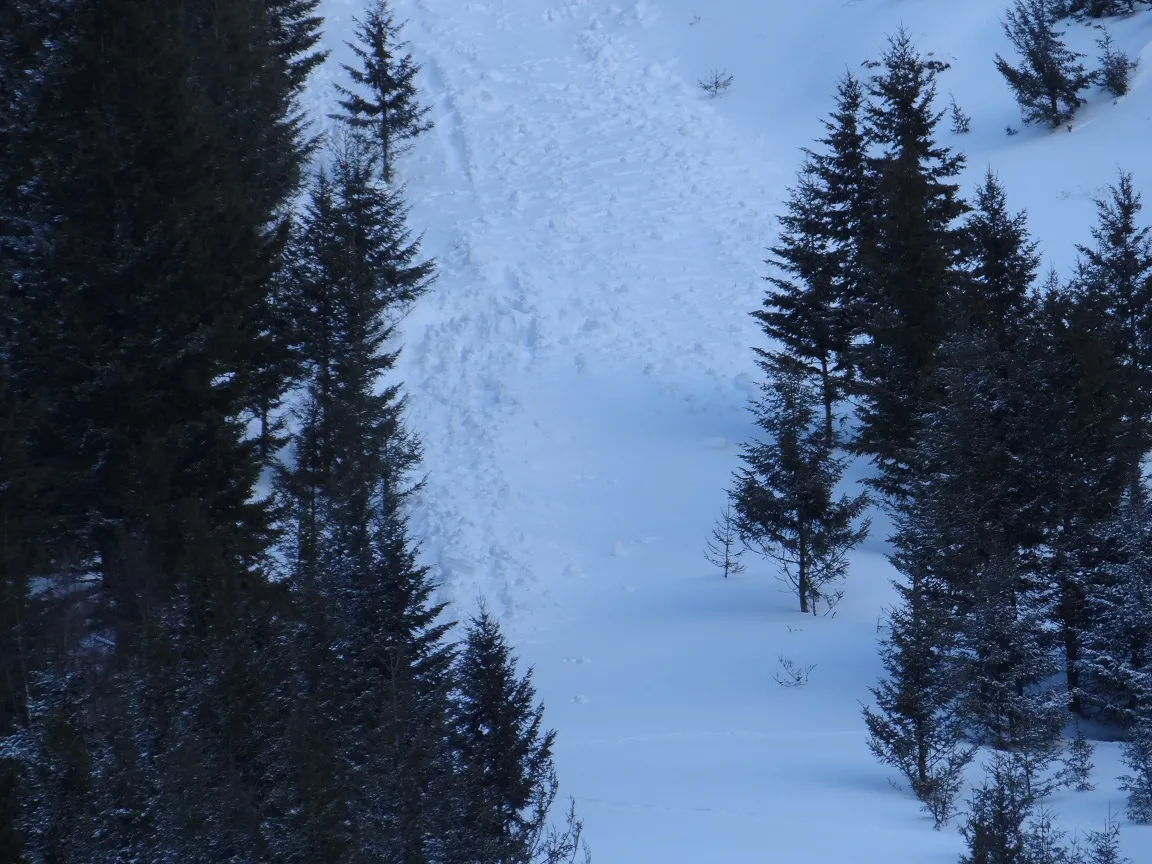 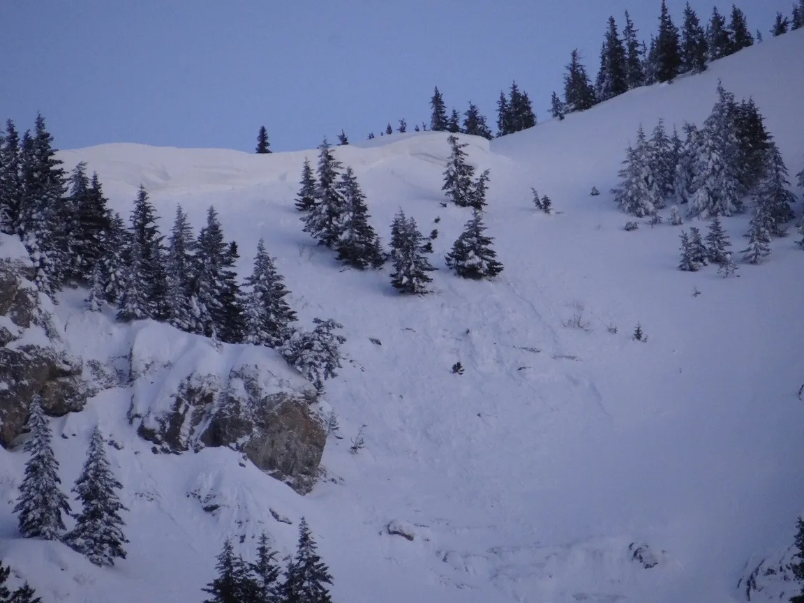 |
|
| 2018-02-09 | 08:05:00 | Elk Mountain | Clark | HS | Natural | N | R2 | D2 | I | M | R | 0 | 1636 | 1576 | 60 | 60 | 60 | 30 | 45.00 | U | BP | - | D | No | 0 | 0 | No | 0 | 0 | - | East aspect of Elk Mountain. Avalanche Prone Terrain. Outside the Program Area. | 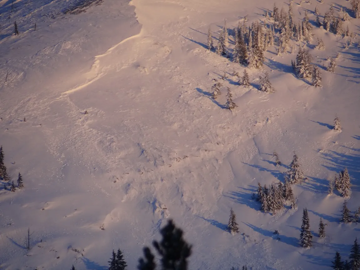 |
||
| 2018-02-09 | 07:41:00 | Path 1163 | Clark | SS | Natural | N | R2 | D2.5 | I | M | L | 37 | 2000 | 1406 | 594 | 40 | 75 | 75 | 75.00 | TK | - | U | M | No | 0 | 0 | No | 0 | 0 | - | Ran nearly 7/8ths distance to the rail grade. | 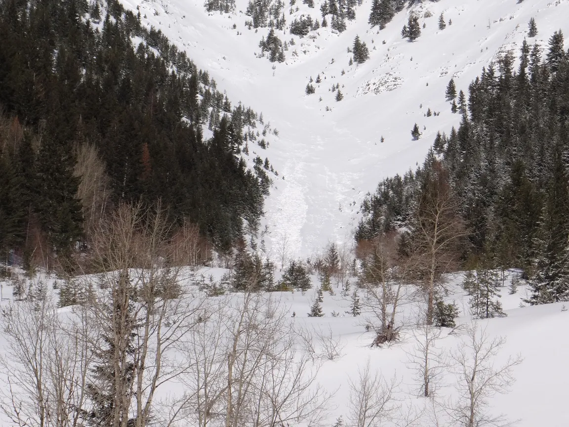 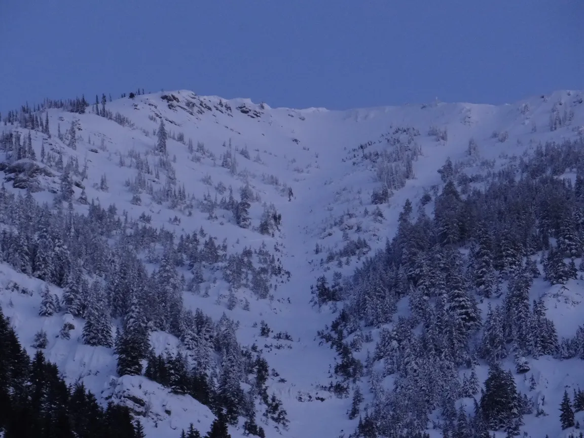 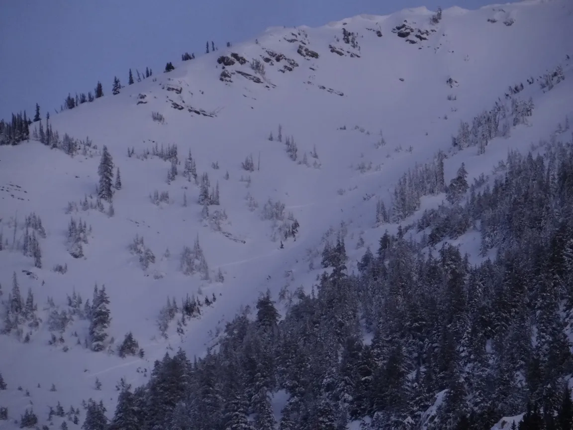 |
||
| 2018-02-08 | 13:00:00 | Infinity | Clark | U | Natural | NU | U | D2 | U | U | U | 0 | 0 | 4550 | -4550 | 0 | 0 | 0 | 0.00 | TK | - | U | W | No | 0 | 0 | No | 0 | 0 | - | Terminated 3/4 distance to the rail grade | No Image | ||
| 2018-02-08 | 08:40:00 | Infinity | Steiner | U | Natural | NU | U | D1.5 | U | U | U | 0 | 0 | 1648 | -1648 | 0 | 0 | 0 | 0.00 | TK | - | U | W | No | 0 | 0 | No | 0 | 0 | - | No Image | |||
| 2018-02-08 | 08:30:00 | Path 1163 | Steiner | U | Natural | NU | R2 | D2 | U | U | U | 0 | 0 | 1515 | -1515 | 0 | 0 | 0 | 0.00 | TK | - | U | W | No | 0 | 0 | No | 0 | 0 | - | 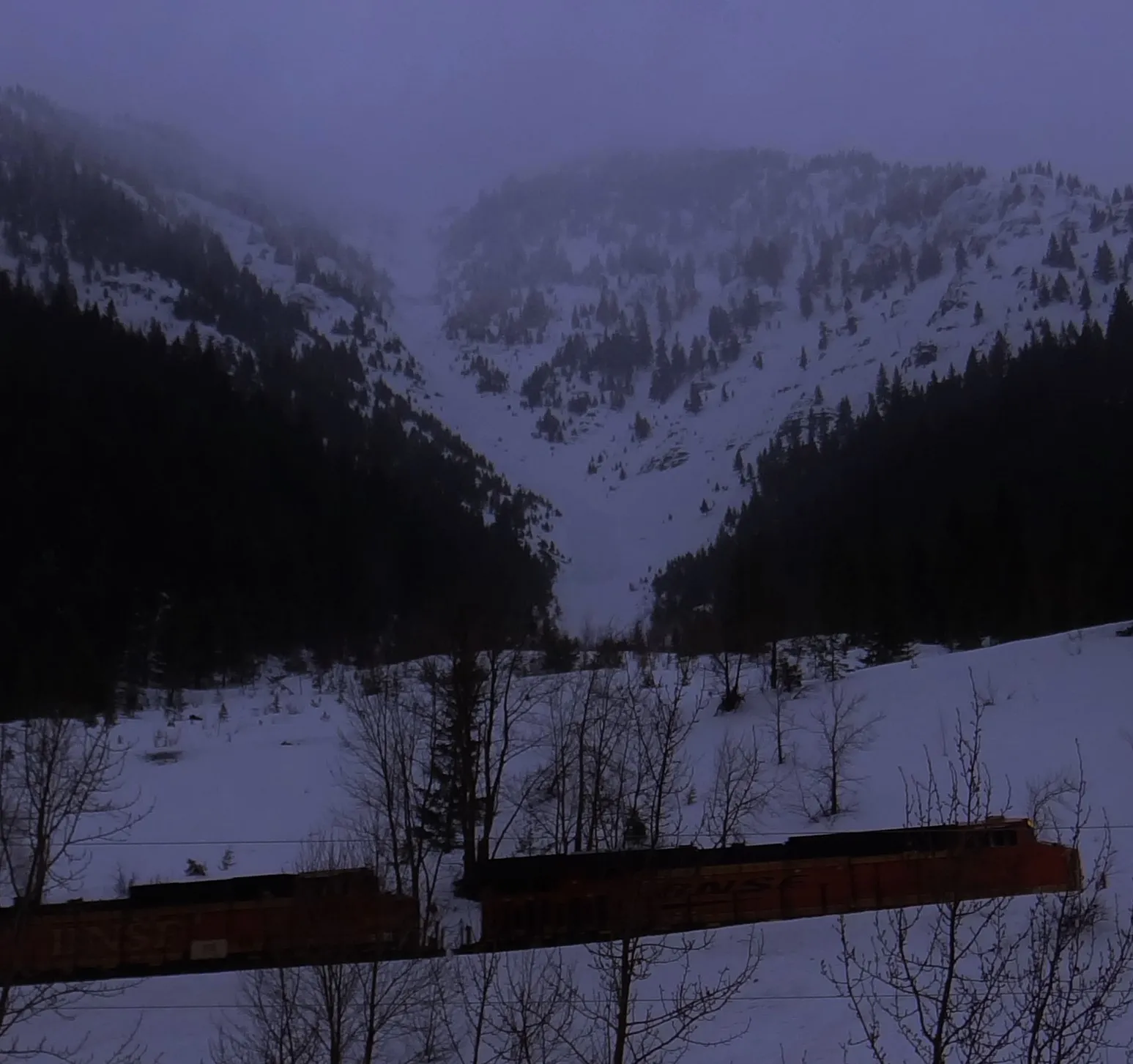 |
|||
| 2018-02-07 | 14:00:00 | Umbrella | Steiner | WS | Natural | NU | R2 | D1 | S | M | C | 0 | N | 1380 | 1347 | 33 | 20 | 20 | 10 | 15.00 | U | BP | U | M | Yes | 5 | 1 | No | 0 | 0 | - | Did not cause slide fence damage or delay any operations. | 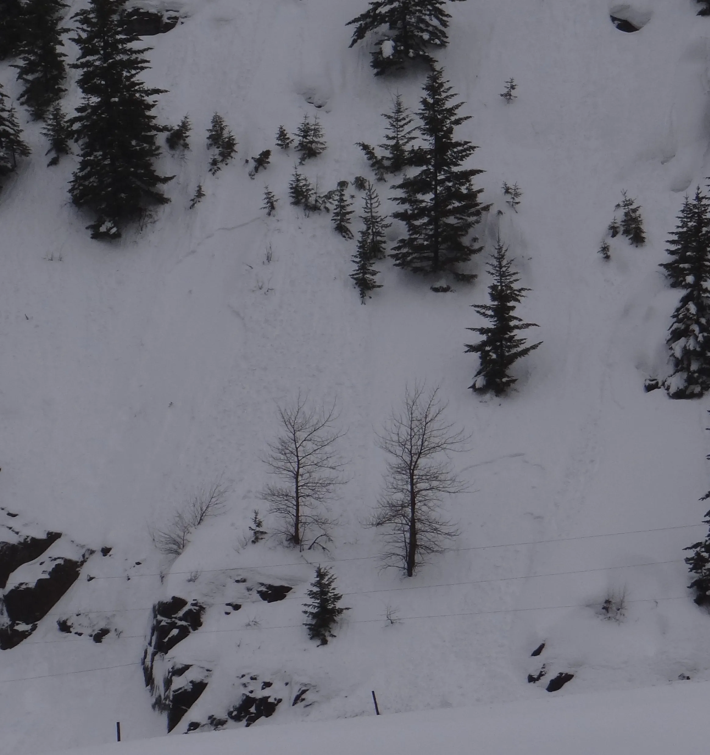 |
|
| 2017-12-30 | 09:00:00 | Infinity | Clark | SS | Natural | N | R4 | D3 | U | T | R | 38 | S | 1866 | 1322 | 544 | 0 | 0 | 0 | 0.00 | BR | - | U | D | Yes | 130 | 0.2 | No | 0 | 0 | - | 12/30/17: Infinity Path ran at approximately 0830. Debris just reached the rail with powder cloud and air blast extending across the grade. Loaded by moderate to strong east winds, 30+ degree F air T increase, and a significant amount of low density snow. | 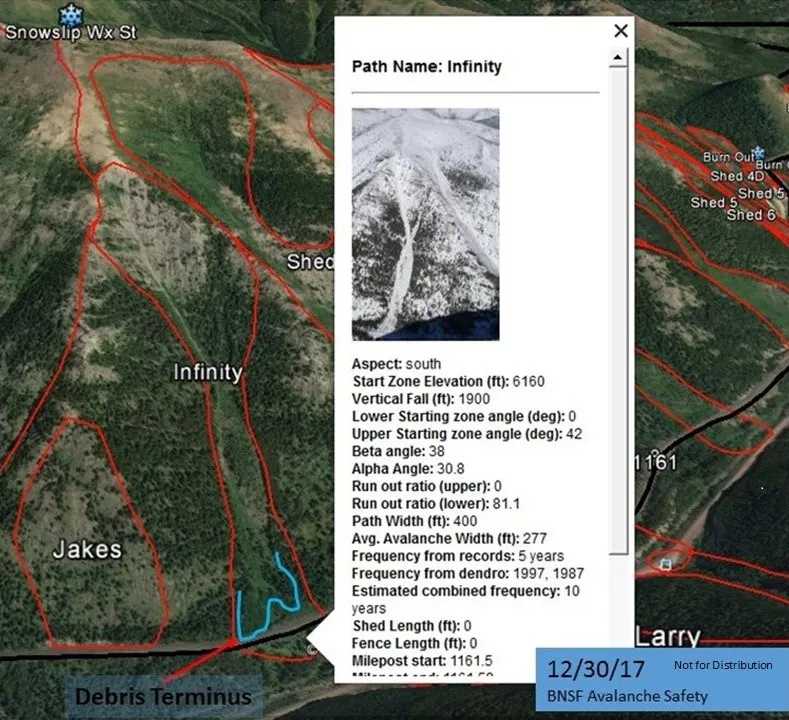 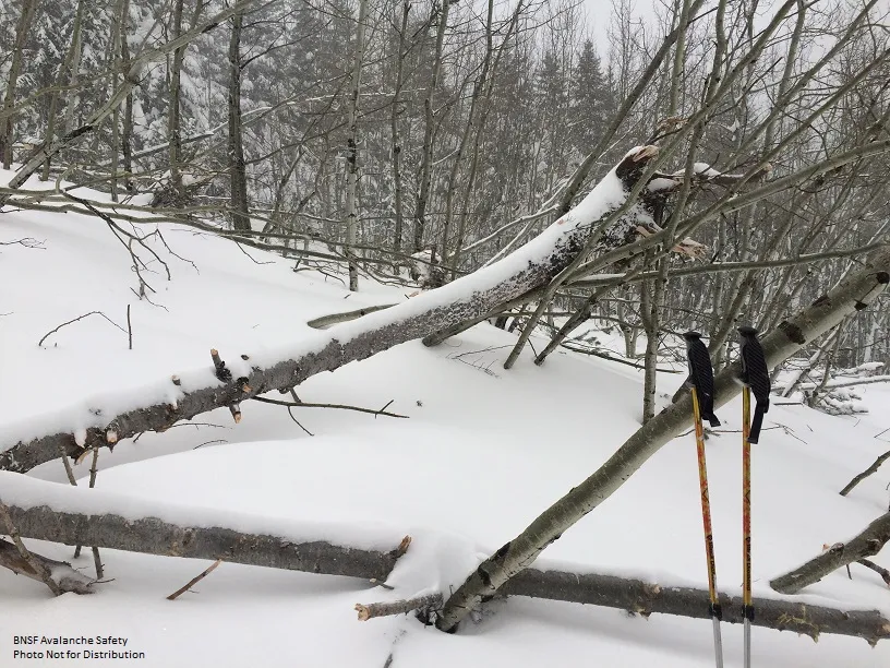 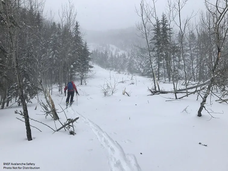 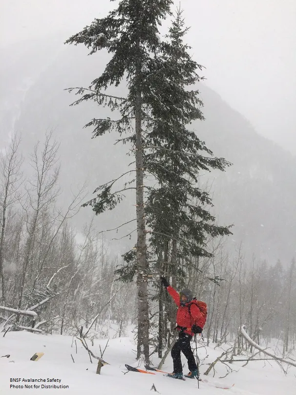 |
|
| 2017-12-30 | 01:37:00 | Jakes (MP 1161.9) | Steiner | SS | Natural | N | R2 | D1.5 | U | U | U | 37 | N | 1721 | 1311 | 410 | 0 | 0 | 0 | 0.00 | U | BP | U | D | Yes | 30 | 2 | No | 0 | 0 | - | Avalanche reported at 0137 on 12/30/2017. Debris covered both mains. | 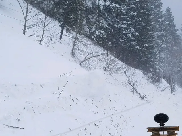 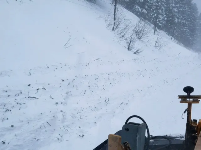 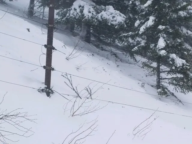 |
|
| 2017-12-29 | 08:30:00 | 1164 Cutbank | Steiner | SS | Natural | N | R3 | D1.5 | I | T | C | 0 | N | 1306 | 1244 | 62 | 40 | 30 | 30 | 30.00 | U | BP | U | D | Yes | 2 | 12 | No | 0 | 0 | - | Avalanche debris reported on the rail grade at approximately 0030 on 12/29/2017. 40' wide and 6' deep. | 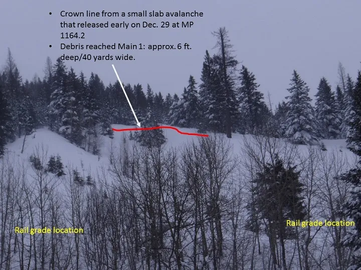 |
|
| 2017-12-20 | 15:30:00 | Infinity | Clark | SS | Natural | N | R2 | D2 | I | T | C | 0 | 1860 | 1400 | 460 | 30 | 60 | 30 | 45.00 | TR | - | 1F | D | No | 0 | 0 | No | 0 | 0 | - | 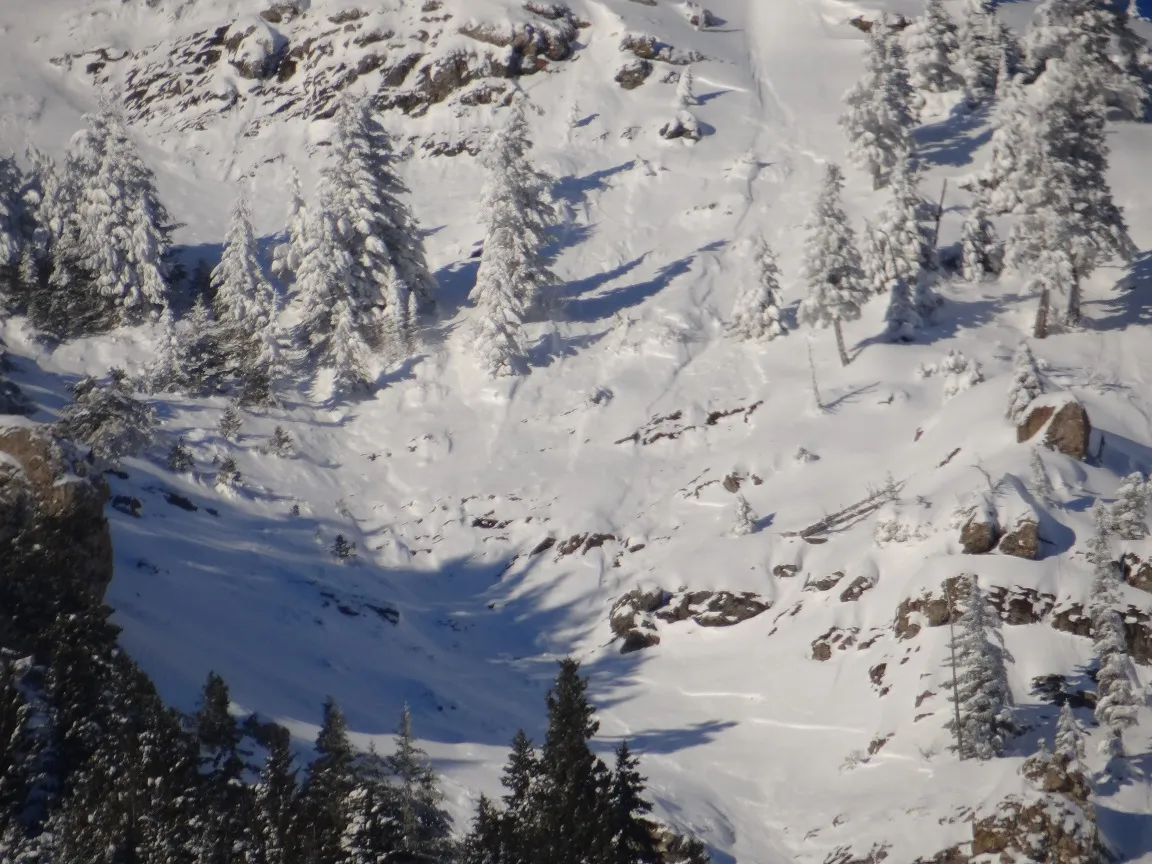 |
|||
| 2017-12-20 | 15:30:00 | Shed 7 East | Clark | SS | Natural | N | R2 | D2 | U | T | L | 0 | 1878 | 0 | 1878 | 0 | 0 | 0 | 0.00 | TK | - | U | D | No | 0 | 0 | No | 0 | 0 | - | 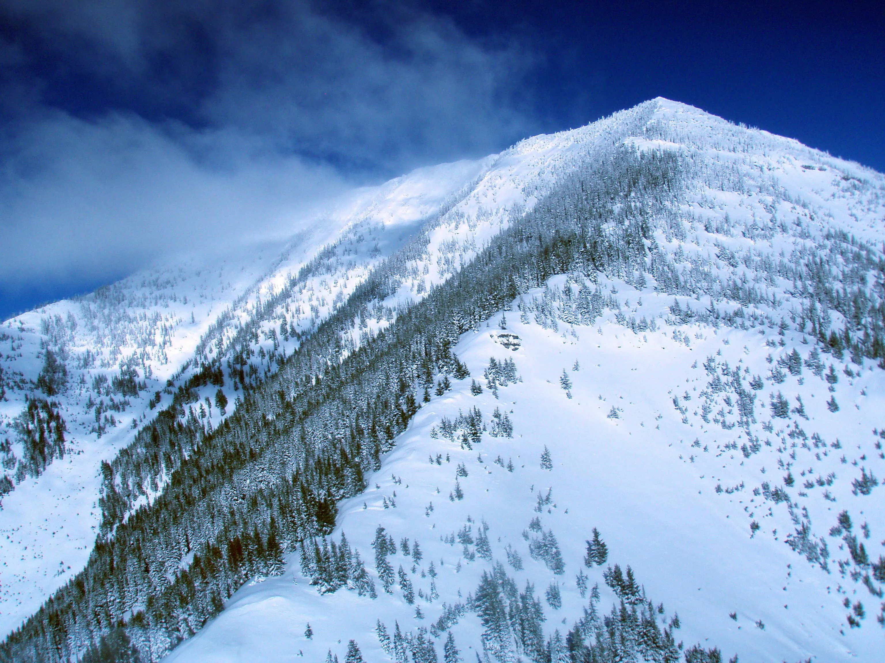 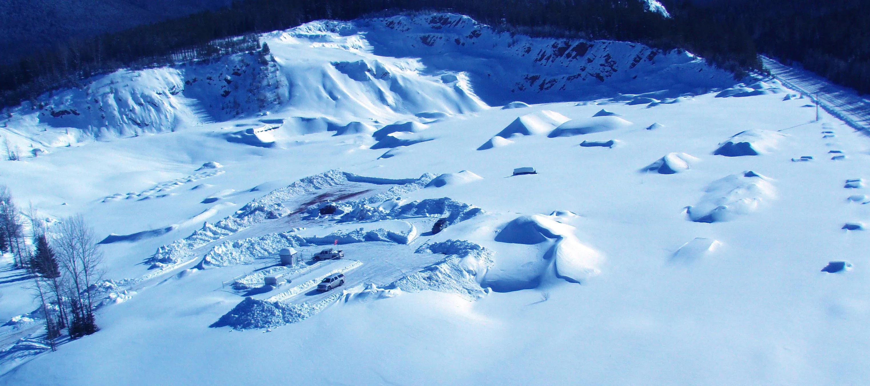 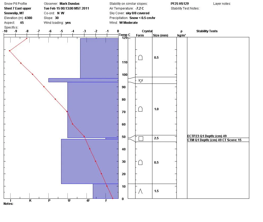 |
|||
| 2017-12-20 | 15:30:00 | Shed 8 | Clark | SS | Natural | N | R2 | D2 | U | M | R | 0 | 1878 | 0 | 1878 | 0 | 0 | 0 | 0.00 | TK | - | U | D | No | 0 | 0 | No | 0 | 0 | - | 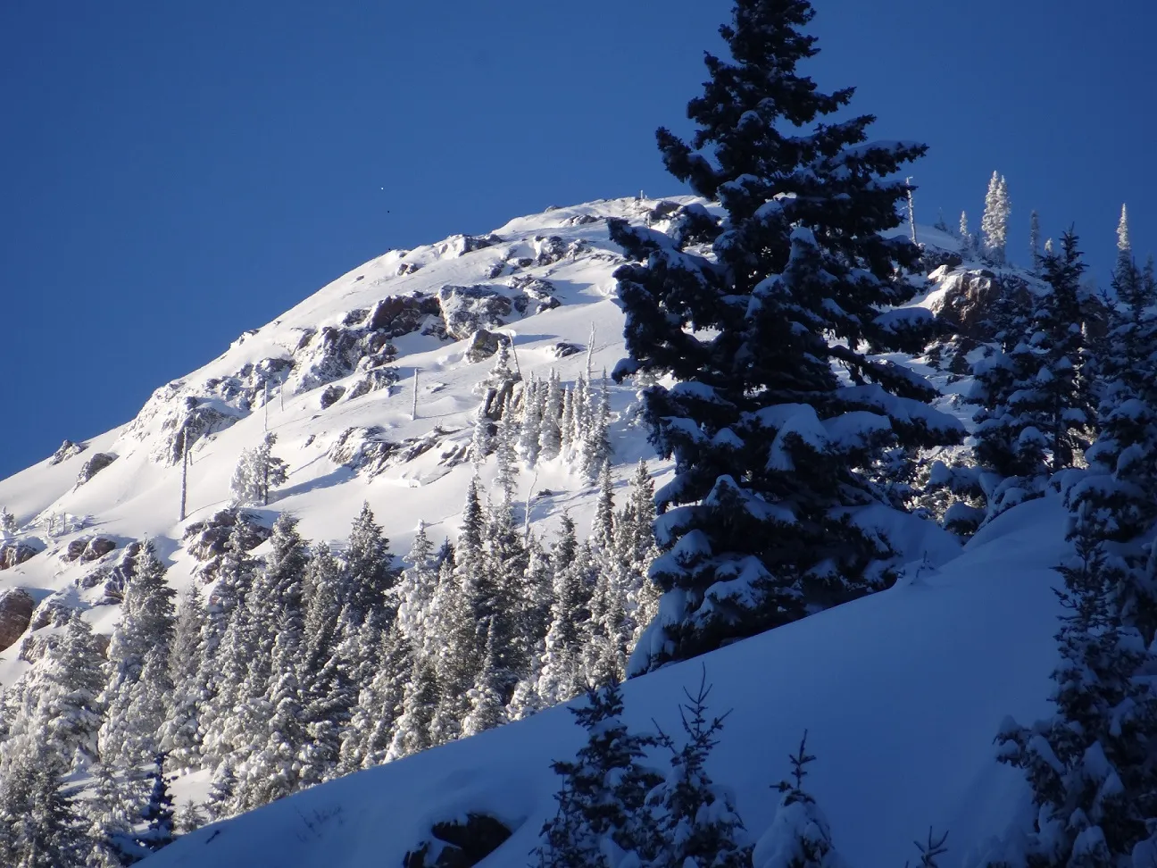 |
|||
| 2017-12-20 | 15:30:00 | Shed 10 | Clark | SS | Natural | N | R2 | D2 | I | T | C | 0 | 0 | 0 | 0 | 0 | 0 | 0 | 0.00 | TK | - | U | D | No | 0 | 0 | No | 0 | 0 | - | Started and terminated in upper 1/3 of Path. | 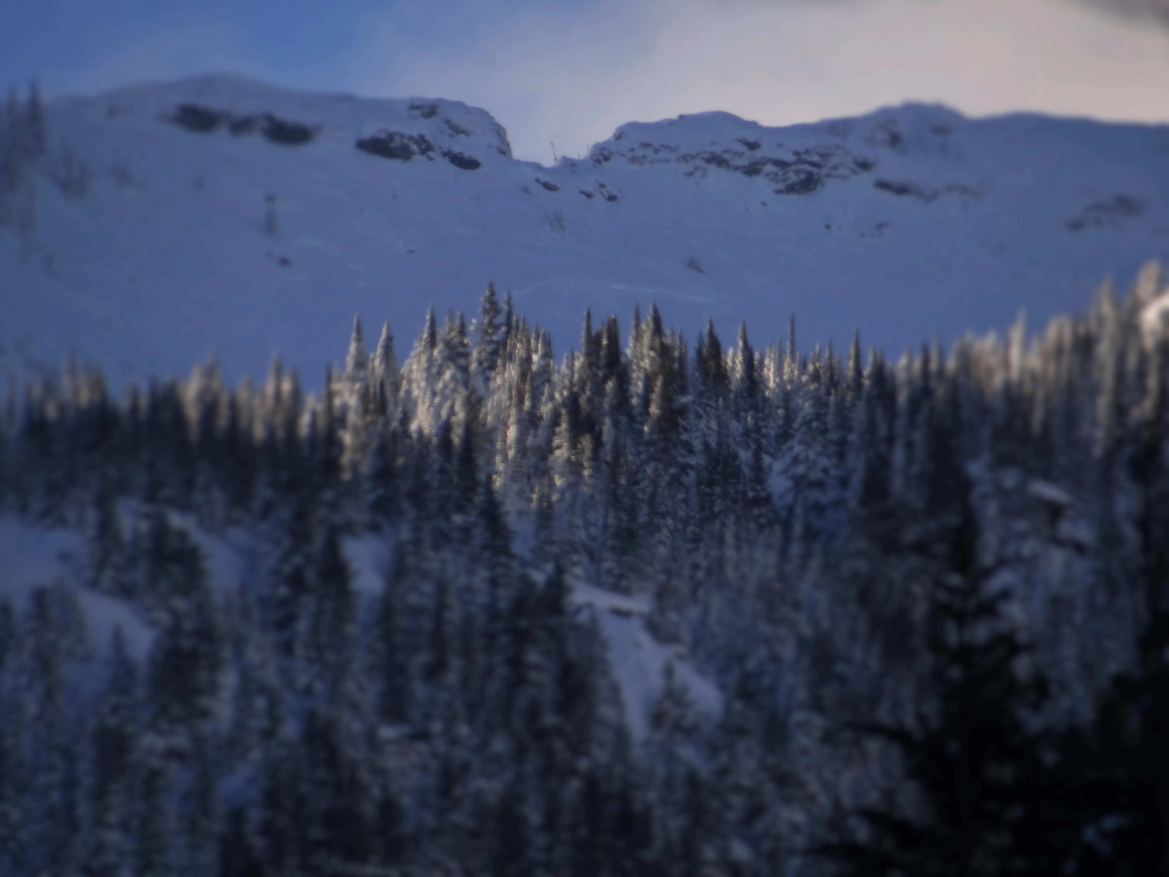 |
||
| 2017-12-20 | 15:00:00 | Mount Shields | Clark | SS | Natural | N | R3 | D3 | I | M | C | 0 | 0 | 0 | 0 | 0 | 0 | 0 | 0.00 | U | - | U | D | No | 0 | 0 | No | 0 | 0 | - | 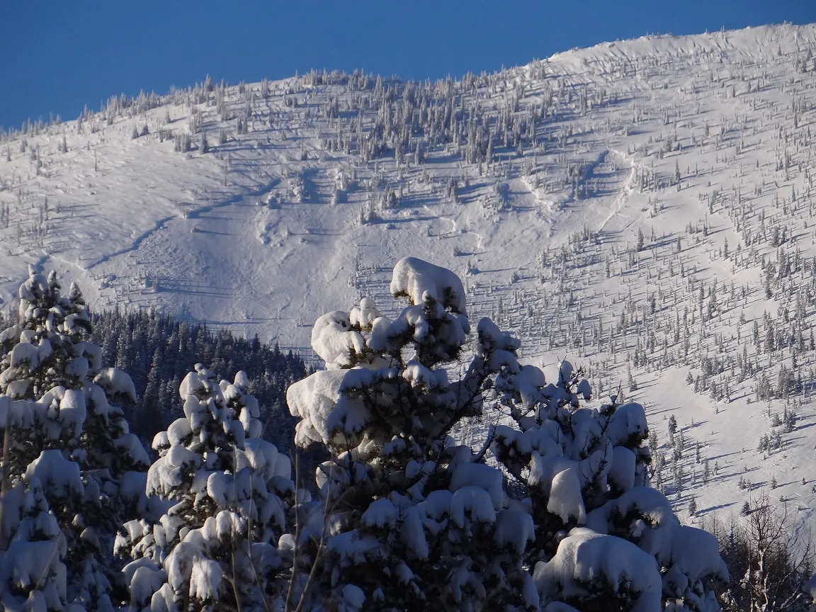 |
|||
| 2017-12-20 | 10:00:00 | Path 1163 Headwall | Clark | SS | Natural | N | R2 | D2 | U | M | R | 0 | 1818 | 1424 | 394 | 0 | 0 | 0 | 0.00 | TK | - | U | D | No | 0 | 0 | No | 0 | 0 | - | No Image | |||
| 2017-03-10 | 14:00:00 | Shed 10 | Clark | SS | Natural | NU | R1 | D2 | U | T | L | 0 | 2040 | 1430 | 610 | 40 | 40 | 10 | 25.00 | MR | - | U | U | No | 0 | 0 | No | 0 | 0 | - | This avalanche was in the feeder path, looker's left. | No Image | ||
| 2017-03-10 | 11:00:00 | Infinity | Clark | SS | Natural | NU | U | D2 | U | U | U | 0 | 0 | 1400 | -1400 | 0 | 0 | 0 | 0.00 | BR | - | U | U | No | 0 | 0 | No | 0 | 0 | - | Poor visibility, could not see crown. Debris terminated above the rail grade. | No Image | ||
| 2017-03-10 | 08:30:00 | Path 1163 | Clark | SS | Natural | NU | U | D2 | U | U | U | 0 | 0 | 1800 | -1800 | 0 | 0 | 0 | 0.00 | MR | - | U | U | No | 0 | 0 | No | 0 | 0 | - | Low visibility. Could not see crown. Ran 2/3rds path. | No Image | ||
| 2017-02-17 | 13:26:00 | Infinity | Steiner | L | Natural | N | U | D2 | U | U | U | 0 | 0 | 1353 | -1353 | 0 | 0 | 0 | 0.00 | TR | - | U | W | No | 0 | 0 | No | 0 | 0 | - | 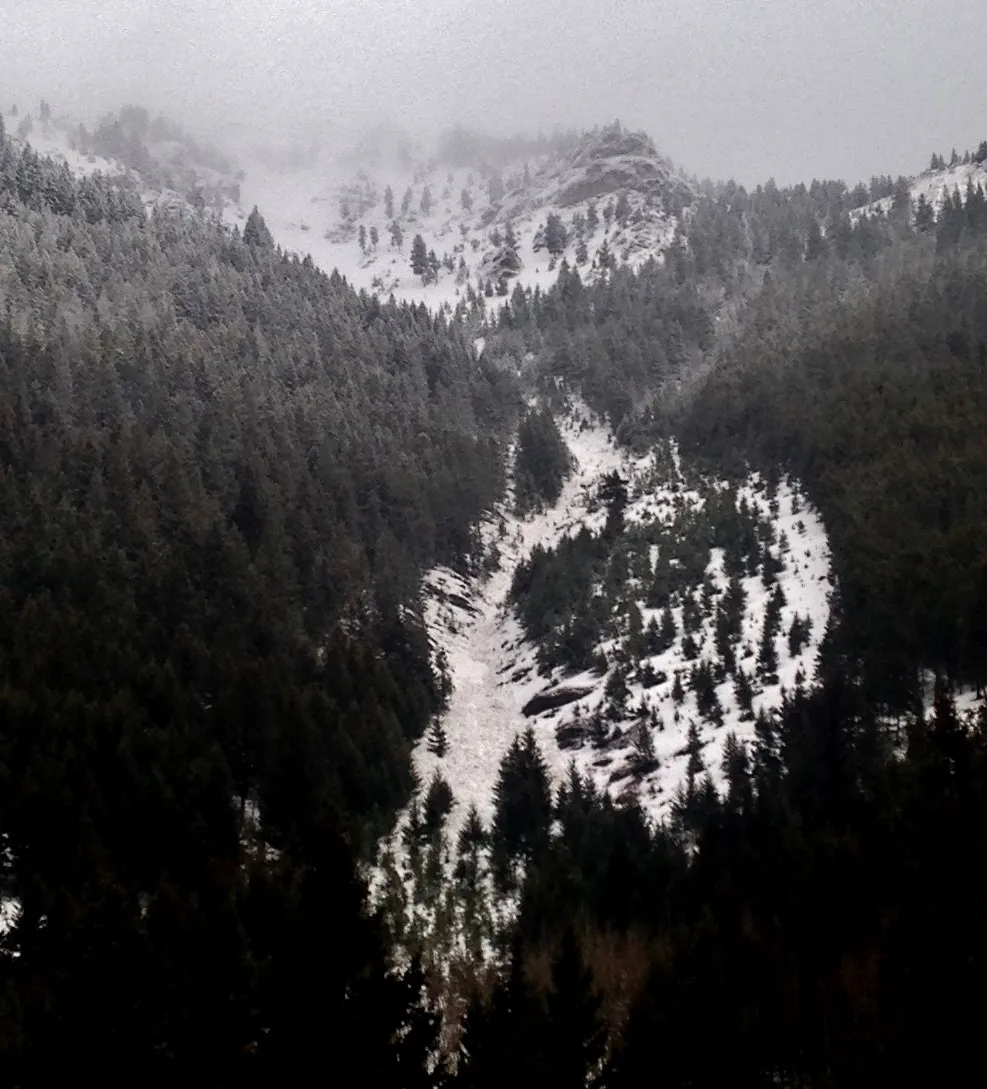 |
|||
| 2017-02-16 | 08:17:00 | Infinity | Steiner | U | Natural | N | U | D2 | U | U | U | 0 | 0 | 1353 | -1353 | 0 | 0 | 0 | 0.00 | TR | - | U | W | No | 0 | 0 | No | 0 | 0 | - | Likely triggered by warm air temperatures and high elevation rain. | No Image | ||
| 2017-02-16 | 08:12:00 | Path 1163 | Steiner | L | Natural | N | U | D2 | U | U | U | 0 | 0 | 1353 | -1353 | 0 | 0 | 0 | 0.00 | TK | - | U | W | No | 0 | 0 | No | 0 | 0 | - | Likely triggered by warm weather and high elevation rain. | No Image | ||
| 2017-02-12 | 13:30:00 | Path 1163 | Steiner | L | Natural | N | R2 | D2 | U | B | L | 0 | 1530 | 1353 | 177 | 0 | 0 | 0 | 0.00 | TK | - | U | W | No | 0 | 0 | No | 0 | 0 | - | No Image | |||
| 2017-02-11 | 14:30:00 | Path 1163 | Steiner | L | Natural | N | R2 | D2 | U | U | R | 40 | 1647 | 1412 | 235 | 0 | 0 | 0 | 0.00 | TK | - | U | W | No | 0 | 0 | No | 0 | 0 | - | No Image | |||
| 2017-02-10 | 10:00:00 | Shed 10 | Steiner | SS | Natural | N | R4 | D2 | U | T | C | 0 | 1950 | 1370 | 580 | 80 | 60 | 30 | 45.00 | TK | - | U | M | No | 0 | 0 | No | 0 | 0 | - | No Image | |||
| 2017-02-09 | 12:40:00 | Curly | Steiner | U | Natural | N | U | D2 | U | U | U | 0 | 0 | 1412 | -1412 | 0 | 0 | 0 | 0.00 | TK | - | U | M | No | 0 | 0 | No | 0 | 0 | - | No Image | |||
| 2017-02-09 | 12:40:00 | Larry | Steiner | U | Natural | N | U | D2 | U | U | U | 0 | N | 0 | 1235 | -1235 | 0 | 0 | 0 | 0.00 | BR | - | U | M | No | 0 | 0 | No | 0 | 0 | - | Terminated at Canyon floor elevation- short of Highway. | No Image | |
| 2017-02-09 | 12:30:00 | Shed 10 | Steiner | L | Natural | N | U | D2 | U | U | U | 0 | 0 | 1353 | -1353 | 0 | 0 | 0 | 0.00 | TK | - | U | M | No | 0 | 0 | No | 0 | 0 | - | No Image | |||
| 2017-02-09 | 10:30:00 | Infinity | Steiner | U | Natural | N | U | D2 | U | U | U | 0 | 0 | 1353 | -1353 | 0 | 0 | 0 | 0.00 | TR | - | U | W | No | 0 | 0 | No | 0 | 0 | - | Likely triggered by warm air temperatures and high elevation rain | No Image | ||
| 2017-02-09 | 10:30:00 | Jakes (MP 1161.9) | Steiner | L | Natural | N | U | D1.5 | U | U | U | 0 | 0 | 1265 | -1265 | 0 | 0 | 0 | 0.00 | U | BP | U | W | No | 0 | 0 | No | 0 | 0 | - | No Image | |||
| 2017-02-09 | 10:30:00 | Shed 10 | Steiner | U | Natural | N | U | D2 | U | U | U | 0 | 0 | 1412 | -1412 | 0 | 0 | 0 | 0.00 | TK | - | U | W | No | 0 | 0 | No | 0 | 0 | - | Likely triggered by warm air temperatures and high elevation rain. | No Image | ||
| 2017-02-09 | 08:30:00 | Path 1163 | Steiner | SS | Natural | N | R3 | D3 | I | M | L | 40 | SE | 2028 | 1236 | 792 | 45 | 120 | 90 | 105.00 | BR | - | U | D | Yes | 100 | 1.5 | Yes | 20 | 0.1 | - | Natural SS avalanche in Path 1163 triggered naturally at approximately 0830. Release occurred after significant warming to near freezing at all elevations. Only .002" of liquid received immediately prior to release. Debris 5-6' deep and 400' wide. Numerous trees destroyed and some of slide fence ripped out and carried over Bear Creek to the Highway. | 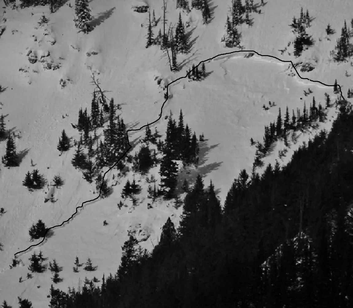 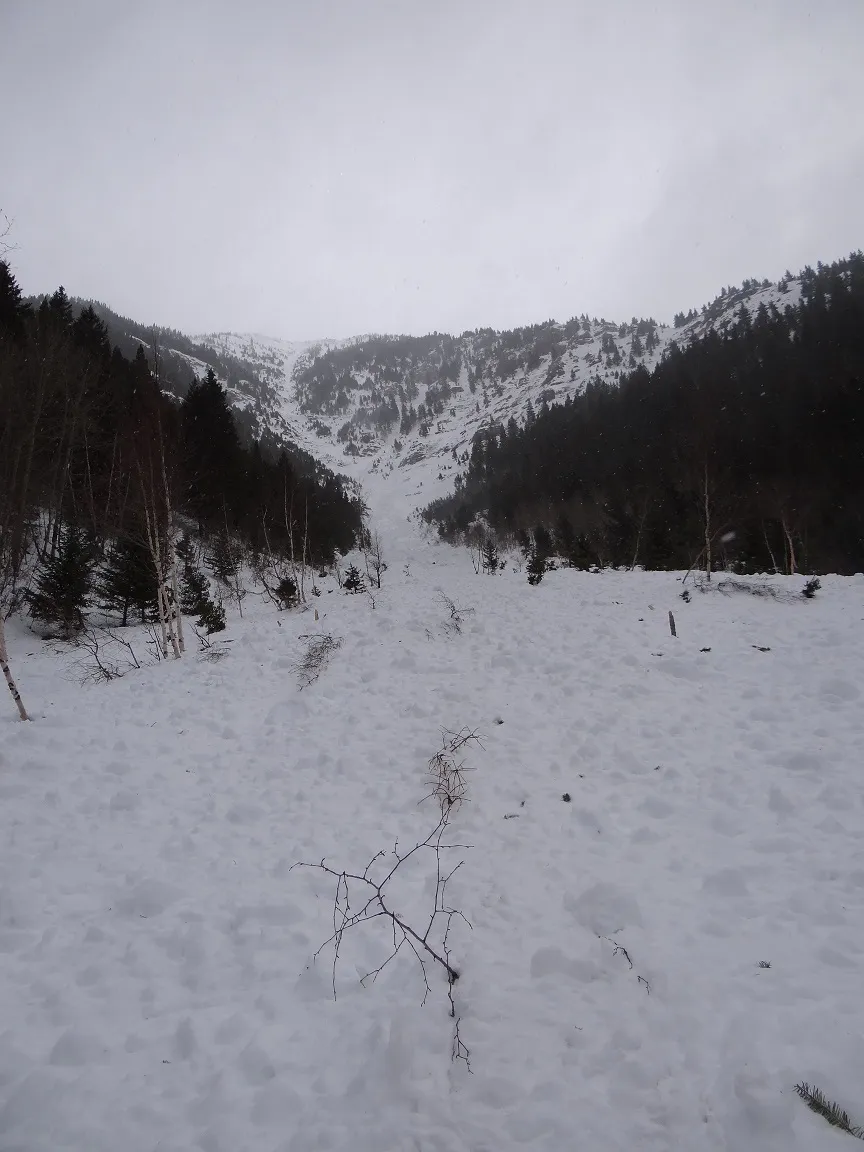 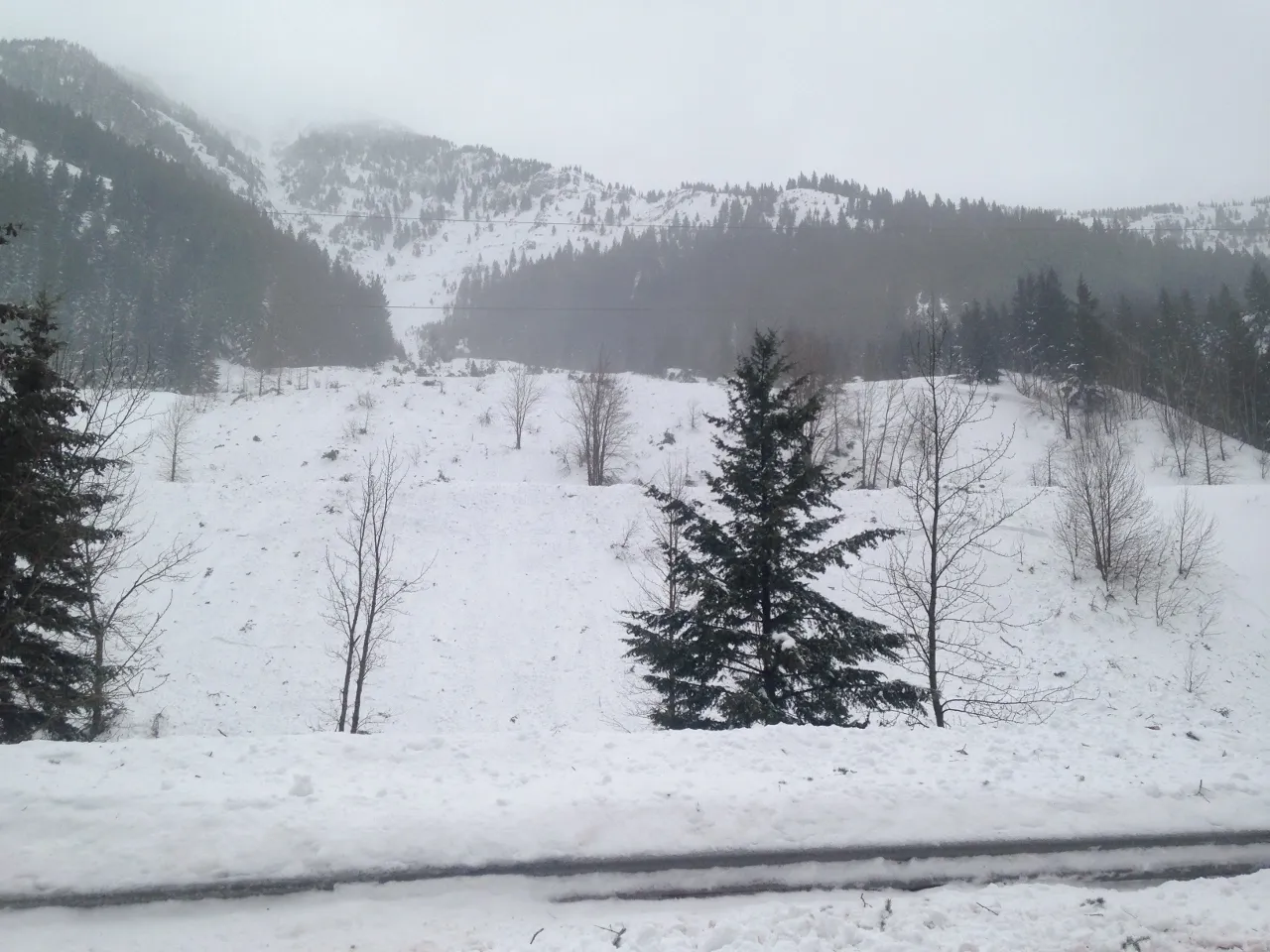 |
|
| 2017-02-07 | 12:37:00 | Jakes (MP 1161.9) | Steiner | SS | Artificial : Explosive | AX | R2 | D1.5 | S | T | L | 0 | S | 1527 | 1303 | 224 | 20 | 30 | 30 | 30.00 | - | BP | U | D | Yes | 20 | 0.5 | No | 0 | 0 | - | Ignition 3 of 3. Terminated on grade. Debris covered both Mains. | No Image | |
| 2017-02-07 | 12:36:00 | Jakes (MP 1161.9) | Steiner | SS | Artificial : Explosive | AX | R2 | D1.5 | S | T | C | 0 | S | 1527 | 1303 | 224 | 20 | 60 | 30 | 45.00 | - | BP | U | D | Yes | 20 | 1 | No | 0 | 0 | - | Ignition 2 of 3 in Jake's. Debris terminated on grade covering both Mains. | No Image | |
| 2017-02-07 | 12:35:00 | Jakes (MP 1161.9) | Steiner | SS | Artificial : Explosive | AX | R2 | D1.5 | S | T | R | 0 | N | 1527 | 1303 | 224 | 20 | 60 | 30 | 45.00 | - | BP | U | D | Yes | 20 | 0.5 | No | 0 | 0 | - | Ignition 1 of 3. Debris terminated on grade and covered both Mains. | No Image | |
| 2017-02-07 | 12:30:00 | Path 1164 | Steiner | SS | Artificial : Explosive | AX | R4 | D2 | G | T | C | 38 | N | 1353 | 1235 | 118 | 30 | 90 | 60 | 75.00 | U | BP | 3F | D | Yes | 30 | 1 | Yes | 10 | 0.2 | - | Triggered with Daisy Bell. Avalanche terminated on the uphill right-of-way of US Highway 2. Crossed both Railway mains putting 1 to 2 meters of debris on rail grade. | No Image | |
| 2017-02-07 | 12:30:00 | Shed 9 Low | Steiner | SS | Artificial : Explosive | AX | R1 | D1.5 | S | M | L | 0 | 1697 | 1448 | 249 | 20 | 30 | 30 | 30.00 | TK | - | U | D | No | 0 | 0 | No | 0 | 0 | - | Ignition 3 of 3 in "Shed 9 Low". | No Image | ||
| 2017-02-07 | 12:26:00 | Shed 9 Low | Steiner | SS | Artificial : Explosive | AX | R1 | D1.5 | S | M | C | 0 | 1697 | 1448 | 249 | 20 | 30 | 30 | 30.00 | TK | - | U | D | No | 0 | 0 | No | 0 | 0 | - | Ignition 2 of 3. Emergency Mitigation operation. | No Image | ||
| 2017-02-07 | 12:21:00 | Shed 9 Low | Steiner | SS | Artificial : Explosive | AX | R1 | D1.5 | S | M | R | 0 | 1697 | 1448 | 249 | 20 | 30 | 30 | 30.00 | TK | - | U | D | No | 0 | 0 | No | 0 | 0 | - | Ignition 1 of 3. Shed 9 headwall (Shed 9 Low). | No Image | ||
| 2017-02-07 | 12:15:00 | Umbrella | Steiner | SS | Artificial : Explosive | AX | R2 | D1 | S | T | C | 0 | SE | 1386 | 1347 | 39 | 20 | 30 | 15 | 22.50 | U | BP | U | D | Yes | 20 | 1 | No | 0 | 0 | - | Debris terminated on the grade covering Main 1. | No Image | |
| 2017-02-07 | 12:07:00 | Burn Out | Steiner | SS | Artificial : Explosive | AX | R1 | D1 | S | M | C | 0 | N | 1515 | 1370 | 145 | 15 | 30 | 15 | 22.50 | U | BP | U | D | Yes | 30 | 0.5 | No | 0 | 0 | - | Debris terminated on the grade covering Main 1. | No Image | |
| 2017-02-07 | 11:30:00 | Path 1163 Headwall | Steiner | SS | Artificial : Explosive | AX | R2 | D2 | S | M | R | 0 | 1833 | 1455 | 378 | 40 | 60 | 30 | 45.00 | TK | - | U | D | No | 0 | 0 | No | 0 | 0 | - | Shot 5. Path 1163 Headwall. Emergency Mitigation Operation. | No Image | ||
| 2017-02-07 | 11:26:00 | Path 1163 Headwall | Steiner | SS | Artificial : Explosive | AX | R1 | D1.5 | S | M | R | 0 | 1758 | 1545 | 213 | 20 | 45 | 30 | 37.50 | TK | - | U | D | No | 0 | 0 | No | 0 | 0 | - | Shot 4. Path 1163 Headwall. Emergency Mitigation Operation. | No Image | ||
| 2017-02-07 | 11:24:00 | Path 1163 | Steiner | SS | Artificial : Explosive | AX | R1 | D1.5 | S | T | R | 0 | 2152 | 1697 | 455 | 20 | 30 | 30 | 30.00 | TK | - | U | D | No | 0 | 0 | No | 0 | 0 | - | Shot 3. Path 1163. Upper SZ. Emergency Mitigation Mission. | No Image | ||
| 2017-02-07 | 11:20:00 | Path 1163 | Steiner | SS | Artificial : Explosive | AX | R2 | D2 | S | T | L | 0 | 2152 | 1697 | 455 | 30 | 45 | 30 | 37.50 | TK | - | U | D | No | 0 | 0 | No | 0 | 0 | - | Shot 2. Emergency Mitigation Mission. | No Image | ||
| 2017-02-07 | 11:17:00 | Path 1163 | Steiner | SS | Artificial : Explosive | AX | R2 | D2 | S | T | C | 0 | 2152 | 1697 | 455 | 30 | 45 | 30 | 37.50 | TK | - | U | D | No | 0 | 0 | No | 0 | 0 | - | Shot 1. Emergency Mitigation Mission Using Daisy Bell. | No Image | ||
| 2017-02-07 | 03:30:00 | Path 1183 | Steiner | SS | Natural | N | R3 | D3 | O | T | C | 39 | N | 1697 | 1030 | 667 | 364 | 120 | 300 | 210.00 | BR | - | - | D | Yes | 120 | 2 | Yes | 30 | 0.1 | - | 1183 avalanche ran at approximately 2230 on 2/6/2017. Avalanche destroyed powerline infrastructure and terminated on US Highway 2. Six to Seven feet (6'-7') of debris was deposited on both mains of the BNSF Railway. | 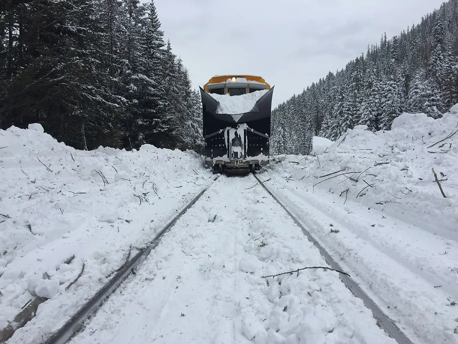 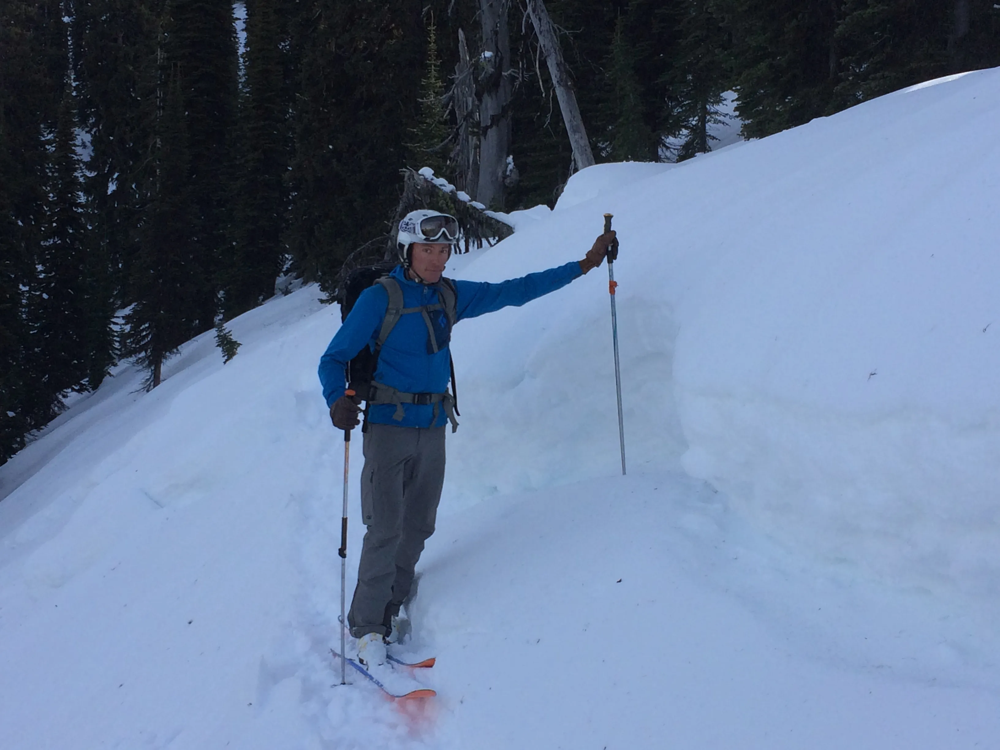  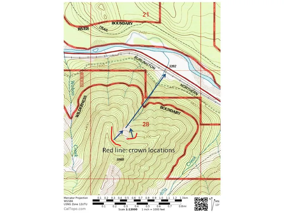 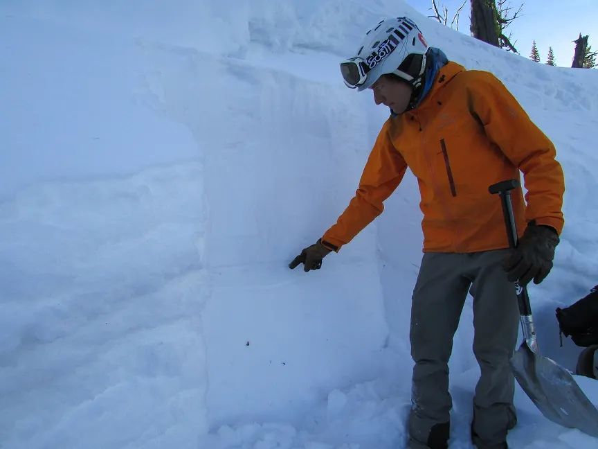 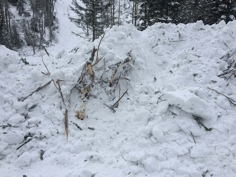 |
|
| 2017-02-06 | 18:12:00 | 1155 Cutbank | Steiner | SS | Natural | N | U | U | U | U | U | 0 | N | 0 | 0 | 0 | 0 | 0 | 0 | 0.00 | U | BP | U | D | Yes | 0 | 0 | No | 0 | 0 | - | Dark hours avalanche. Debris deposited on both mains. | No Image | |
| 2017-02-06 | 10:15:00 | Shed 7 East | Clark | SS | Natural | NU | R3 | D3 | U | T | C | 40 | N | 1882 | 1294 | 588 | 70 | 90 | 90 | 90.00 | TR | - | U | D | Yes | 30 | 1.5 | No | 0 | 0 | - | Terminated in runout below Shed 7. Climbing ladder damaged by debris on east end of shed. | No Image | |
| 2017-02-06 | 10:07:00 | Infinity | Clark | SS | Natural | NU | U | D2 | U | U | U | 0 | 0 | 1437 | -1437 | 0 | 0 | 0 | 0.00 | TR | - | U | D | No | 0 | 0 | No | 0 | 0 | - | Terminated 3/4 path to the rail grade. | No Image | ||
| 2017-02-06 | 10:00:00 | Shed 10.7 | Clark | SS | Natural | NU | R2 | D3 | U | U | U | 0 | N | 1796 | 1257 | 539 | 0 | 0 | 0 | 0.00 | MR | - | U | U | Yes | 20 | 0.2 | No | 0 | 0 | - | Terminated on Shed 10.7 roof | No Image | |
| 2017-02-06 | 08:00:00 | Shed 11 | Steiner | SS | Natural | NU | U | U | U | T | C | 37 | 1939 | 0 | 1939 | 0 | 0 | 0 | 0.00 | U | - | U | D | No | 0 | 0 | No | 0 | 0 | - | Avalanche crown visible post storm cycle. Debris buried by recent snowfall. Crown not far below wx station. Terminus elevation unknown. | No Image | ||
| 2017-02-06 | 03:30:00 | Umbrella | Steiner | SS | Natural | N | R4 | D1.5 | I | U | U | 0 | S | 0 | 1353 | -1353 | 0 | 30 | 100 | 65.00 | U | BP | U | U | Yes | 40 | 2 | No | 0 | 0 | - | This avalanche released in steep rock band that wraps around the terrain above what is known as the Umbrella Fence. Debris covered both mains up to 8' deep. Avalanche time is estimated. | No Image | |
| 2017-02-06 | 02:00:00 | 1159 Cutbank | Steiner | U | Natural | N | U | U | U | U | U | 0 | N | 0 | 1385 | -1385 | 0 | 0 | 0 | 0.00 | U | - | U | U | Yes | 0 | 0 | No | 0 | 0 | - | Time is approximate. Debris across Main 1. | No Image | |
| 2017-02-06 | 02:00:00 | 1160 Cutbank | Steiner | U | Natural | N | U | U | U | U | U | 0 | N | 0 | 1364 | -1364 | 0 | 0 | 0 | 0.00 | U | - | U | U | Yes | 0 | 0 | No | 0 | 0 | - | Time is approximate. Debris fully across main 1 and partially across main 2. | No Image | |
| 2017-02-06 | 02:00:00 | 1160 Cutbank | Steiner | U | Natural | N | U | U | U | U | U | 0 | N | 0 | 1364 | -1364 | 0 | 0 | 0 | 0.00 | U | - | U | U | Yes | 0 | 0 | No | 0 | 0 | - | Time is approximate. Debris across both mains. | No Image | |
| 2017-02-06 | 02:00:00 | 1160.3 Cutbank | Steiner | U | Natural | N | U | U | U | U | U | 0 | N | 0 | 1356 | -1356 | 0 | 0 | 0 | 0.00 | U | - | U | U | Yes | 0 | 0 | No | 0 | 0 | - | Time is approximate. Debris fully across main 1 and partially across main 2. | No Image | |
| 2017-02-06 | 02:00:00 | 1164 Cutbank | Steiner | U | Natural | N | U | U | U | U | U | 0 | N | 0 | 1250 | -1250 | 0 | 0 | 0 | 0.00 | U | BP | U | U | Yes | 0 | 0 | No | 0 | 0 | - | Time is approximate. Debris fully across main 1 and partially across main 2. | No Image | |
| 2017-02-06 | 02:00:00 | Jakes (MP 1161.9) | Steiner | U | Natural | N | U | U | U | U | U | 0 | N | 0 | 1265 | -1265 | 0 | 0 | 0 | 0.00 | U | BP | U | U | Yes | 0 | 0 | No | 0 | 0 | - | Time is approximate. Debris across both mains. | No Image | |
| 2017-02-06 | 00:33:00 | Burn Out | Clark | SS | Natural | NU | U | D2.5 | U | U | U | 0 | N | 0 | 0 | 0 | 0 | 0 | 0 | 0.00 | BR | - | U | U | Yes | 0 | 0 | No | 0 | 0 | - | Dark hours avalanche. Debris covered both Mains and damaged slide fence. Size estimated at D2-2.5 given reports from RR. | No Image | |
| 2017-02-05 | 15:00:00 | 1159 Cutbank | Steiner | SS | Natural | N | U | D1.5 | I | U | U | 0 | 0 | 1372 | -1372 | 0 | 0 | 0 | 0.00 | U | BP | U | D | No | 0 | 0 | No | 0 | 0 | - | Time of avalanche is estimated | No Image | ||
| 2017-02-05 | 15:00:00 | 1164 Cutbank | Steiner | SS | Natural | N | U | U | U | U | U | 0 | 0 | 1250 | -1250 | 0 | 0 | 0 | 0.00 | U | - | U | U | No | 0 | 0 | No | 0 | 0 | - | Avalanche time is estimated | No Image | ||
| 2017-01-18 | 12:35:00 | Jakes (MP 1161.9) | Steiner | L | Natural | N | R3 | D2 | G | T | C | 40 | N | 1588 | 1265 | 323 | 0 | 0 | 0 | 0.00 | U | BP | U | W | Yes | 10 | 0.8 | No | 0 | 0 | - | Wet, loose avalanche. Covered Main 1- Inside line. | 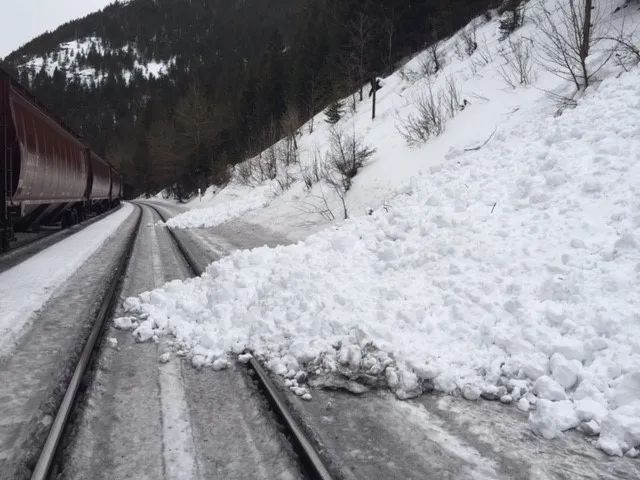 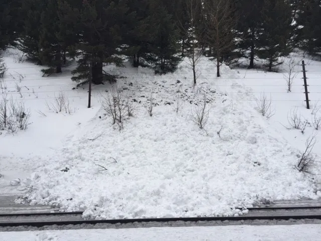 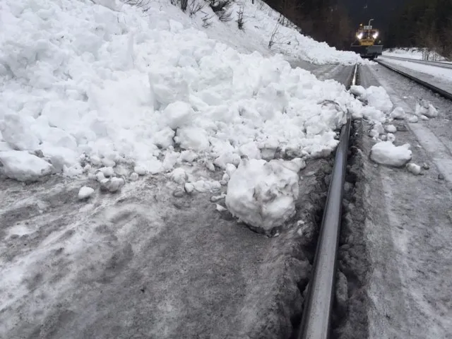 |
|
| 2017-01-18 | 09:12:00 | Path 1163 | Steiner | U | Natural | NU | U | D2 | U | U | U | 0 | 0 | 1557 | -1557 | 0 | 0 | 0 | 0.00 | TK | - | U | M | No | 0 | 0 | No | 0 | 0 | - | No Image | |||
| 2017-01-11 | 16:00:00 | Path 1163 | Steiner | SS | Natural | NU | R2 | D2 | U | T | R | 0 | 2156 | 1557 | 599 | 50 | 90 | 60 | 75.00 | TK | - | U | D | No | 0 | 0 | No | 0 | 0 | - | 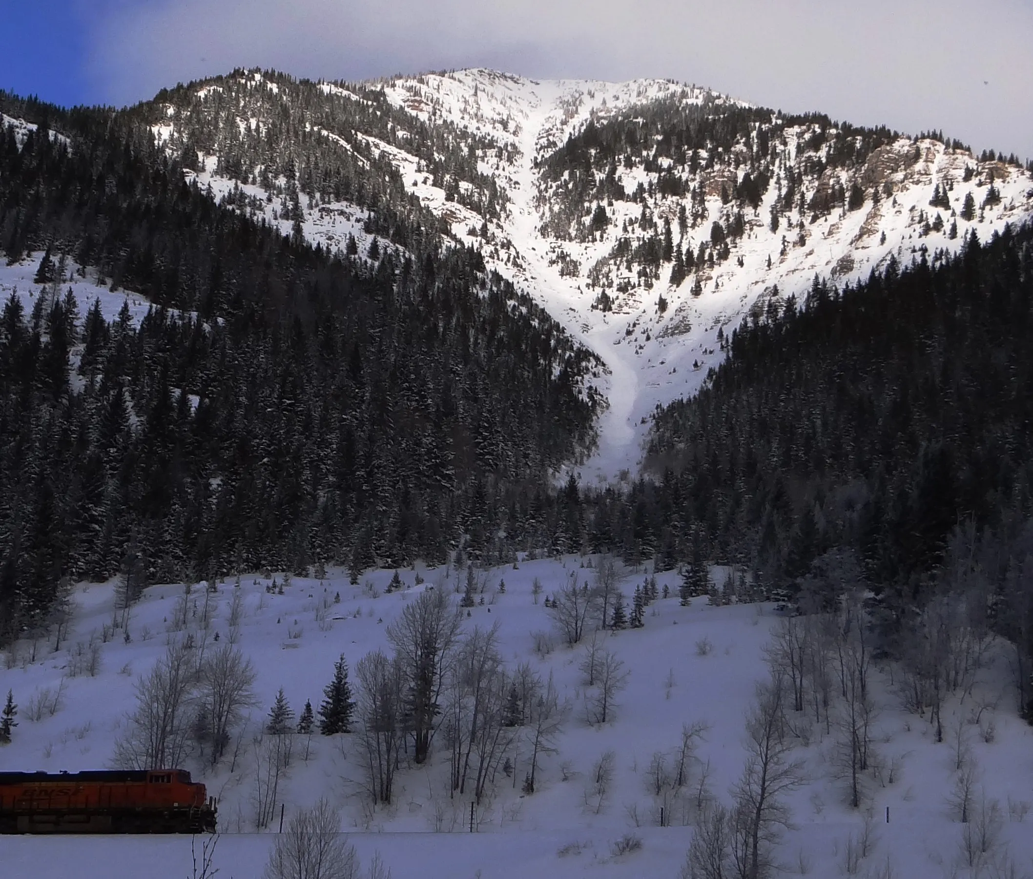 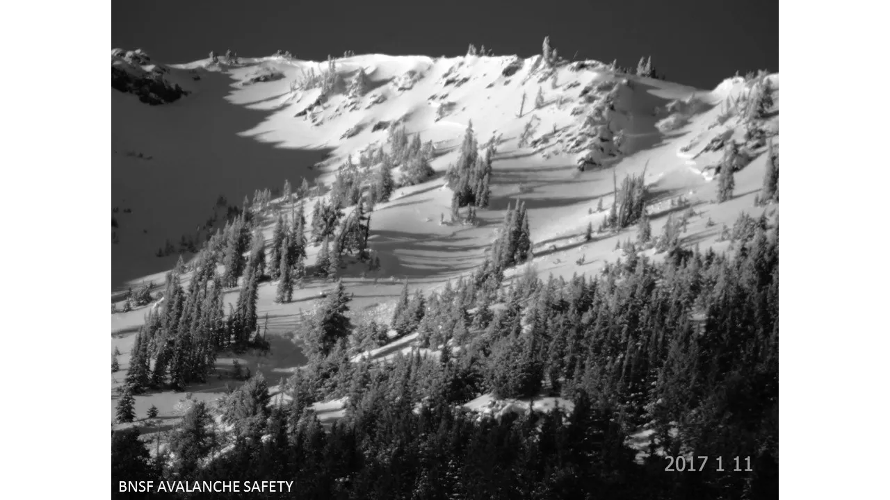  |
|||
| 2016-12-27 | 12:38:00 | Path 1163 | Steiner | U | Natural | NU | U | D1.5 | U | U | U | 0 | 0 | 1455 | -1455 | 0 | 0 | 0 | 0.00 | TK | - | U | D | No | 0 | 0 | No | 0 | 0 | - | Starting zone obscured by clouds. No crown lines observed. | No Image | ||
| 2016-04-04 | 16:25:00 | Shed 7 West | Steiner | U | Natural | NC | R2 | D2 | U | T | L | 0 | 1940 | 1757 | 183 | 0 | 0 | 0 | 0.00 | TK | TP | U | W | No | 0 | 0 | No | 0 | 0 | - | Avalanche debris terminated in the upper third of the Shed 7 West path. | No Image | ||
| 2016-01-14 | 13:30:00 | Test Slope 2 | Clark | SS | Artificial : Human | AS | R2 | D1.5 | I | T | R | 38 | 1707 | 1667 | 40 | 30 | 130 | 30 | 80.00 | BP | D | No | 0 | 0 | No | 0 | 0 | - | No Image | |||||
| 2015-12-23 | 11:30:00 | Shed 8 | Steiner | SS | Natural | NU | R2 | D1.5 | I | T | C | 37 | 1909 | 0 | 1909 | 30 | 30 | 30 | 30.00 | U | D | No | 0 | 0 | No | 0 | 0 | - | Unknown terminus elevation | No Image | ||||
| 2015-12-21 | 11:00:00 | Shed 7 West | Steiner | SS | Natural | NC | R1 | D2 | I | T | L | 35 | 2060 | 1850 | 210 | 40 | 90 | 20 | 55.00 | TK | U | No | 0 | 0 | No | 0 | 0 | - | Likely ran early morning on 12/21/2015 | No Image | ||||
| 2015-12-20 | 12:00:00 | Infinity | Steiner | SS | Natural | NC | R1 | D1 | S | T | L | 42 | 1866 | 1836 | 30 | 20 | 25 | 20 | 22.50 | SZ | D | No | 0 | 0 | No | 0 | 0 | - | No Image | |||||
| 2015-02-06 | 08:08:00 | Path 1163 | Steiner | WS | Natural | NU | R2 | D2 | I | T | C | 40 | 2200 | 1591 | 609 | 50 | 30 | 30 | 30.00 | TK | W | No | 0 | 0 | No | 0 | 0 | - | No Image | |||||
| 2015-01-24 | 10:00:00 | Shed 7 West | Steiner | SS | Natural | NC | R1 | D2 | I | T | R | 34 | 1939 | 1742 | 197 | 30 | 30 | 30 | 30.00 | TK | D | No | 0 | 0 | No | 0 | 0 | - | No Image | |||||
| 2015-01-19 | 12:42:00 | Shed 9 Low | Steiner | C | Natural | NU | R1 | D2 | I | T | 40 | 1692 | 1496 | 196 | 30 | 45 | 30 | 37.50 | BP | M | No | 0 | 0 | No | 0 | 0 | - | No Image | ||||||
| 2015-01-06 | 12:00:00 | Java | Dundas | SS | Natural | N | R3 | D2 | U | T | U | 0 | 1950 | 1700 | 250 | 0 | 0 | 0 | 0.00 | TK | U | No | 0 | 0 | No | 0 | 0 | - | Could not see a crown. | No Image | ||||
| 2015-01-06 | 09:00:00 | Shed 7 East | Dundas | SS | Natural | N | R3 | D2 | U | B | L | 0 | 1725 | 1550 | 175 | 0 | 0 | 0 | 0.00 | TK | No | 0 | 0 | No | 0 | 0 | - | Could not see a crown. Debris terminated just above confluence with Shed 7 west. | No Image | |||||
| 2015-01-06 | 08:50:00 | Path 1163 | Dundas | SS | Natural | N | R3 | D2 | U | B | U | 0 | 1800 | 1525 | 275 | 0 | 0 | 0 | 0.00 | TK | U | No | 0 | 0 | No | 0 | 0 | - | Rain line seemed to be where the avalanche originated. Could not see a crown. | No Image | ||||
| 2015-01-06 | 08:40:00 | Shed 11 | Dundas | SS | Natural | N | R3 | D2 | U | T | U | 0 | 1828 | 1524 | 304 | 0 | 0 | 0 | 0.00 | TK | 1F | U | No | 0 | 0 | No | 0 | 0 | - | No Image | ||||
| 2015-01-06 | 08:30:00 | Java Gauntlet | Dundas | SS | Natural | N | R4 | D1.5 | U | T | U | 0 | 1280 | 1219 | 61 | 300 | 12 | 4 | 8.00 | BP | 3F | U | No | 0 | 0 | No | 0 | 0 | - | No Image | ||||
| 2014-12-25 | 13:20:00 | Path 1163 | Steiner | SS | Natural | NU | R2 | D2 | I | B | R | 0 | 2000 | 1500 | 500 | 100 | 30 | 30 | 30.00 | TK | D | No | 0 | 0 | No | 0 | 0 | - | SS-N-R2D2-I. Terminated approximately 1700 lineal feet from Railway grade. | No Image | ||||
| 2014-12-23 | 10:30:00 | Shed 8 | Dundas | SS | Natural | R4 | D2 | O | T | L | 34 | 1976 | 1524 | 452 | 300 | 60 | 30 | 45.00 | TK | D | No | 0 | 0 | No | 0 | 0 | - | Poor basal snowpack structure. Avalanche occurred following warming air temperatures and wind transport of new snow. | No Image | |||||
| 2014-04-08 | 15:15:00 | Mo | Steiner | U | Natural | N | U | D1.5 | U | U | U | 0 | 0 | 1303 | -1303 | 0 | 0 | 0 | 0.00 | BR | W | No | 0 | 0 | No | 0 | 0 | - | No Image | |||||
| 2014-04-08 | 12:00:00 | Larry | Steiner | U | Natural | N | U | D1.5 | U | U | U | 0 | 0 | 1394 | -1394 | 0 | 0 | 0 | 0.00 | TK | W | No | 0 | 0 | No | 0 | 0 | - | No Image | |||||
| 2014-04-07 | 13:30:00 | Shed 7 West | Steiner | SS | Natural | NC | R2 | D2.5 | I | T | C | 38 | 1939 | 1636 | 303 | 121 | 30 | 30 | 30.00 | TK | W | No | 0 | 0 | No | 0 | 0 | - | Terminus debris was mostly generated by cornice. Associated avalanche was relatively small. | No Image | ||||
| 2014-04-05 | 11:20:00 | Shed 12 | Steiner | WL | Natural | N | R2 | D1 | G | T | C | 42 | 1454 | 1212 | 242 | 0 | 0 | 0 | 0.00 | BP | W | No | 0 | 0 | No | 0 | 0 | - | No Image | |||||
| 2014-03-18 | 12:00:00 | Shed 7 West | Dundas | C | Natural | N | R1 | D1 | S | M | C | 0 | 1890 | 1850 | 40 | 20 | 40 | 10 | 25.00 | SZ | D | No | 0 | 0 | No | 0 | 0 | - | No Image | |||||
| 2014-03-18 | 12:00:00 | Shed 10 | Dundas | SS | Natural | N | R1 | D1 | S | T | C | 0 | 2194 | 2100 | 94 | 30 | 40 | 10 | 25.00 | SZ | D | No | 0 | 0 | No | 0 | 0 | - | No Image | |||||
| 2014-03-18 | 12:00:00 | Shed 10 | Dundas | SS | Natural | N | R1 | D1 | S | M | L | 0 | 1800 | 1750 | 50 | 25 | 30 | 10 | 20.00 | SZ | D | No | 0 | 0 | No | 0 | 0 | - | Shed 10 feeder | No Image | ||||
| 2014-03-13 | 12:30:00 | Mount Shields | Steiner | SS | Natural | N | R2 | D2 | U | M | C | 45 | 1818 | 0 | 1818 | 60 | 45 | 45 | 45.00 | U | U | No | 0 | 0 | No | 0 | 0 | - | Released on Peak 6996 "False Shields" SSW aspect- mid-slope. | No Image | ||||
| 2014-03-12 | 15:30:00 | Shed 7 West | Dundas | SS | Natural | N | R1 | D1 | S | T | C | 40 | 2075 | 2045 | 30 | 70 | 40 | 20 | 30.00 | SZ | M | No | 0 | 0 | No | 0 | 0 | - | No Image | |||||
| 2014-03-09 | 17:06:00 | Shed 7 East | Steiner | WS | Natural | NC | R2 | D2.5 | O | M | L | 38 | N | 1818 | 1318 | 500 | 60 | 90 | 60 | 75.00 | BR | - | 2F | W | Yes | 0 | 0 | No | 0 | 0 | - | Released as a SS at rain line about half way down the east facing cornice on looker's left. Debris conveyed over the Shed 7 infrastructure as wet debris and terminated at elevation below snowshed. WS-N-R2-D2.5-O | No Image | |
| 2014-03-09 | 13:46:00 | Infinity | Steiner | WS | Natural | N | R3 | D2 | O | T | U | 40 | 1758 | 1333 | 425 | 30 | 90 | 20 | 55.00 | MR | - | 1F | W | No | 0 | 0 | No | 0 | 0 | - | SE Aspect (Looker's Left Under Rock) of Main Path. WS-N-R3-D2-O | No Image | ||
| 2014-03-08 | 10:30:00 | Grizzly Gulch | Steiner | SS | Natural | R2 | D2 | I | T | R | 40 | 2060 | 1576 | 484 | 70 | 60 | 60 | 60.00 | BR | M | No | 0 | 0 | No | 0 | 0 | - | Released on a SSW aspect. Second path up the Grizzly drainage on looker's right. | No Image | |||||
| 2014-03-08 | 10:00:00 | Shed 11 | Steiner | SS | Natural | N | R2 | D2 | O | M | R | 40 | 1879 | 1455 | 424 | 100 | 60 | 30 | 45.00 | TK | U | No | 0 | 0 | No | 0 | 0 | - | No Image | |||||
| 2014-03-08 | 00:10:00 | Shed 10 | Steiner | SS | Natural | N | R3 | D2 | O | T | C | 40 | 1818 | 1394 | 424 | 60 | 60 | 60 | 60.00 | TK | M | No | 0 | 0 | No | 0 | 0 | - | Started in second obvious avalanche path on the looker's right of the Shed 10 drainage. Debris conveyed into the Shed 10 path | No Image | ||||
| 2014-03-06 | 16:04:00 | Path 1163 | Steiner | SS | Artificial : Explosive | AX | R2 | D2 | S | T | L | 0 | 2112 | 1667 | 445 | 30 | 45 | 30 | 37.50 | TK | - | U | M | No | 0 | 0 | No | 0 | 0 | - | Ignition 2 of 2. | No Image | ||
| 2014-03-06 | 16:02:00 | Path 1163 | Steiner | SS | Artificial : Explosive | AX | R1 | D1.5 | S | T | C | 0 | 2182 | 1948 | 234 | 30 | 30 | 30 | 30.00 | TK | - | U | M | No | 0 | 0 | No | 0 | 0 | - | Ignition 1 of 2. Emergency mitigation mission. | No Image | ||
| 2014-03-06 | 14:45:00 | Shed 10.7 | Steiner | SS | Natural | N | R2 | D2 | I | T | C | 40 | 1879 | 1333 | 546 | 60 | 60 | 30 | 45.00 | TK | W | No | 0 | 0 | No | 0 | 0 | - | No Image | |||||
| 2014-03-06 | 08:00:00 | Infinity | Steiner | U | Natural | N | U | D2 | U | U | U | 0 | 0 | 1333 | -1333 | 0 | 0 | 0 | 0.00 | TK | M | No | 0 | 0 | No | 0 | 0 | - | No crown visible. | No Image | ||||
| 2014-03-06 | 08:00:00 | Path 1163 | Steiner | U | Natural | N | U | D2 | U | U | U | 0 | 0 | 1455 | -1455 | 0 | 0 | 0 | 0.00 | TK | M | No | 0 | 0 | No | 0 | 0 | - | No Image | |||||
| 2014-03-06 | 07:00:00 | Goat Lick | Steiner | SS | Natural | N | R3 | D4 | O | T | C | 35 | N | 2212 | 1152 | 1060 | 800 | 120 | 120 | 120.00 | BR | - | U | W | No | 0 | 0 | Yes | 30 | 20 | - | SS-N-R3-D4-O. Aspect= 240. Ran full path passing under the Highway 2 Goat Lick bridge. Approximately 20 m of debris remained in the path under the Goat Lick bridge. Debris terminus temporarily blocked the Middle Fork of the Flathead River and was approximately 30 m in height. Caused by significant precipitation intensities, heavy snowfall rates, and air temperatures near freezing. | 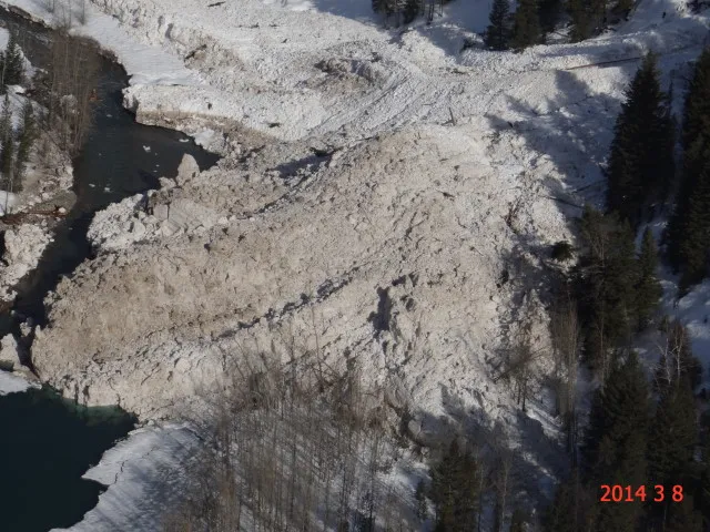 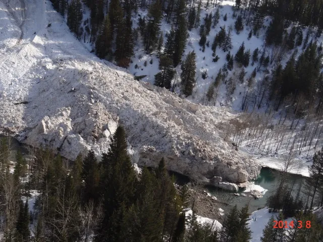 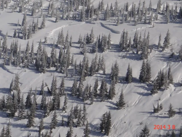 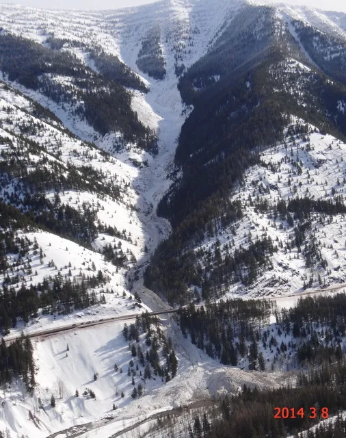 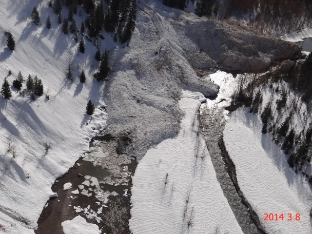 |
|
| 2014-03-06 | 05:30:00 | I Beam | Steiner | SS | Natural | NU | R2 | D3 | O | T | R | 40 | N | 2242 | 1230 | 1012 | 160 | 150 | 100 | 125.00 | TK | - | U | W | No | 0 | 0 | Yes | 20 | 20 | - | SS-N-R2-D3-O. Debris terminated at Highway elevation and in debris catchment feature (gully) enhanced on uphill side of Highway. Triggered by significant precipitation intensity, heavy snowfall rates, and air temperatures near freezing. | 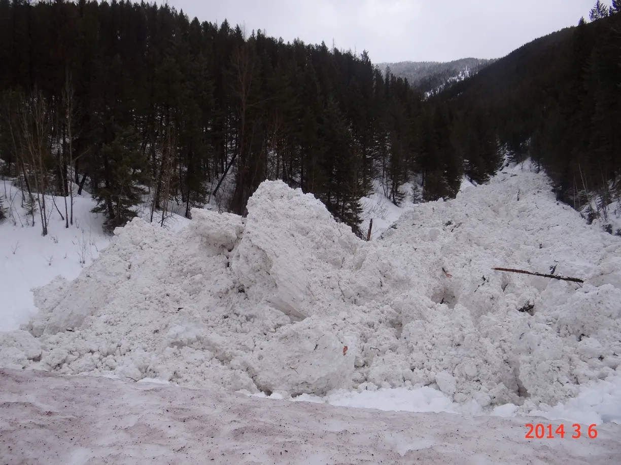 |
|
| 2014-03-06 | 01:40:00 | Shed 7 East | Steiner | SS | Artificial : Explosive | AX | R2 | D2 | I | M | L | 0 | N | 1773 | 1438 | 335 | 75 | 60 | 30 | 45.00 | TK | - | U | M | No | 0 | 0 | No | 0 | 0 | - | This soft slab avalanche was triggered during emergency mitigation and consisted of only storm snow. It was relatively small in comparison to previous natural avalanche activity that initiated in the Shed 7 West path. | No Image | |
| 2014-03-06 | 00:05:00 | Shed 7 West | Steiner | SS | Natural | N | R3 | D3.5 | O | T | R | 35 | N | 1924 | 1327 | 597 | 360 | 120 | 120 | 120.00 | MR | - | U | W | Yes | 30 | 20 | No | 0 | 0 | - | SS-N-R3-D3+-O. Avg. Aspect= 180 Terminus conveyed into the Shed 7 main path and over the Shed 7 infrastructure on the rail grade. Main 2 was back filled with terminus debris. | 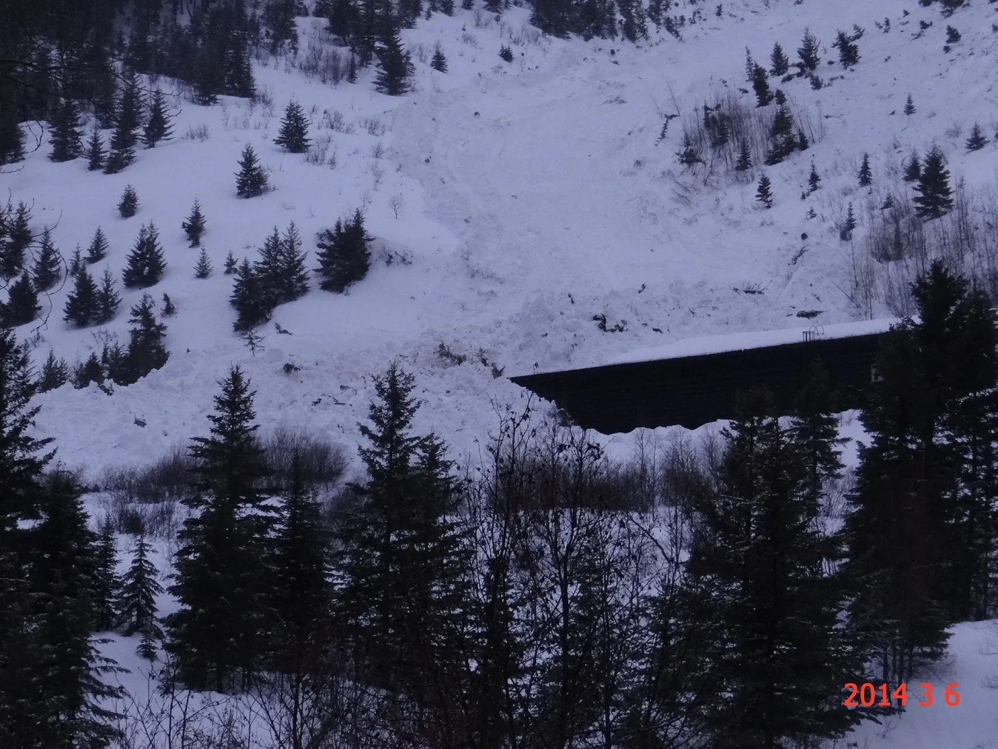 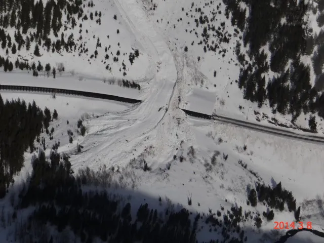 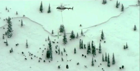 |
|
| 2014-03-05 | 17:00:00 | Shed 4D | Dundas | SS | Natural | NU | R2 | D2 | I | M | L | 0 | 5000 | 4400 | 600 | 60 | 60 | 30 | 45.00 | BP | M | No | 0 | 0 | No | 0 | 0 | - | No Image | |||||
| 2014-03-05 | 17:00:00 | Shed 5 | Dundas | SS | Natural | N | R2 | D2 | I | M | R | 0 | 1700 | 1400 | 300 | 100 | 60 | 20 | 40.00 | BP | 2F | M | No | 0 | 0 | No | 0 | 0 | - | Debris stopped just short of the shed | No Image | |||
| 2014-03-05 | 17:00:00 | Shed 8 | Dundas | C | Natural | N | R1 | D1 | S | T | L | 0 | 1800 | 1740 | 60 | 33 | 40 | 20 | 30.00 | SZ | M | No | 0 | 0 | No | 0 | 0 | - | No Image | |||||
| 2014-03-05 | 16:00:00 | Curly | Clark | WL | Natural | NU | R2 | D2 | S | U | U | 0 | N | 0 | 4400 | -4400 | 0 | 0 | 0 | 0.00 | MR | - | 2F | W | No | 0 | 0 | No | 0 | 0 | - | Debris terminated above Highway elevation. | No Image | |
| 2014-03-05 | 16:00:00 | Larry | Clark | WL | Natural | N | R2 | D2 | S | U | U | 0 | N | 0 | 4400 | -4400 | 0 | 0 | 0 | 0.00 | TR | - | 2F | W | No | 0 | 0 | No | 0 | 0 | - | Obs by Dundas. Debris ran full path but did not reach the Highway | 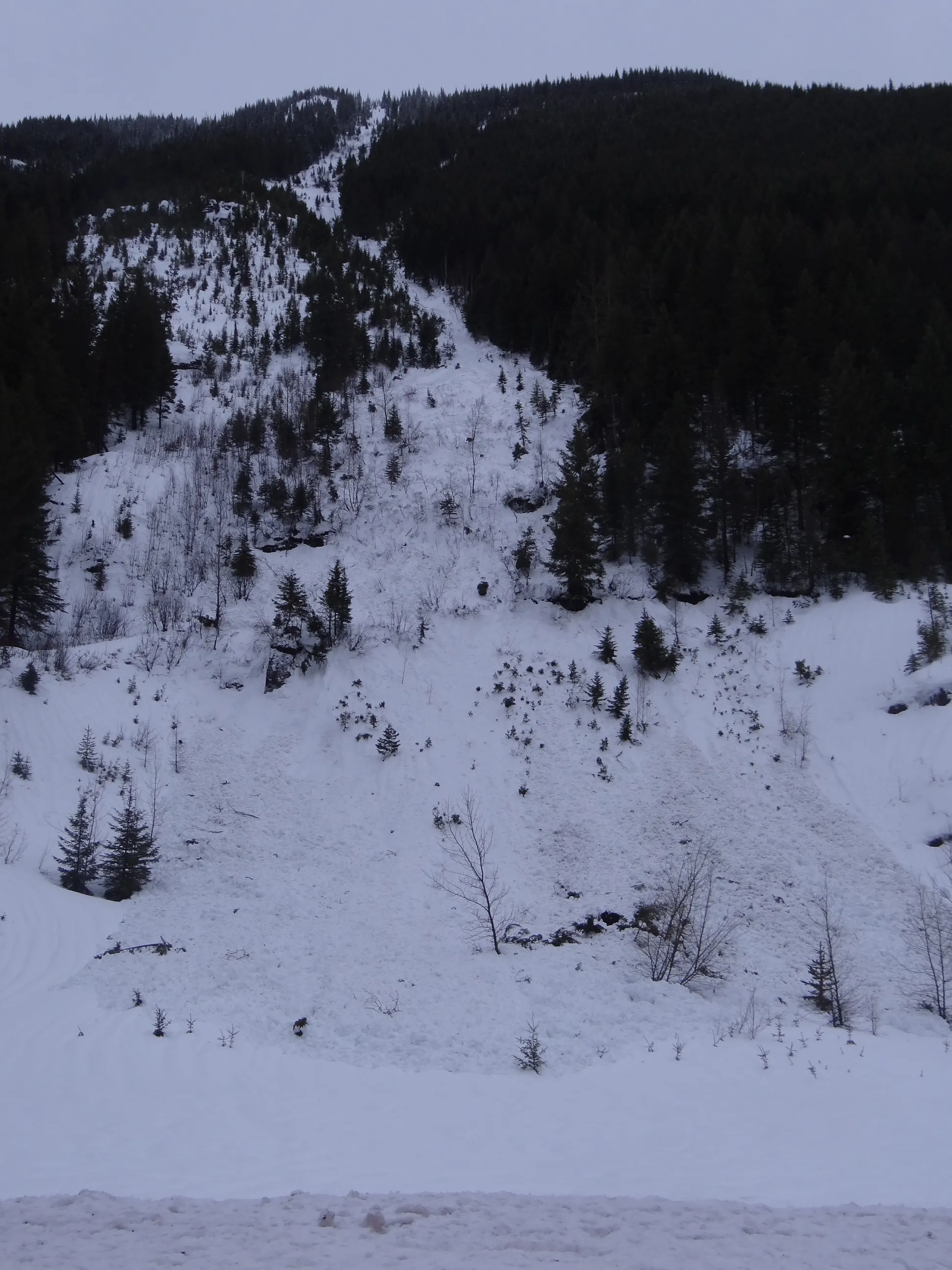 |
|
| 2014-03-05 | 14:00:00 | Infinity | Steiner | SS | Natural | N | R1 | D1.5 | I | M | R | 45 | 1758 | 1576 | 182 | 30 | 20 | 20 | 20.00 | TK | M | No | 0 | 0 | No | 0 | 0 | - | No Image | |||||
| 2014-03-05 | 14:00:00 | Path 1163 | Steiner | SS | Natural | N | R2 | D1.5 | I | M | R | 45 | 1697 | 1515 | 182 | 20 | 30 | 30 | 30.00 | TK | M | No | 0 | 0 | No | 0 | 0 | - | No Image | |||||
| 2014-03-05 | 14:00:00 | Shed 9 Low | Steiner | L | Natural | N | R2 | D1.5 | I | M | R | 45 | 1758 | 1636 | 122 | 0 | 0 | 0 | 0.00 | TK | M | No | 0 | 0 | No | 0 | 0 | - | No Image | |||||
| 2014-03-05 | 07:40:00 | Path 1163 | Steiner | U | Natural | N | R1 | D1.5 | U | U | U | 0 | 0 | 1455 | -1455 | 0 | 0 | 0 | 0.00 | TK | M | No | 0 | 0 | No | 0 | 0 | - | Starting Zone obscure | No Image | ||||
| 2014-03-05 | 07:35:00 | Elk Fence | Steiner | SS | Natural | N | R2 | D1.5 | O | M | C | 35 | 1515 | 1455 | 60 | 25 | 30 | 20 | 25.00 | U | MP | U | M | No | 0 | 0 | No | 0 | 0 | - | Consisted of three individual soft slab pockets. Debris did not reach the rail grade. | No Image | ||
| 2014-03-04 | 17:00:00 | Shed 4D | Steiner | SS | Natural | N | R1 | D1 | I | B | R | 45 | 1394 | 1273 | 121 | 20 | 20 | 20 | 20.00 | BP | M | No | 0 | 0 | No | 0 | 0 | - | No Image | |||||
| 2014-03-03 | 17:00:00 | Goat Lick | Steiner | SS | Natural | N | R3 | D1.5 | I | M | C | 40 | 1273 | 1224 | 49 | 150 | 30 | 20 | 25.00 | BP | M | No | 0 | 0 | No | 0 | 0 | - | Goat Lick roadside face to the east of the Goat Lick avalanche path. Avalanche was triggered by warm air temperatures and rain. | No Image | ||||
| 2014-03-01 | 13:20:00 | Shed 10 | Steiner | C | Natural | N | R3 | D2 | I | M | C | 40 | 1697 | 1515 | 182 | 80 | 30 | 30 | 30.00 | BP | D | No | 0 | 0 | No | 0 | 0 | - | Below Shed 10 Left Feeder in lower elevation concave bowl. | No Image | ||||
| 2014-03-01 | 13:15:00 | Grizzly Gulch | Steiner | SS | Natural | R2 | D2 | I | T | L | 40 | 1939 | 1697 | 242 | 60 | 75 | 75 | 75.00 | BR | D | No | 0 | 0 | No | 0 | 0 | - | Terminated in Grizzly Basin | No Image | |||||
| 2014-03-01 | 13:10:00 | Shed 10 | Steiner | SS | Natural | N | R2 | D2 | I | M | L | 40 | 1939 | 1576 | 363 | 60 | 30 | 20 | 25.00 | TK | D | No | 0 | 0 | No | 0 | 0 | - | No Image | |||||
| 2014-03-01 | 13:00:00 | Path 1163 | Steiner | SS | Natural | N | R2 | D2 | I | M | L | 40 | 1939 | 1576 | 363 | 100 | 60 | 30 | 45.00 | TK | D | No | 0 | 0 | No | 0 | 0 | - | Wind Slab developed by strong easterly winds 2/28-3/1/14 | No Image | ||||
| 2014-02-26 | 15:40:00 | Infinity | Steiner | SS | Natural | N | R1 | D1 | I | T | C | 42 | 1818 | 1700 | 118 | 20 | 20 | 20 | 20.00 | TK | D | No | 0 | 0 | No | 0 | 0 | - | No Image | |||||
| 2014-02-26 | 15:30:00 | Path 1163 | Steiner | WL | Natural | N | R2 | D1.5 | I | M | R | 0 | 1640 | 1455 | 185 | 0 | 0 | 0 | 0.00 | TK | W | No | 0 | 0 | No | 0 | 0 | - | No Image | |||||
| 2014-02-19 | 12:00:00 | Java | Steiner | SS | Natural | N | R3 | D3 | O | T | C | 38 | 1970 | 1212 | 758 | 200 | 90 | 60 | 75.00 | BR | U | No | 0 | 0 | No | 0 | 0 | - | 3rd Path from the Looker's Right. | No Image | ||||
| 2014-02-19 | 11:30:00 | Java | Steiner | SS | Natural | N | R2 | D2.5 | I | T | L | 35 | 1879 | 1212 | 667 | 120 | 90 | 60 | 75.00 | BR | U | No | 0 | 0 | No | 0 | 0 | - | No Image | |||||
| 2014-02-19 | 11:30:00 | Java | Steiner | SS | Natural | N | R2 | D2 | O | T | R | 35 | 1879 | 1212 | 667 | 70 | 70 | 60 | 65.00 | U | U | No | 0 | 0 | No | 0 | 0 | - | 2nd Path from Looker's Right. | No Image | ||||
| 2014-02-19 | 11:20:00 | Shed 10 | Steiner | SS | Natural | N | R2 | D2 | I | M | L | 40 | 1939 | 1636 | 303 | 40 | 60 | 60 | 60.00 | TK | M | No | 0 | 0 | No | 0 | 0 | - | No Image | |||||
| 2014-02-19 | 11:15:00 | Shed 7 East | Steiner | SS | Natural | N | R1 | D1.5 | I | M | L | 35 | 1697 | 1667 | 30 | 30 | 45 | 30 | 37.50 | SZ | M | No | 0 | 0 | No | 0 | 0 | - | No Image | |||||
| 2014-02-19 | 11:05:00 | Shed 11 | Steiner | SS | Natural | N | R2 | D2 | I | T | C | 38 | 1939 | 0 | 1939 | 200 | 70 | 60 | 65.00 | U | U | No | 0 | 0 | No | 0 | 0 | - | No Image | |||||
| 2014-02-19 | 11:00:00 | Path 1163 | Steiner | SS | Natural | N | R2 | D2 | I | M | L | 40 | 1818 | 1515 | 303 | 60 | 60 | 30 | 45.00 | TK | M | No | 0 | 0 | No | 0 | 0 | - | No Image | |||||
| 2014-02-16 | 08:15:00 | Infinity | Steiner | SS | Natural | N | R2 | D2 | U | T | L | 0 | 1818 | 1515 | 303 | 30 | 60 | 60 | 60.00 | TR | D | No | 0 | 0 | No | 0 | 0 | - | No Image | |||||
| 2014-02-16 | 08:15:00 | Shed 7 East | Steiner | SS | Natural | N | R3 | D2 | U | T | C | 35 | 1818 | 1333 | 485 | 100 | 60 | 60 | 60.00 | TK | M | No | 0 | 0 | No | 0 | 0 | - | Terminated at the top edge of the Shed 7 infrastructure. | No Image | ||||
| 2014-02-16 | 08:00:00 | Path 1163 | Steiner | SS | Natural | NC | R2 | D1.5 | U | T | L | 0 | 2061 | 1515 | 546 | 20 | 45 | 45 | 45.00 | TK | D | No | 0 | 0 | No | 0 | 0 | - | Ran 2/3rds path the rail grade. | No Image | ||||
| 2014-02-12 | 15:30:00 | Burn Out | Steiner | SS | Natural | N | R1 | D1 | I | M | L | 40 | 1515 | 1455 | 60 | 30 | 15 | 15 | 15.00 | BP | M | No | 0 | 0 | No | 0 | 0 | - | Relatively very small soft slab avalanche likely triggered by warming air temperatures above freezing, moderate west winds, and light rain. | No Image | ||||
| 2014-02-12 | 15:25:00 | Umbrella | Steiner | SS | Natural | N | R2 | D1 | I | M | C | 45 | 1394 | 1333 | 61 | 30 | 30 | 20 | 25.00 | BP | M | No | 0 | 0 | No | 0 | 0 | - | Relatively small slab avalanche triggered by light rain, moderate west winds, and warming air temperatures. | No Image | ||||
| 2014-02-12 | 15:23:00 | Shed 8 | Steiner | U | Natural | NU | R2 | D1.5 | U | 0 | 0 | 1697 | -1697 | 0 | 0 | 0 | 0.00 | TK | M | No | 0 | 0 | No | 0 | 0 | - | No Image | |||||||
| 2014-02-12 | 15:22:00 | Larry | Steiner | SS | Natural | NU | U | D1.5 | U | T | C | 0 | 1818 | 1333 | 485 | 0 | 0 | 0 | 0.00 | BR | M | No | 0 | 0 | No | 0 | 0 | - | No Image | |||||
| 2014-02-12 | 15:20:00 | Infinity | Steiner | SS | Natural | NU | R3 | D2 | O | T | C | 42 | 1866 | 1515 | 351 | 60 | 90 | 20 | 55.00 | TK | D | No | 0 | 0 | No | 0 | 0 | - | South Aspect. | No Image | ||||
| 2014-02-12 | 10:39:00 | Path 1163 | Steiner | U | Natural | NU | U | D2 | U | U | U | 0 | 0 | 1515 | -1515 | 0 | 0 | 0 | 0.00 | TK | D | No | 0 | 0 | No | 0 | 0 | - | soft slab crows were observed mid-path but debris was also observed above these crowns. It appears these crowns (slab releases)were the result of debris from an higher elevation- which was obscured. | No Image | ||||
| 2014-02-11 | 11:00:00 | Infinity | Steiner | SS | Natural | NU | R2 | D1.5 | I | T | L | 40 | 1818 | 1640 | 178 | 20 | 30 | 20 | 25.00 | TK | D | No | 0 | 0 | No | 0 | 0 | - | Released just below cornice in steep rocks of the Looker's Left feeder path. A second, smaller slab release was observed just under rock to the looker's left of the main path and approximately 50 meters below the ridge line. | No Image | ||||
| 2014-01-11 | 16:00:00 | Infinity | Steiner | SS | Natural | N | R2 | D1.5 | I | T | C | 42 | 1818 | 1640 | 178 | 20 | 45 | 20 | 32.50 | TK | D | No | 0 | 0 | No | 0 | 0 | - | This avalanche was in the MAIN path of Infinity. 0936 observation was in a lookers LEFT feeder path of Infinity. | No Image | ||||
| 2014-01-11 | 09:36:00 | Infinity | Steiner | SS | Natural | NU | R2 | U | I | T | C | 0 | 1758 | 0 | 1758 | 40 | 45 | 20 | 32.50 | U | U | No | 0 | 0 | No | 0 | 0 | - | Could not see runout. | No Image | ||||
| 2014-01-10 | 14:12:00 | Path 1163 | Steiner | SS | Natural | NU | R1 | D1.5 | I | T | C | 0 | 1576 | 1394 | 182 | 20 | 45 | 45 | 45.00 | MR | D | No | 0 | 0 | No | 0 | 0 | - | Terminated 2/3rds path in main path of Path 1163 | No Image | ||||
| 2013-12-12 | 09:30:00 | Shed 7 West | Steiner | U | Natural | NC | R1 | D1.5 | U | T | L | 0 | N | 2060 | 1879 | 181 | 50 | 0 | 0 | 0.00 | TK | - | U | D | No | 0 | 0 | No | 0 | 0 | - | 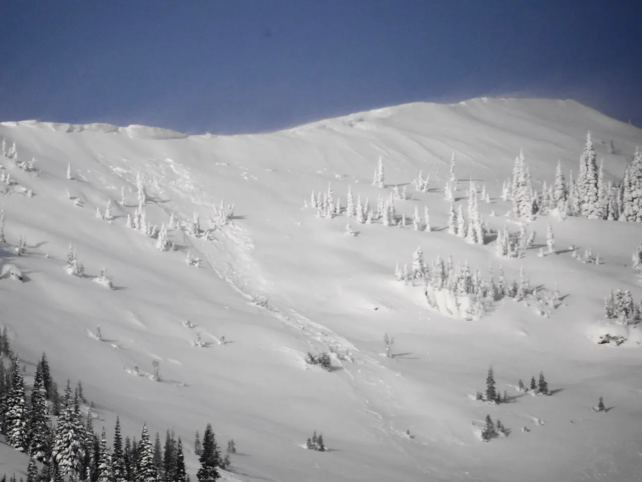 |
||
| 2013-12-10 | 12:13:00 | Test Slope 3 | Steiner | HS | Artificial : Human | AS | R1 | D1.5 | O | T | C | 35 | N | 1667 | 1550 | 117 | 40 | 60 | 20 | 40.00 | U | BP | U | D | No | 0 | 0 | No | 0 | 0 | - | HS-ASi-R2-D1.5-O | No Image | |
| 2013-12-10 | 12:00:00 | Test Slope 1 | Steiner | SS | Artificial : Human | AS | R2 | D1.5 | O | T | C | 35 | 1606 | 1500 | 106 | 30 | 60 | 20 | 40.00 | BP | No | 0 | 0 | No | 0 | 0 | - | SS-ASi-R2-D1.5-O | No Image | |||||
| 2013-04-06 | 12:00:00 | Larry | Steiner | U | Natural | N | R2 | D1.5 | U | U | U | 0 | 0 | 1700 | -1700 | 0 | 0 | 0 | 0.00 | TK | W | No | 0 | 0 | No | 0 | 0 | - | Starting zone obscured. | No Image | ||||
| 2013-04-06 | 11:30:00 | Shed 7 West | Steiner | U | Natural | N | R2 | D1.5 | U | T | C | 35 | 2060 | 1697 | 363 | 0 | 0 | 0 | 0.00 | TK | W | No | 0 | 0 | No | 0 | 0 | - | Likely related to cornice fall but upper SZ is obscured. | No Image | ||||
| 2013-04-06 | 11:00:00 | Shed 10 | Steiner | U | Natural | N | U | D2 | U | U | U | 0 | 0 | 1394 | -1394 | 0 | 0 | 0 | 0.00 | TK | W | No | 0 | 0 | No | 0 | 0 | - | No Image | |||||
| 2013-04-04 | 14:20:00 | I Beam | Steiner | WS | Natural | NL | R2 | D2 | O | M | L | 0 | 1879 | 1515 | 364 | 70 | 120 | 60 | 90.00 | TK | W | No | 0 | 0 | No | 0 | 0 | - | No Image | |||||
| 2013-04-03 | 17:00:00 | Shed 11 | Steiner | U | Natural | NU | R3 | D2.5 | G | T | C | 40 | 1880 | 1394 | 486 | 120 | 120 | 120 | 120.00 | TK | W | No | 0 | 0 | No | 0 | 0 | - | Avalanche associated with massive glide crack failure. Glide crack first observed 2/7/2013. Failed between 1200 on 4/2/2013 and 1700 4/3/2013. Debris remained confined to path and, based on five (5) collected tree disk samples, entrained vegetation up to 16 years of age. Average age was 12 years. Terminus elevation was approximately 120 m above rail grade elevation. | No Image | ||||
| 2013-04-03 | 12:00:00 | Path 1163 | Steiner | WL | Natural | N | R2 | D1.5 | U | M | C | 38 | 2060 | 1455 | 605 | 0 | 0 | 0 | 0.00 | TK | W | No | 0 | 0 | No | 0 | 0 | - | No Image | |||||
| 2013-03-14 | 13:45:00 | Shed 7 West | Steiner | L | Natural | NU | R2 | D1.5 | I | T | C | 34 | N | 2018 | 1758 | 260 | 0 | 0 | 0 | 0.00 | TK | - | U | W | No | 0 | 0 | No | 0 | 0 | - | Wet~ Loose snow avalanche triggered by cornice fall... Debris terminated in upper 1/3 of 7W path. Cornice failure and resulting loose snow avalanche did not result in initiating slab avalanche activity. | No Image | |
| 2013-02-19 | 10:30:00 | Path 1163 | Steiner | SS | Natural | R1 | D1.5 | I | M | R | 0 | 2000 | 1800 | 200 | 30 | 60 | 60 | 60.00 | TK | D | No | 0 | 0 | No | 0 | 0 | - | SS-N-R1D1.5-I. Looker's right path. Ran 1/3 path to rail grade. | No Image | |||||
| 2013-01-21 | 14:10:00 | Path 1163 | Steiner | L | Natural | NU | R1 | D1.5 | U | M | R | 0 | 1700 | 1515 | 185 | 0 | 0 | 0 | 0.00 | TK | M | No | 0 | 0 | No | 0 | 0 | - | Occurred during Hp event and appears to be triggered by solar input. | No Image | ||||
| 2013-01-21 | 13:30:00 | Test Slope 2 | Steiner | SS | Artificial : Human | AS | R1 | D1 | I | T | R | 0 | N | 1700 | 1640 | 60 | 30 | 25 | 10 | 17.50 | U | MP | U | D | No | 0 | 0 | No | 0 | 0 | - | East Aspect. Windslab deposited on previously scoured aspects- 12/25/2012. NSF buried beneath slab. | No Image | |
| 2013-01-09 | 09:05:00 | Path 1163 | Steiner | SS | Natural | NU | R1 | D2 | I | T | C | 0 | 2121 | 1515 | 606 | 60 | 30 | 20 | 25.00 | TK | M | No | 0 | 0 | No | 0 | 0 | - | No Image | |||||
| 2013-01-08 | 13:00:00 | Shed 7 West | Steiner | SS | Natural | N | R1 | D1.5 | I | T | L | 37 | 2000 | 1697 | 303 | 0 | 0 | 0 | 0.00 | TK | D | No | 0 | 0 | No | 0 | 0 | - | No Image | |||||
| 2013-01-03 | 15:30:00 | Shed 11 | Steiner | L | Natural | NL | R1 | D1.5 | I | T | L | 37 | 1863 | 1606 | 257 | 0 | 0 | 0 | 0.00 | TK | M | No | 0 | 0 | No | 0 | 0 | - | Avalanche Triggered by Loose Snow From Rock Outcrop on Lookers Left of Starting Zone. | No Image | ||||
| 2012-03-26 | 12:45:00 | Shed 10 | Steiner | WS | Natural | NL | R1 | D1.5 | O | B | R | 0 | 0 | 0 | 0 | 0 | 0 | 0 | 0.00 | TK | No | 0 | 0 | No | 0 | 0 | - | Wet slab released on SE aspect @ 5400 feet (1636 m) elevation. Debris ran 2/3rds path to at least 4,600 feet (1394 m) elevation. | No Image | |||||
| 2012-03-16 | 08:34:00 | Curly | Steiner | U | Natural | NU | U | D1 | U | U | U | 0 | 0 | 0 | 0 | 0 | 0 | 0 | 0.00 | TR | No | 0 | 0 | No | 0 | 0 | - | Terminus at canyon floor elevation. Debris wet and relatively small amount. | No Image | |||||
| 2012-03-16 | 08:30:00 | Path 1163 | Steiner | U | Natural | NU | U | D2 | U | U | U | 0 | 0 | 0 | 0 | 0 | 0 | 0 | 0.00 | TK | No | 0 | 0 | No | 0 | 0 | - | Wet debris ran 2/3 path in main path to 4700 feet (1424 m) elevation. Upper SZ obscured. | No Image | |||||
| 2012-03-10 | 14:54:00 | Infinity | Steiner | L | Natural | N | R2 | D1 | I | T | C | 0 | 0 | 0 | 0 | 0 | 0 | 0 | 0.00 | TK | No | 0 | 0 | No | 0 | 0 | - | D1.5- 1/2 Path. | No Image | |||||
| 2012-03-10 | 14:50:00 | Shed 10 | Steiner | WL | Natural | R2 | D1 | I | M | R | 0 | 0 | 0 | 0 | 0 | 0 | 0 | 0.00 | TK | No | 0 | 0 | No | 0 | 0 | - | D1.5 | No Image | ||||||
| 2012-03-05 | 11:45:00 | Second Slide | Steiner | SS | Natural | N | R2 | D1 | I | T | C | 0 | 0 | 0 | 0 | 0 | 0 | 0 | 0.00 | BP | No | 0 | 0 | No | 0 | 0 | - | SS-NC-R2D 1.5-I on east aspect of Second Slide's looker's right ridge. | No Image | |||||
| 2012-03-03 | 01:30:00 | Burn Out | Steiner | SS | Natural | N | R1 | D1 | I | M | L | 0 | 0 | 0 | 0 | 0 | 0 | 0 | 0.00 | BP | No | 0 | 0 | No | 0 | 0 | - | Debris did not make the rail grade. | No Image | |||||
| 2012-02-28 | 11:16:00 | Shed 9 | Steiner | HS | Natural | N | R3 | D2 | O | T | C | 34 | 2045 | 1712 | 333 | 424 | 100 | 30 | 65.00 | TK | - | U | D | No | 0 | 0 | No | 0 | 0 | - | Upper Shed 9 Fracture line - 6750' Debris toe - 5650' Aspect - South through East Crown depth - 12"- 36" Crown width - 1400' Starting zone horizontal - left and center Likely wildlife trigger | 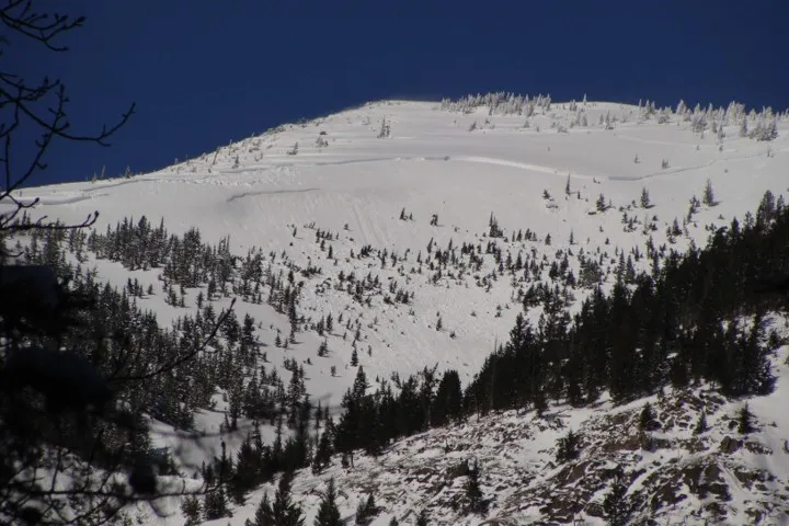 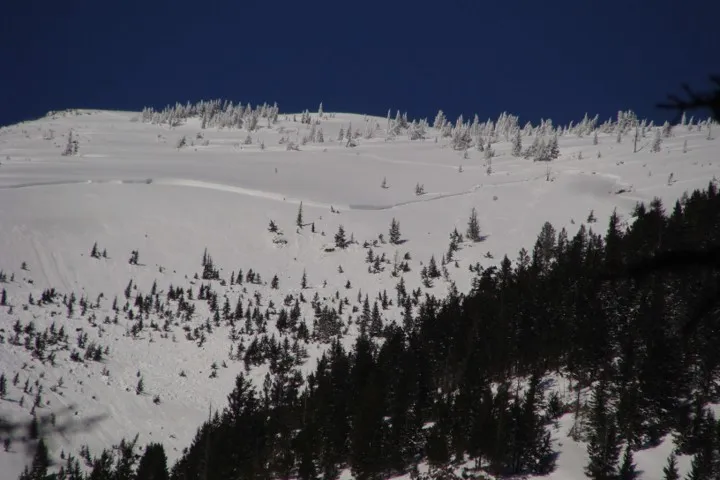 |
||
| 2012-02-28 | 11:16:00 | Shed 9 Low | Steiner | SS | Natural | NS | R2 | D2 | I | T | L | 0 | 2000 | 1424 | 576 | 48 | 45 | 30 | 37.50 | MR | - | U | M | No | 0 | 0 | No | 0 | 0 | - | Likely triggered by avalanche in Shed 9 upper SZ. Crown width - 160 feet Crown depth - 12-18 inches Debris - 2/3 path Crown line - 6600' Terminus of debris - 4700' Aspect - SE | 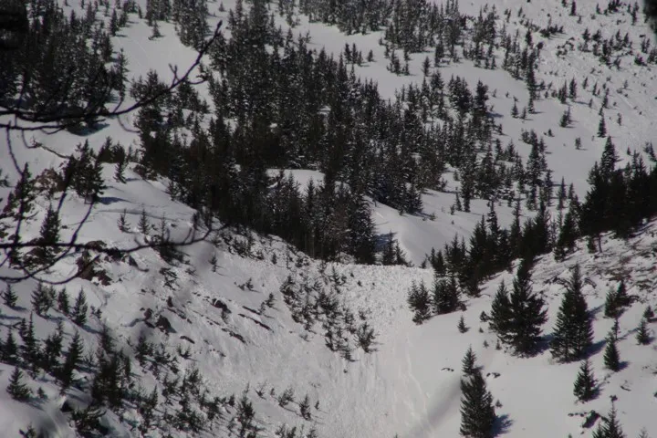 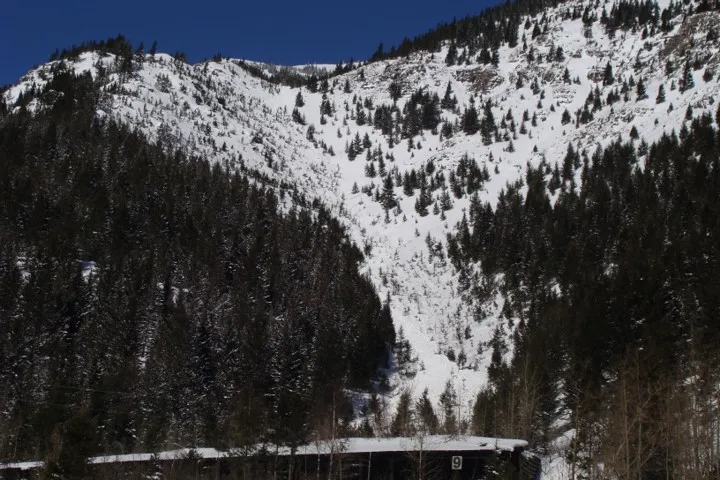 |
||
| 2012-02-28 | 11:09:00 | Infinity | Dundas | SS | Natural | N | R2 | D1 | I | T | R | 0 | 0 | 0 | 0 | 0 | 0 | 0 | 0.00 | TK | No | 0 | 0 | No | 0 | 0 | - | Fracture line - 6400' | No Image | |||||
| 2012-02-22 | 17:00:00 | Mount Shields | Steiner | HS | Natural | NC | R3 | U | O | T | R | 0 | 0 | 0 | 0 | 0 | 0 | 0 | 0.00 | U | No | 0 | 0 | No | 0 | 0 | - | Avalanche Released on SE aspect of "Peak 6996" or "False Shields." Crown width was approximately 120 meters (400 feet). | No Image | |||||
| 2012-02-22 | 13:30:00 | Elk Fence | Steiner | SS | Natural | N | R3 | D2 | O | M | C | 0 | N | 0 | 0 | 0 | 0 | 0 | 0 | 0.00 | U | BP | U | U | No | 0 | 0 | No | 0 | 0 | - | This was a low elevation slab avalanche that did not reach the grade- D1.5. Occurred on "Windy Point" or "Elk Fence." Crown width 40m and depth 30 cm. | No Image | |
| 2012-02-22 | 13:00:00 | Shed 4D | Steiner | SS | Natural | R3 | D1 | O | M | C | 0 | 0 | 0 | 0 | 0 | 0 | 0 | 0.00 | BP | No | 0 | 0 | No | 0 | 0 | - | Avalanche released on steep rock face above Shed 4/4D... Debris deposited on shed roof. | No Image | ||||||
| 2012-02-22 | 12:52:00 | Infinity | Steiner | SS | Natural | NC | R2 | D2 | O | T | C | 0 | N | 0 | 0 | 0 | 0 | 0 | 0 | 0.00 | TR | - | U | U | No | 0 | 0 | No | 0 | 0 | - | Crown blown back in. Avalanche appears to be cornice related. Crown 50m wide. Depth unknown. Debris terminated above the grade at 4680 feet elevation. | No Image | |
| 2012-02-22 | 12:40:00 | Path 1163 | Steiner | SS | Natural | N | R2 | D2 | O | T | L | 0 | 0 | 0 | 0 | 0 | 0 | 0 | 0.00 | TR | No | 0 | 0 | No | 0 | 0 | - | Crown on Looker's Left Top of Main Path- Below Rocks. Crown width= 100 m Crown depth 0.5 m to 1.5m. Debris ran to 4680 feet elevation. | No Image | |||||
| 2012-02-22 | 08:40:00 | Shed 6 | Steiner | SS | Natural | N | R4 | D2 | O | T | C | 0 | 0 | 0 | 0 | 0 | 0 | 0 | 0.00 | BP | No | 0 | 0 | No | 0 | 0 | - | Tree Pocket located on Looker's Left @ approximately 5000 feet (1515m) elevation. | No Image | |||||
| 2012-02-22 | 08:35:00 | Shed 6 | Steiner | SS | Natural | N | R4 | D2 | O | T | C | 0 | 0 | 0 | 0 | 0 | 0 | 0 | 0.00 | BP | No | 0 | 0 | No | 0 | 0 | - | Looker's Right Tree Pocket located at approximately 4800 feet (1455m). | No Image | |||||
| 2012-02-22 | 08:15:00 | Path 1163 | Steiner | U | Natural | N | U | D2 | U | U | U | 0 | 0 | 0 | 0 | 0 | 0 | 0 | 0.00 | U | No | 0 | 0 | No | 0 | 0 | - | Fresh avalanche debris located 2/3 path at 4,680 feet (1418 m) elevation. | No Image | |||||
| 2012-02-21 | 12:45:00 | Curly | Steiner | U | Natural | N | U | D1 | U | U | U | 0 | 0 | 0 | 0 | 0 | 0 | 0 | 0.00 | TK | No | 0 | 0 | No | 0 | 0 | - | D1 debris ran 2/3 path to runout. | No Image | |||||
| 2012-02-21 | 11:00:00 | Test Slope 1 | Steiner | HS | Natural | N | R4 | D2 | O | M | C | 0 | 0 | 0 | 0 | 0 | 0 | 0 | 0.00 | BP | No | 0 | 0 | No | 0 | 0 | - | HS-N-R4D2-O. Crown Width= 120m Crown depth 0.5m to 1.25m | No Image | |||||
| 2012-02-21 | 10:00:00 | Shed 7 East | Steiner | SS | Natural | N | R2 | D2 | O | T | C | 0 | 0 | 0 | 0 | 0 | 0 | 0 | 0.00 | TK | No | 0 | 0 | No | 0 | 0 | - | Ran in main Shed 7 path to 150m above Shed 7. | No Image | |||||
| 2012-02-21 | 10:00:00 | Shed 7 West | Steiner | SS | Natural | N | R2 | D2 | I | M | R | 0 | 0 | 0 | 0 | 0 | 0 | 0 | 0.00 | TK | No | 0 | 0 | No | 0 | 0 | - | Isolated SS located on S aspect of path- Lookers R of ridge 75m at rock 6400 foot (1940m) elevation. Crown depth avg. 30 cm. | No Image | |||||
| 2012-02-21 | 01:00:00 | Shed 5 | Steiner | SS | Natural | N | R1 | D2 | I | M | R | 0 | 0 | 0 | 0 | 0 | 0 | 0 | 0.00 | TK | No | 0 | 0 | No | 0 | 0 | - | Triggered in isolated rock outcrop- Looker's R of Shed 5 path @ 5700 feet (1727m) elevation. Avg. crown depth= 30 cm. Crown width= 50m | No Image | |||||
| 2012-01-20 | 09:50:00 | Java Gauntlet | Steiner | SS | Natural | N | R2 | D1 | I | T | 0 | 0 | 0 | 0 | 0 | 0 | 0 | 0.00 | BP | No | 0 | 0 | No | 0 | 0 | - | Widespread low elevation slab cycle continues. | No Image | ||||||
| 2012-01-19 | 11:30:00 | Shed 6 | Dundas | SS | Natural | N | R2 | D1 | S | T | 0 | 0 | 0 | 0 | 0 | 0 | 0 | 0.00 | BP | No | 0 | 0 | No | 0 | 0 | - | Widespread low elevation small magnitude slab cycle. Triggered by warm T and poor quality basal snowpack. | No Image | ||||||
| 2011-12-29 | 13:00:00 | Java | Dundas | SS | Natural | NU | R3 | D2 | U | T | C | 0 | 0 | 0 | 0 | 0 | 0 | 0 | 0.00 | U | No | 0 | 0 | No | 0 | 0 | - | Located in Center Path. | No Image | |||||
| 2011-12-29 | 13:00:00 | Java | Dundas | SS | Natural | NU | R2 | D2 | U | T | C | 0 | 0 | 0 | 0 | 0 | 0 | 0 | 0.00 | U | No | 0 | 0 | No | 0 | 0 | - | Located in furthest Looker's R path. | No Image | |||||
| 2011-12-29 | 13:00:00 | Path 1163 | Dundas | SS | Natural | N | R1 | D2 | U | T | C | 0 | 0 | 0 | 0 | 0 | 0 | 0 | 0.00 | TK | No | 0 | 0 | No | 0 | 0 | - | Slab in main gully. Crown 100' vertical from ridge. Crown width= 50'. Numerous WL releases. Debris ran to nick point. | No Image | |||||
| 2011-12-29 | 13:00:00 | Shed 5 | Dundas | U | Natural | N | U | U | U | U | U | 0 | 0 | 0 | 0 | 0 | 0 | 0 | 0.00 | TK | No | 0 | 0 | No | 0 | 0 | - | Debris in upper path. No crown visible. | No Image | |||||
| 2011-12-29 | 13:00:00 | Shed 7 East | Dundas | U | Natural | N | U | U | U | U | U | 0 | 0 | 0 | 0 | 0 | 0 | 0 | 0.00 | TK | No | 0 | 0 | No | 0 | 0 | - | Debris in upper bowl. No crown visible. | No Image | |||||
| 2011-12-29 | 13:00:00 | Shed 7 West | Dundas | SS | Natural | NC | R1 | D2 | U | T | L | 0 | 0 | 0 | 0 | 0 | 0 | 0 | 0.00 | TK | No | 0 | 0 | No | 0 | 0 | - | Crown at rock-band just below cornice NE aspect | No Image | |||||
| 2011-12-29 | 13:00:00 | Shed 8 | Dundas | SS | Natural | N | R1 | D1 | U | M | L | 0 | 0 | 0 | 0 | 0 | 0 | 0 | 0.00 | U | No | 0 | 0 | No | 0 | 0 | - | Crown just below cornice. Looker's Left | No Image | |||||
| 2011-12-29 | 13:00:00 | Shed 11 | Dundas | SS | Natural | N | U | U | U | T | C | 0 | 0 | 0 | 0 | 0 | 0 | 0 | 0.00 | U | No | 0 | 0 | No | 0 | 0 | - | Debris/ Crown located in Center of Path- 200' vertical from top of SZ | No Image | |||||
| 2011-12-29 | 13:00:00 | Test Slope 2 | Dundas | U | Natural | N | U | U | U | U | U | 0 | 0 | 0 | 0 | 0 | 0 | 0 | 0.00 | BP | No | 0 | 0 | No | 0 | 0 | - | Debris in several locations. No crown visible. | No Image | |||||
| 2011-01-18 | 11:00:00 | Shed 7 West | Steiner | HS | Natural | NU | R2 | D2 | U | T | R | 0 | 0 | 0 | 0 | 0 | 0 | 0 | 0.00 | TK | - | - | No | 0 | 0 | No | 0 | 0 | - | - | No Image | |||
| 2011-01-18 | 09:30:00 | Grizzly Gulch | Steiner | SU | Natural | NU | R3 | D3 | O | T | L | 0 | 0 | 0 | 0 | 0 | 0 | 0 | 0.00 | U | - | - | No | 0 | 0 | No | 0 | 0 | - | South facing Ridgeline in the back of Grizzly | No Image | |||
| 2011-01-17 | 08:30:00 | Infinity | Steiner | SS | Natural | N | R2 | D2 | O | T | C | 0 | 0 | 0 | 0 | 0 | 0 | 0 | 0.00 | TR | - | - | No | 0 | 0 | No | 0 | 0 | - | Terminus Wet. | No Image | |||
| 2011-01-16 | 20:15:00 | Shed 5 | Steiner | HS | Natural | N | R4 | D4 | O | T | C | 0 | N | 0 | 0 | 0 | 0 | 0 | 0 | 0.00 | BR | - | U | U | Yes | 30 | 0.2 | No | 0 | 0 | - | HS-N-R4-D3.5-O. 85% SZ. This was a rain/snow induced natural avalanche that released as a hard slab and transitioned into a wet avalanche with wet avalanche debris characteristics at the terminus. It was moving relatively fast when it crossed Shed 5 and very little snow back-filled the shed. | 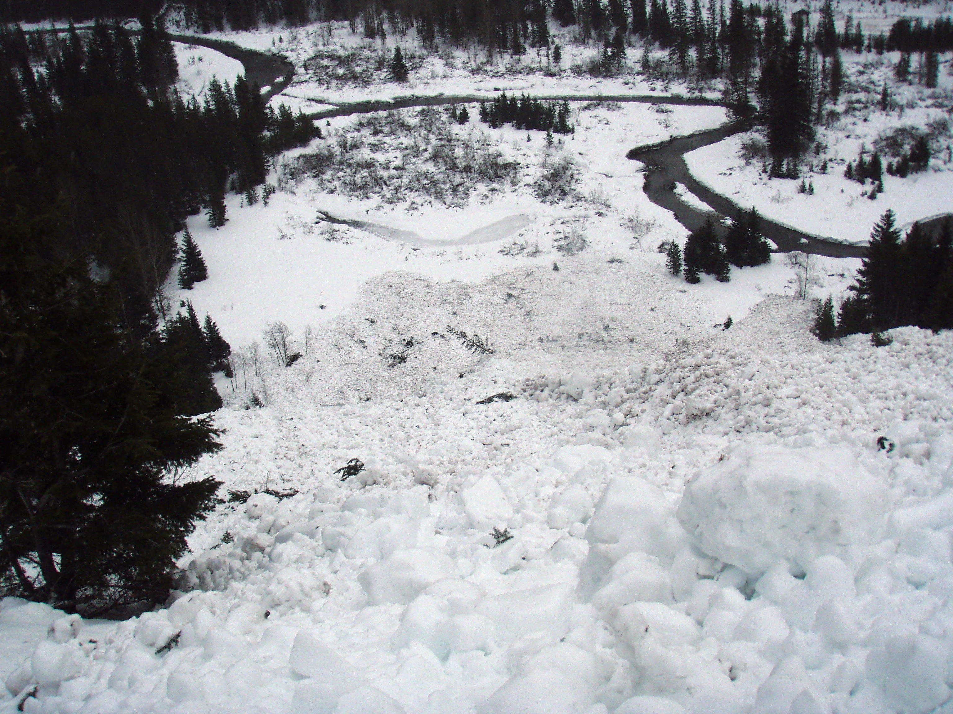 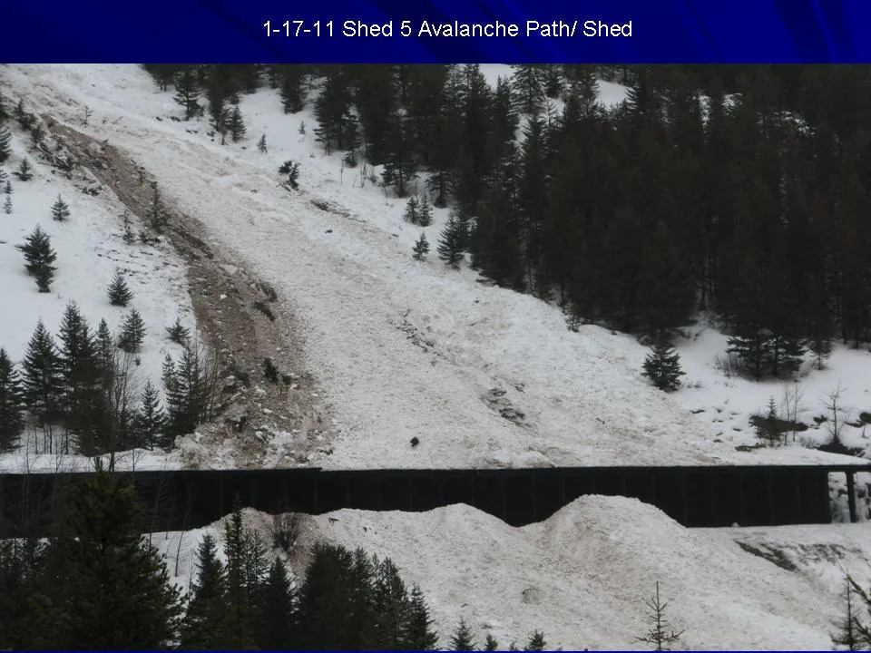 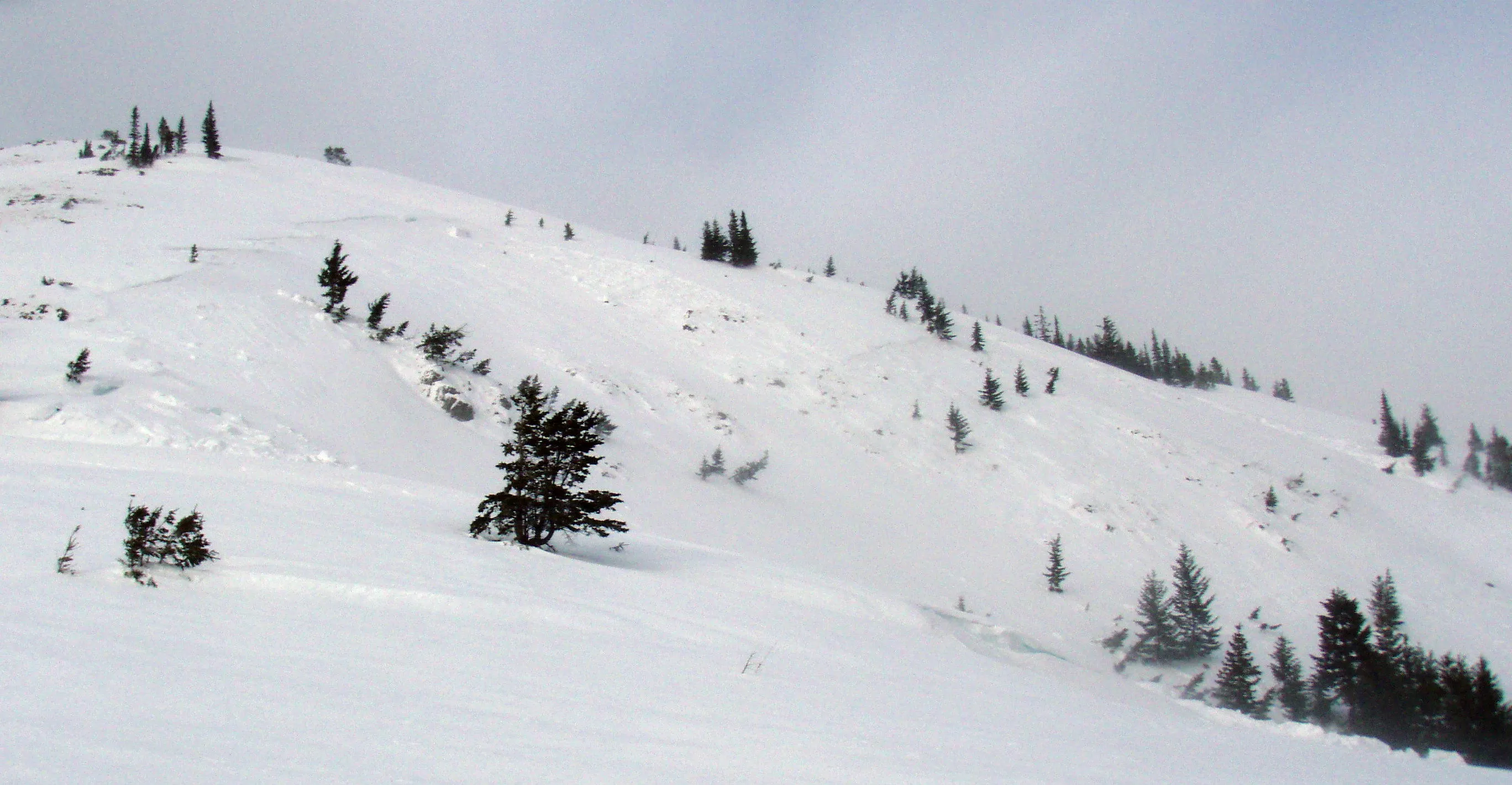 |
|
| 2011-01-16 | 11:00:00 | Shed 7 East | Steiner | HS | Natural | N | R3 | D3 | O | M | L | 0 | 0 | 0 | 0 | 0 | 0 | 0 | 0.00 | TK | - | - | No | 0 | 0 | No | 0 | 0 | - | Terminus 120 meters above rail grade. | No Image | |||
| 2011-01-16 | 09:00:00 | Infinity | Steiner | SU | Natural | N | R2 | D2 | U | T | L | 0 | 0 | 0 | 0 | 0 | 0 | 0 | 0.00 | TK | - | - | No | 0 | 0 | No | 0 | 0 | - | - | No Image | |||
| 2011-01-16 | 09:00:00 | Path 1163 | Steiner | U | Natural | NU | R2 | D2 | U | U | U | 0 | 0 | 0 | 0 | 0 | 0 | 0 | 0.00 | TK | - | - | No | 0 | 0 | No | 0 | 0 | - | Ran 2/3rds path | No Image | |||
| 2011-01-13 | 15:45:00 | Infinity | Steiner | U | Natural | N | R2 | D1.5 | U | T | U | 0 | 0 | 0 | 0 | 0 | 0 | 0 | 0.00 | TK | - | - | No | 0 | 0 | No | 0 | 0 | - | - | No Image | |||
| 2011-01-13 | 13:30:00 | Path 1163 | Steiner | U | Natural | N | R2 | D2 | U | T | U | 0 | 0 | 0 | 0 | 0 | 0 | 0 | 0.00 | TK | - | - | No | 0 | 0 | No | 0 | 0 | - | - | No Image | |||
| 2011-01-12 | 12:50:00 | Test Slope 2 | Steiner | HS | Artificial : Human | Asr | R3 | D2 | O | T | R | 0 | 0 | 0 | 0 | 0 | 0 | 0 | 0.00 | BR | - | - | No | 0 | 0 | No | 0 | 0 | - | Start: Looker's Right. Remote Trigger | No Image | |||
| 2011-01-10 | 10:11:00 | Infinity | Steiner | SS | Natural | R2 | D2 | I | T | R | 0 | 0 | 0 | 0 | 0 | 0 | 0 | 0.00 | TK | No | 0 | 0 | No | 0 | 0 | - | Crown depth 15-30 cm, width 30 m. Dry snow. | No Image | ||||||
| 2010-12-12 | 14:20:00 | Path 1163 | Steiner | U | Natural | NU | U | D2 | U | U | U | 0 | 0 | 0 | 0 | 0 | 0 | 0 | 0.00 | TK | No | 0 | 0 | No | 0 | 0 | - | Debris ran 5/8ths Path- Filled path wall to wall. Lots of small to moderate activity occurring on lower elev. cutbanks. | No Image | |||||
| 2010-12-12 | 12:00:00 | Shed 7 East | Steiner | SS | Natural | N | R2 | D2 | U | M | C | 0 | 0 | 0 | 0 | 0 | 0 | 0 | 0.00 | TK | No | 0 | 0 | No | 0 | 0 | - | Debris terminated at confluence with the Shed 7 West Path. | No Image | |||||
| 2010-12-12 | 08:45:00 | Broken Bridge | Steiner | U | Natural | NU | U | U | U | U | U | 0 | 0 | 0 | 0 | 0 | 0 | 0 | 0.00 | TK | No | 0 | 0 | No | 0 | 0 | - | Debris ran 2/3rds path confined to main gully. SZ obscured. | No Image | |||||
| 2010-12-11 | 16:00:00 | Path 1163 | Steiner | SS | Natural | N | R2 | D2 | U | T | C | 0 | 0 | 0 | 0 | 0 | 0 | 0 | 0.00 | TK | No | 0 | 0 | No | 0 | 0 | - | Debris terminated at nick point- 50% of path. | No Image | |||||
| 2010-12-10 | 11:49:00 | Path 1163 | Steiner | U | Natural | NU | U | U | U | U | U | 0 | 0 | 0 | 0 | 0 | 0 | 0 | 0.00 | TK | No | 0 | 0 | No | 0 | 0 | - | New Debris 1/2 Path. SZ obscured. | No Image | |||||
| 2010-12-10 | 11:35:00 | Shed 8 | Steiner | SS | Natural | N | R2 | D2 | U | M | L | 0 | 0 | 0 | 0 | 0 | 0 | 0 | 0.00 | TK | No | 0 | 0 | No | 0 | 0 | - | Debris ran 7/8ths path. Crown approximately 30 cm depth and 50 m wide. | No Image | |||||
| 2010-12-06 | 11:30:00 | Path 1163 | Steiner | L | Natural | NU | U | U | U | U | U | 0 | 0 | 0 | 0 | 0 | 0 | 0 | 0.00 | TK | No | 0 | 0 | No | 0 | 0 | - | Loose debris ran 1/2 path to "nick point." | No Image | |||||
| 2010-01-12 | 16:40:00 | Shed 9 | Steiner | L | Natural | NU | R1 | D1 | U | T | C | 0 | 0 | 0 | 0 | 0 | 0 | 0 | 0.00 | BP | No | 0 | 0 | No | 0 | 0 | - | Release in looker's R lower path. Debris ran to main path. | No Image | |||||
| 2010-01-12 | 16:35:00 | Infinity | Steiner | L | Natural | NU | U | D1 | U | U | 0 | 0 | 0 | 0 | 0 | 0 | 0 | 0.00 | TK | No | 0 | 0 | No | 0 | 0 | - | Debris ran 1/2 Path. Associated with rain event. | No Image | ||||||
| 2010-01-12 | 16:30:00 | Jakes (MP 1161.9) | Steiner | L | Natural | NU | R1 | D1 | U | B | 0 | 0 | 0 | 0 | 0 | 0 | 0 | 0.00 | No | 0 | 0 | No | 0 | 0 | - | Release associated with 1/12 rain event. | No Image | |||||||
| 2010-01-12 | 16:25:00 | Path 1163 | Steiner | U | Natural | NU | U | U | U | U | U | 0 | 0 | 0 | 0 | 0 | 0 | 0 | 0.00 | TK | No | 0 | 0 | No | 0 | 0 | - | Debris ran 1/2 path | No Image | |||||
| 2009-03-28 | 15:30:00 | Path 1163 | Steiner | L | - | - | - | D1 | - | - | L | 0 | 0 | 0 | 0 | 0 | 0 | 0 | 0.00 | - | - | - | No | 0 | 0 | No | 0 | 0 | - | - | No Image | |||
| 2009-03-21 | 15:30:00 | Fry Pan | Steiner | L | Natural | NU | U | U | U | U | U | 0 | 0 | 0 | 0 | 0 | 0 | 0 | 0.00 | BR | - | U | U | No | 0 | 0 | No | 0 | 0 | - | Debris ran full path | No Image | ||
| 2009-03-20 | 16:00:00 | Infinity | Steiner | L | Natural | NU | R2 | U | U | U | U | 0 | 0 | 0 | 0 | 0 | 0 | 0 | 0.00 | BR | - | U | U | No | 0 | 0 | No | 0 | 0 | - | Debris ran 2/3 path terminating above the grade. | No Image | ||
| 2009-03-20 | 16:00:00 | Path 1163 | Clark | L | Natural | NU | R2 | U | U | U | U | 0 | 0 | 0 | 0 | 0 | 0 | 0 | 0.00 | U | - | U | U | No | 0 | 0 | No | 0 | 0 | - | Debris ran 2/3 path terminating above the grade. | No Image | ||
| 2009-03-20 | 16:00:00 | Shed 10 | Steiner | L | Natural | NU | U | U | U | U | U | 0 | 0 | 0 | 0 | 0 | 0 | 0 | 0.00 | BR | - | U | U | No | 0 | 0 | No | 0 | 0 | - | Debris ran 2/3 path terminating above the grade. | No Image | ||
| 2009-03-16 | 08:00:00 | Infinity | Steiner | WS | Natural | N | R2 | D2 | - | - | L | 0 | 0 | 0 | 0 | 0 | 0 | 0 | 0.00 | - | - | - | No | 0 | 0 | No | 0 | 0 | - | - | No Image | |||
| 2009-03-16 | 08:00:00 | Path 1163 | Steiner | L | Natural | NU | U | U | U | U | U | 0 | 0 | 0 | 0 | 0 | 0 | 0 | 0.00 | TK | - | U | U | No | 0 | 0 | No | 0 | 0 | - | Debris ran 1/2 path terminating above the rail grade. | No Image | ||
| 2009-03-04 | 10:15:00 | Goat Lick | Steiner | WS | Natural | N | R2 | D2 | I | T | - | 0 | 0 | 0 | 0 | 0 | 0 | 0 | 0.00 | BR | - | - | No | 0 | 0 | No | 0 | 0 | - | - | No Image | |||
| 2009-02-28 | 13:45:00 | Java | Steiner | SS | Artificial : Human | AS | R3 | D3 | O | T | U | 0 | 0 | 0 | 0 | 0 | 0 | 0 | 0.00 | BR | - | U | U | No | 0 | 0 | No | 0 | 0 | - | No Image | |||
| 2009-02-06 | 11:00:00 | Infinity | Steiner | U | Natural | N | R2 | U | U | 0 | 0 | 0 | 0 | 0 | 0 | 0 | 0.00 | TK | No | 0 | 0 | No | 0 | 0 | - | No Image | ||||||||
| 2009-02-06 | 11:00:00 | Path 1163 | Steiner | U | Natural | N | R2 | U | U | 0 | 0 | 0 | 0 | 0 | 0 | 0 | 0.00 | TK | No | 0 | 0 | No | 0 | 0 | - | No Image | ||||||||
| 2009-01-30 | 09:44:00 | Shed 10.7 | Dundas | L | Natural | N | R1 | D1 | T | C | 0 | 0 | 0 | 0 | 0 | 0 | 0 | 0.00 | SZ | No | 0 | 0 | No | 0 | 0 | - | No Image | |||||||
| 2009-01-30 | 09:44:00 | Shed 11 | Dundas | L | Natural | R1 | T | C | 0 | 0 | 0 | 0 | 0 | 0 | 0 | 0.00 | SZ | No | 0 | 0 | No | 0 | 0 | - | No Image | |||||||||
| 2009-01-12 | 12:00:00 | Grizzly Gulch | Dundas | HS | Natural | N | R3 | T | C | 0 | 0 | 0 | 0 | 0 | 0 | 0 | 0.00 | No | 0 | 0 | No | 0 | 0 | - | No Image | |||||||||
| 2009-01-12 | 12:00:00 | Grizzly Gulch | Steiner | SS | - | - | - | - | - | T | - | 0 | 0 | 0 | 0 | 0 | 0 | 0 | 0.00 | BR | - | - | No | 0 | 0 | No | 0 | 0 | - | - | No Image | |||
| 2009-01-12 | 12:00:00 | Shed 11 | Dundas | U | Natural | N | R2 | T | U | 0 | 0 | 0 | 0 | 0 | 0 | 0 | 0.00 | TK | No | 0 | 0 | No | 0 | 0 | - | No Image | ||||||||
| 2009-01-12 | 12:00:00 | Shed 11 | Steiner | U | - | - | - | - | - | - | - | 0 | 0 | 0 | 0 | 0 | 0 | 0 | 0.00 | TK | - | - | No | 0 | 0 | No | 0 | 0 | - | - | No Image | |||
| 2009-01-08 | 13:59:00 | Shed 5 | Steiner | HS | Natural | N | U | D3 | G | T | U | 0 | N | 0 | 0 | 0 | 0 | 0 | 0 | 0.00 | BR | - | U | U | Yes | 30 | 8 | No | 0 | 0 | - | backfilled snowshed 30' height 100' linear - avalanche watch posted | 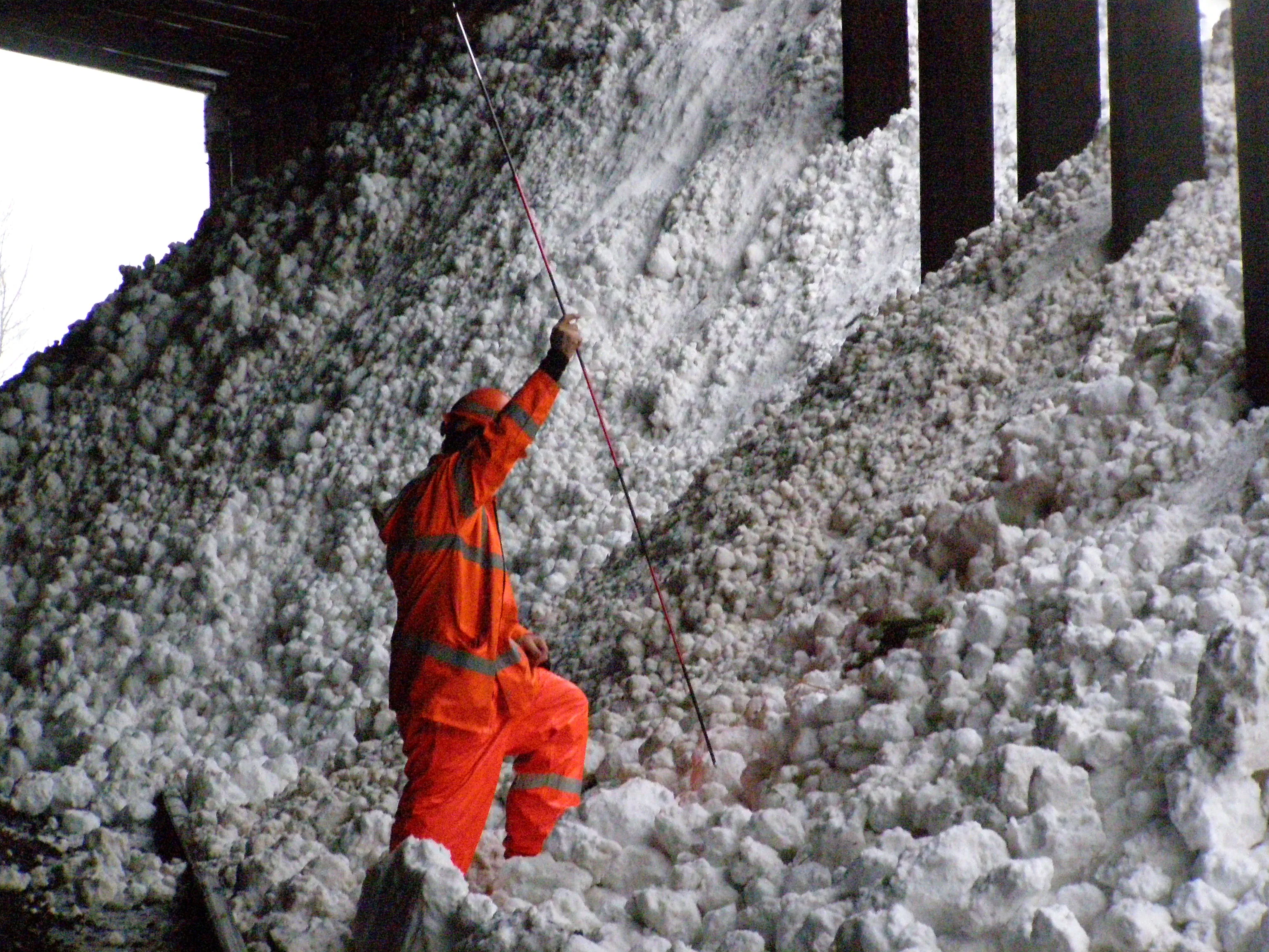 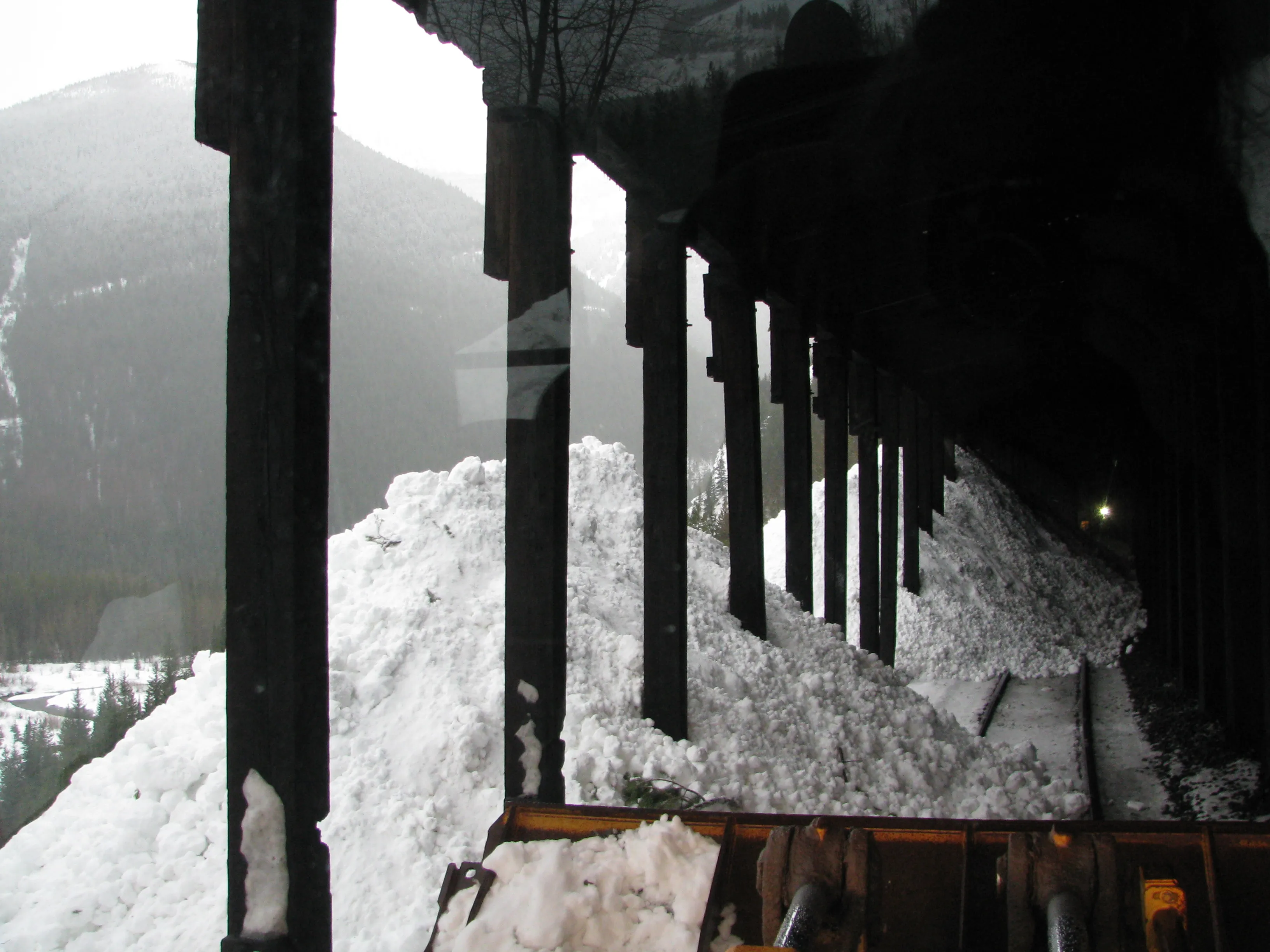 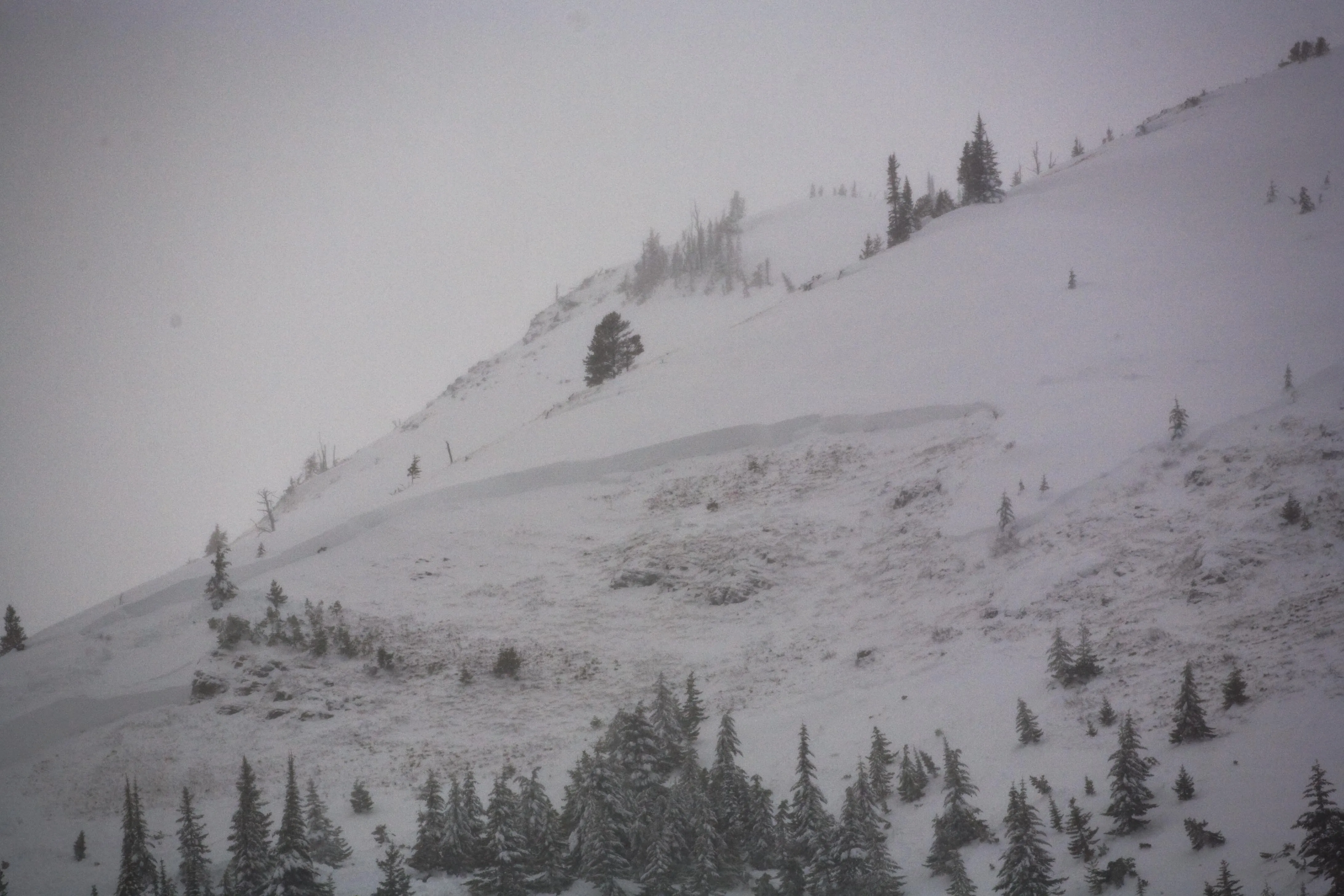 |
|
| 2009-01-08 | 05:00:00 | Umbrella | Clark | SS | Natural | NU | U | D1.5 | U | U | U | 0 | N | 0 | 0 | 0 | 0 | 0 | 0 | 0.00 | U | BP | U | U | Yes | 0 | 0 | No | 0 | 0 | - | Debris terminated at rail grade elevation. | No Image | |
| 2009-01-07 | 08:22:00 | Burn Out | Steiner | WL | - | - | R2 | - | - | U | U | 0 | 0 | 0 | 0 | 0 | 0 | 0 | 0.00 | U | - | - | No | 0 | 0 | No | 0 | 0 | - | - | No Image | |||
| 2009-01-07 | 08:22:00 | 1160 Cutbank | Steiner | SS | Natural | NU | U | D1.5 | U | T | U | 0 | 0 | 0 | 0 | 0 | 100 | 50 | 75.00 | U | BP | U | U | No | 0 | 0 | No | 0 | 0 | - | Ran 150' vertical feet. Unknown if debris reached grade. | No Image | ||
| 2009-01-07 | 08:22:00 | Infinity | Steiner | SS | - | - | R2 | - | - | U | U | 0 | 0 | 0 | 0 | 0 | 0 | 0 | 0.00 | BR | - | - | No | 0 | 0 | No | 0 | 0 | - | 250' from rail | No Image | |||
| 2009-01-07 | 08:22:00 | Jakes (MP 1161.9) | Steiner | SS | - | - | R1 | - | - | T | - | 0 | 0 | 0 | 0 | 0 | 0 | 0 | 0.00 | BR | - | - | No | 0 | 0 | No | 0 | 0 | - | - | No Image | |||
| 2009-01-07 | 08:22:00 | Path 1163 | Steiner | U | - | - | - | - | - | U | U | 0 | 0 | 0 | 0 | 0 | 0 | 0 | 0.00 | U | - | - | No | 0 | 0 | No | 0 | 0 | - | 200' above nick point | No Image | |||
| 2009-01-07 | 08:22:00 | Shed 9 | Steiner | SS | - | - | R1 | - | - | B | - | 0 | 0 | 0 | 0 | 0 | 0 | 0 | 0.00 | BR | - | - | No | 0 | 0 | No | 0 | 0 | - | - | No Image | |||
| 2009-01-04 | 12:00:00 | Path 1163 | Steiner | U | - | - | - | - | - | - | - | 0 | 0 | 0 | 0 | 0 | 0 | 0 | 0.00 | BR | - | - | No | 0 | 0 | No | 0 | 0 | - | ran to nick point | No Image | |||
| 2009-01-03 | 19:30:00 | Path 1163 | Steiner | U | Natural | NU | U | U | U | U | U | 0 | N | 0 | 0 | 0 | 0 | 0 | 0 | 0.00 | U | - | U | U | Yes | 0 | 0 | No | 0 | 0 | - | Debris on the grade reported by train crew that was able to push through. Night time hours, no other information recorded. | No Image | |
| 2009-01-03 | 09:00:00 | Infinity | Steiner | SS | Natural | NU | U | U | U | U | U | 0 | 0 | 0 | 0 | 0 | 0 | 0 | 0.00 | BR | - | U | U | No | 0 | 0 | No | 0 | 0 | - | Debris ran 3/4 path. | No Image | ||
| 2009-01-03 | 09:00:00 | Jakes (MP 1161.9) | Steiner | L | Natural | NU | R1 | U | U | T | U | 0 | 0 | 0 | 0 | 0 | 0 | 0 | 0.00 | BR | - | U | U | No | 0 | 0 | No | 0 | 0 | - | Debris terminated above the grade. | No Image | ||
| 2009-01-03 | 09:00:00 | Shed 10 | Steiner | SS | Natural | N | R2 | D3 | - | T | - | 0 | 0 | 0 | 0 | 0 | 0 | 0 | 0.00 | BR | - | - | No | 0 | 0 | No | 0 | 0 | - | - | No Image | |||
| 2009-01-02 | 09:50:00 | Umbrella | Steiner | U | Natural | NU | U | U | U | U | U | 0 | N | 0 | 0 | 0 | 0 | 0 | 0 | 0.00 | U | - | U | U | Yes | 20 | 2 | No | 0 | 0 | - | Reported. 10 feet debris on Main 1, 2 feet debris on Main 2. | No Image | |
| 2008-12-30 | 09:50:00 | Shed 7 East | Steiner | SS | Natural | NU | R3 | D2.5 | G | T | C | 0 | N | 1920 | 1340 | 580 | 0 | 0 | 0 | 0.00 | U | - | U | U | Yes | 0 | 0 | No | 0 | 0 | - | Path filled, debris over shed. | No Image | |
| 2008-12-30 | 09:50:00 | Shed 7 West | Steiner | SS | Natural | NU | R3 | D2.5 | G | U | U | 0 | 1950 | 1460 | 490 | 0 | 0 | 0 | 0.00 | U | - | U | U | No | 0 | 0 | No | 0 | 0 | - | Path filled, debris ran to Shed 7 East confluence. | No Image | ||
| 2008-12-30 | 09:50:00 | Shed 10.7 | Steiner | U | Natural | NU | R1 | D2 | U | U | U | 0 | 0 | 0 | 0 | 0 | 0 | 0 | 0.00 | U | - | U | U | No | 0 | 0 | No | 0 | 0 | - | Debris terminus not observed, but no debris on the grade. | No Image | ||
| 2008-12-30 | 09:50:00 | Shed 11 | Steiner | SS | Natural | NU | R1 | D2 | U | U | U | 0 | 0 | 0 | 0 | 0 | 0 | 0 | 0.00 | U | - | U | U | No | 0 | 0 | No | 0 | 0 | - | Debris terminus not observed but no debris on the grade. | No Image | ||
| 2008-12-29 | 12:25:00 | Infinity | Steiner | SS | Natural | N | R3 | D3 | G | T | C | 0 | 0 | 0 | 0 | 0 | 0 | 0 | 0.00 | BR | - | U | U | No | 0 | 0 | No | 0 | 0 | - | Ran 3/4 path w/ debris terminated above the grade. | No Image | ||
| 2008-12-29 | 12:25:00 | Java | Steiner | SS | - | - | R3 | - | - | T | - | 0 | 0 | 0 | 0 | 0 | 0 | 0 | 0.00 | U | - | - | No | 0 | 0 | No | 0 | 0 | - | Java L Path | No Image | |||
| 2008-12-29 | 12:25:00 | Path 1163 | Steiner | U | Natural | NU | U | U | U | U | U | 0 | 0 | 0 | 0 | 0 | 0 | 0 | 0.00 | BR | - | U | U | No | 0 | 0 | No | 0 | 0 | - | Debris ran 2/3 path terminating above the grade. | No Image | ||
| 2008-12-29 | 12:25:00 | Shed 7 West | Steiner | SS | Natural | NU | U | U | U | T | U | 0 | N | 0 | 0 | 0 | 0 | 0 | 0 | 0.00 | BR | - | U | U | Yes | 0 | 0 | No | 0 | 0 | - | Started around upper cliff band. Debris to Shed | No Image | |
| 2008-12-29 | 12:25:00 | Shed 8 | Steiner | SS | Natural | N | R3 | D3 | G | U | L | 0 | N | 0 | 0 | 0 | 0 | 0 | 0 | 0.00 | BR | - | U | U | Yes | 0 | 0 | No | 0 | 0 | - | 8 foot crown, path filled and debris over the shed. | No Image | |
| 2008-12-29 | 12:25:00 | Shed 10.7 | Steiner | U | Natural | NU | R2 | D1.5 | U | U | U | 0 | 0 | 0 | 0 | 0 | 0 | 0 | 0.00 | TK | - | U | U | No | 0 | 0 | No | 0 | 0 | - | Debris ran 1/2 path terminating above the grade. | No Image | ||
| 2008-12-29 | 12:25:00 | Shed 11 | Steiner | U | Natural | NU | R2 | D1.5 | U | U | U | 0 | 0 | 0 | 0 | 0 | 0 | 0 | 0.00 | BR | - | U | U | No | 0 | 0 | No | 0 | 0 | - | Debris ran 2/3 path terminating above rail grade. | No Image | ||
| 2008-12-28 | 10:20:00 | Java Gauntlet | Steiner | SS | - | - | R2 | - | - | T | - | 0 | 0 | 0 | 0 | 0 | 0 | 0 | 0.00 | BR | - | - | No | 0 | 0 | No | 0 | 0 | - | - | No Image | |||
| 2008-12-28 | 08:50:00 | Java Gauntlet | Steiner | SS | Natural | NU | U | D1.5 | U | U | U | 0 | N | 1280 | 1220 | 60 | 0 | 0 | 0 | 0.00 | U | - | U | U | Yes | 1 | 0 | No | 0 | 0 | - | 10 feet of debris piled on slide fence. 3 feet debris on Main 2. | No Image | |
| 2008-12-10 | 11:10:00 | Shed 7 East | Steiner | SS | Natural | N | R3 | D2.5 | G | T | U | 0 | N | 0 | 0 | 0 | 0 | 0 | 0 | 0.00 | BR | - | U | U | Yes | 0 | 0 | No | 0 | 0 | - | Shed 7 E - ran to shed | No Image | |
| 2008-03-20 | 16:00:00 | Path 1163 | Steiner | L | - | - | R2 | - | - | U | U | 0 | 0 | 0 | 0 | 0 | 0 | 0 | 0.00 | BR | - | - | No | 0 | 0 | No | 0 | 0 | - | - | No Image | |||
| 2008-02-19 | Ukn | Path 1163 | Steiner | L | Natural | NU | U | U | U | U | U | 0 | - | 0 | 0 | 0 | 0 | 0 | 0 | 0.00 | BR | - | U | U | No | 0 | 0 | No | 0 | 0 | - | Loose debris terminated 2/3rds path to the grade. | No Image | |
| 2008-02-19 | Ukn | Shed 11 | Steiner | L | Natural | NU | R1 | D1.5 | U | U | U | 0 | - | 0 | 0 | 0 | 0 | 0 | 0 | 0.00 | U | - | U | U | No | 0 | 0 | No | 0 | 0 | - | Loose snow avalanche... just below rock outcrop | No Image | |
| 2008-02-13 | 10:00:00 | Infinity | Steiner | WL | Natural | NU | R2 | D2 | U | U | U | 0 | 0 | 0 | 0 | 0 | 0 | 0 | 0.00 | BR | - | U | U | No | 0 | 0 | No | 0 | 0 | - | Debris terminated 3/4 path to grade. | No Image | ||
| 2008-02-11 | Ukn | Shed 7 | Steiner | SS | Natural | N | R1 | D2 | U | U | U | 0 | NE | 0 | 0 | 0 | 0 | 0 | 0 | 0.00 | BR | - | U | U | No | 0 | 0 | No | 0 | 0 | - | Released on northeasterly aspect below ridge top cornice. | No Image | |
| 2008-02-11 | Ukn | Shed 7 West | Steiner | SS | Natural | NU | R1 | D2 | U | T | L | 0 | - | 0 | 0 | 0 | 0 | 0 | 0 | 0.00 | TK | - | U | U | No | 0 | 0 | No | 0 | 0 | - | Released just below ridge top cornice. Debris terminus in upper 1/3rd of Shed 7 West path. | No Image | |
| 2008-02-10 | 15:10:00 | Shed 10 | Steiner | SS | Natural | N | R1 | D1 | - | - | - | 0 | 0 | 0 | 0 | 0 | 0 | 0 | 0.00 | - | - | - | No | 0 | 0 | No | 0 | 0 | - | sz=feeder | No Image | |||
| 2008-02-10 | Ukn | Jakes (MP 1161.9) | Steiner | SS | Natural | N | R1 | D1 | - | - | - | 0 | - | 0 | 0 | 0 | 0 | 0 | 0 | 0.00 | - | - | - | - | No | 0 | 0 | No | 0 | 0 | - | - | No Image | |
| 2008-02-05 | 16:00:00 | Path 1163 | Steiner | U | Natural | NU | U | U | U | U | R | 0 | 0 | 0 | 0 | 0 | 0 | 0 | 0.00 | BR | - | U | U | No | 0 | 0 | No | 0 | 0 | - | Avalanche type unknown. Fresh debris below rocks on looker's right in lower path. | No Image | ||
| 2008-01-28 | 08:30:00 | Infinity | Steiner | U | Natural | N | R3 | D2 | U | U | U | 0 | 0 | 0 | 0 | 0 | 0 | 0 | 0.00 | BR | - | U | U | No | 0 | 0 | No | 0 | 0 | - | Debris terminated 75' from rail. | No Image | ||
| 2008-01-21 | 11:30:00 | Infinity | Steiner | U | - | - | R1 | - | - | U | U | 0 | 0 | 0 | 0 | 0 | 0 | 0 | 0.00 | TK | - | - | No | 0 | 0 | No | 0 | 0 | - | - | No Image | |||
| 2008-01-21 | 11:30:00 | Path 1163 | Steiner | U | Natural | NU | R1 | U | U | U | U | 0 | 0 | 0 | 0 | 0 | 0 | 0 | 0.00 | BR | - | U | U | No | 0 | 0 | No | 0 | 0 | - | Debris 1/2 path. | No Image | ||
| 2008-01-16 | 09:30:00 | Shed 7 | Steiner | SS | Natural | N | R1 | D2 | - | M | L | 0 | 0 | 0 | 0 | 0 | 0 | 0 | 0.00 | TK | - | - | No | 0 | 0 | No | 0 | 0 | - | SZ= mid-left cornice | No Image | |||
| 2008-01-16 | 09:30:00 | Shed 7 East | Steiner | SS | Natural | NC | R1 | D1.5 | U | M | L | 0 | 0 | 0 | 0 | 0 | 0 | 0 | 0.00 | TK | - | U | U | No | 0 | 0 | No | 0 | 0 | - | SS likely triggered by cornice fall. Cornice- mid-slope.Lookers Left. | No Image | ||
| 2008-01-06 | 07:30:00 | Shed 6 | Steiner | SS | Natural | N | R1 | D1 | O | U | U | 0 | 0 | 0 | 0 | 0 | 0 | 0 | 0.00 | U | - | U | U | No | 0 | 0 | No | 0 | 0 | - | Isolated SS releases in small open-pockets of trees and below rocks just above shed. | No Image | ||
| 2008-01-04 | 14:30:00 | Shed 7 West | Steiner | SS | Natural | N | R1 | D2 | - | T | L | 0 | 0 | 0 | 0 | 0 | 0 | 0 | 0.00 | U | - | - | No | 0 | 0 | No | 0 | 0 | - | Shed 7 W | No Image | |||
| 2007-12-10 | 11:10:00 | Path 1163 | Steiner | WL | Natural | NU | R1 | U | U | U | U | 0 | 0 | 0 | 0 | 0 | 0 | 0 | 0.00 | BR | - | U | U | No | 0 | 0 | No | 0 | 0 | - | Terminated 1/2 path at nick-point | No Image | ||
| 2007-12-10 | 11:10:00 | Shed 7 East | Steiner | HS | Natural | NU | R1 | D1.5 | U | U | U | 0 | 0 | 0 | 0 | 0 | 0 | 0 | 0.00 | U | - | U | U | No | 0 | 0 | No | 0 | 0 | - | Terminated upper 1/3 of path. N-HS-R1-D1.5-O | No Image | ||
| 2007-03-09 | 10:00:00 | Path 1163 | Steiner | L | Natural | NU | R1 | U | U | T | U | 0 | 0 | 0 | 0 | 0 | 0 | 0 | 0.00 | TR | - | U | U | No | 0 | 0 | No | 0 | 0 | - | Ran 2/3 path terminating above the rail. | No Image | ||
| 2007-03-07 | 15:00:00 | Path 1163 | Steiner | L | Natural | NU | R1 | U | U | T | U | 0 | 0 | 0 | 0 | 0 | 0 | 0 | 0.00 | TR | - | U | U | No | 0 | 0 | No | 0 | 0 | - | Debris ran 2/3 path terminating above the rail. | No Image | ||
| 2007-03-07 | 15:00:00 | Shed 8 | Steiner | HS | - | - | - | - | - | - | L | 0 | 0 | 0 | 0 | 0 | 0 | 0 | 0.00 | U | - | - | No | 0 | 0 | No | 0 | 0 | - | - | No Image | |||
| 2007-03-07 | 04:30:00 | Burn Out | Steiner | WL | Natural | N | R1 | D1 | U | U | U | 0 | N | 0 | 0 | 0 | 0 | 0 | 0 | 0.00 | U | - | U | U | Yes | 0 | 0 | No | 0 | 0 | - | Debris reached the rail grade. | No Image | |
| 2007-03-06 | 10:30:00 | Path 1163 | Steiner | L | Natural | NU | R1 | U | U | T | U | 0 | 0 | 0 | 0 | 0 | 0 | 0 | 0.00 | TR | - | U | U | No | 0 | 0 | No | 0 | 0 | - | Debris ran 2/3 path terminating above the rail | No Image | ||
| 2007-03-05 | 12:35:00 | Infinity | Steiner | SS | Natural | N | R2 | D2 | U | T | U | 0 | 0 | 0 | 0 | 0 | 0 | 0 | 0.00 | BR | - | U | U | No | 0 | 0 | No | 0 | 0 | - | Debris ran 3/4 path terminating above the rail. | No Image | ||
| 2007-03-05 | 12:35:00 | Path 1163 | Steiner | L | Natural | NU | U | U | U | U | R | 0 | 0 | 0 | 0 | 0 | 0 | 0 | 0.00 | TR | - | U | U | No | 0 | 0 | No | 0 | 0 | - | Debris ran 1/2 path terminating above the rail. | No Image | ||
| 2007-02-20 | 10:00:00 | Shed 8 | Steiner | SS | Natural | N | R2 | D2 | U | U | U | 0 | 0 | 0 | 0 | 0 | 0 | 0 | 0.00 | BR | - | U | U | No | 0 | 0 | No | 0 | 0 | - | Debris reached within 100 feet of the shed. | No Image | ||
| 2007-02-16 | 10:10:00 | Jakes (MP 1161.9) | Steiner | SS | Natural | N | R1 | D1 | U | B | R | 0 | 0 | 0 | 0 | 0 | 0 | 0 | 0.00 | TR | - | U | U | No | 0 | 0 | No | 0 | 0 | - | Debris ran 1/2 path terminating above the rail. | No Image | ||
| 2007-02-16 | 10:10:00 | Path 1163 | Steiner | L | Natural | N | U | U | U | U | R | 0 | 0 | 0 | 0 | 0 | 0 | 0 | 0.00 | TR | - | U | U | No | 0 | 0 | No | 0 | 0 | - | Debris ran 1/2 path terminating above the rail. | No Image | ||
| 2007-02-07 | 09:45:00 | Java | Clark | SS | Natural | NU | R3 | U | U | U | U | 0 | 0 | 0 | 0 | 0 | 0 | 0 | 0.00 | U | - | U | U | No | 0 | 0 | No | 0 | 0 | - | Located on the top of Java Mountain. | No Image | ||
| 2007-02-07 | 09:30:00 | Shed 11 | Steiner | GS | Natural | NU | R2 | D2.5 | G | T | U | 0 | 0 | 0 | 0 | 0 | 0 | 0 | 0.00 | BR | - | U | U | No | 0 | 0 | No | 0 | 0 | - | Debris terminated in bottom of run out, but still above the rail grade. | No Image | ||
| 2007-01-31 | 10:40:00 | Shed 11 | Steiner | U | - | - | - | - | - | T | - | 0 | 0 | 0 | 0 | 0 | 0 | 0 | 0.00 | U | - | - | No | 0 | 0 | No | 0 | 0 | - | - | No Image | |||
| 2007-01-30 | 12:00:00 | Path 1163 | Steiner | L | Natural | NU | U | U | U | U | U | 0 | 0 | 0 | 0 | 0 | 0 | 0 | 0.00 | MR | - | U | U | No | 0 | 0 | No | 0 | 0 | - | Debris ran 2/3 path terminating above the grade. | No Image | ||
| 2007-01-26 | 09:00:00 | Burn Out | Steiner | L | Natural | NU | U | U | U | M | R | 0 | 0 | 0 | 0 | 0 | 0 | 0 | 0.00 | TR | - | U | U | No | 0 | 0 | No | 0 | 0 | - | Debris terminated above the grade. | No Image | ||
| 2007-01-26 | 09:00:00 | Infinity | Steiner | L | Natural | NU | R2 | U | U | U | R | 0 | 0 | 0 | 0 | 0 | 0 | 0 | 0.00 | BR | - | U | U | No | 0 | 0 | No | 0 | 0 | - | Debris ran 2/3rds path terminating above the grade. | No Image | ||
| 2007-01-26 | 09:00:00 | Path 1163 | Steiner | L | Natural | NU | U | U | U | U | R | 0 | 0 | 0 | 0 | 0 | 0 | 0 | 0.00 | TK | - | U | U | No | 0 | 0 | No | 0 | 0 | - | No Image | |||
| 2007-01-20 | 08:00:00 | Shed 11 | Steiner | U | - | - | - | - | - | T | - | 0 | 0 | 0 | 0 | 0 | 0 | 0 | 0.00 | U | - | - | No | 0 | 0 | No | 0 | 0 | - | - | No Image | |||
| 2007-01-19 | 13:20:00 | Shed 11 | Steiner | U | - | - | R3 | - | - | T | - | 0 | 0 | 0 | 0 | 0 | 0 | 0 | 0.00 | U | - | - | No | 0 | 0 | No | 0 | 0 | - | - | No Image | |||
| 2007-01-06 | 15:00:00 | Path 1163 | Steiner | L | Natural | NU | U | U | U | U | U | 0 | 0 | 0 | 0 | 0 | 0 | 0 | 0.00 | TK | - | U | U | No | 0 | 0 | No | 0 | 0 | - | Debris ran 1/2 path terminating above the grade. | No Image | ||
| 2006-12-10 | 12:00:00 | Path 1163 | Steiner | WL | - | - | - | - | - | - | - | 0 | 0 | 0 | 0 | 0 | 0 | 0 | 0.00 | TK | - | - | No | 0 | 0 | No | 0 | 0 | - | - | No Image | |||
| 2006-12-10 | 12:00:00 | Shed 7 | Steiner | WL | - | - | - | - | - | - | - | 0 | 0 | 0 | 0 | 0 | 0 | 0 | 0.00 | TR | - | - | No | 0 | 0 | No | 0 | 0 | - | - | No Image | |||
| 2006-02-28 | 10:55:00 | Infinity | Steiner | WL | - | - | R2 | - | - | - | - | 0 | 0 | 0 | 0 | 0 | 0 | 0 | 0.00 | BR | - | - | No | 0 | 0 | No | 0 | 0 | - | - | No Image | |||
| 2006-02-28 | 10:00:00 | Shed 10 | Steiner | WL | - | - | R2 | - | - | - | L | 0 | 0 | 0 | 0 | 0 | 0 | 0 | 0.00 | TR | - | - | No | 0 | 0 | No | 0 | 0 | - | - | No Image | |||
| 2006-02-28 | 10:00:00 | Shed 10 | Steiner | WL | - | - | R2 | - | - | - | - | 0 | 0 | 0 | 0 | 0 | 0 | 0 | 0.00 | - | - | - | No | 0 | 0 | No | 0 | 0 | - | - | No Image | |||
| 2006-02-28 | 10:00:00 | Shed 11 | Steiner | WS | Natural | N | R2 | - | - | T | - | 0 | 0 | 0 | 0 | 0 | 0 | 0 | 0.00 | MR | - | - | No | 0 | 0 | No | 0 | 0 | - | - | No Image | |||
| 2006-02-28 | 07:30:00 | Jakes (MP 1161.9) | Steiner | WL | - | - | R2 | - | - | T | C | 0 | 0 | 0 | 0 | 0 | 0 | 0 | 0.00 | BR | - | - | No | 0 | 0 | No | 0 | 0 | - | - | No Image | |||
| 2006-02-27 | 13:30:00 | Shed 10.7 | Steiner | L | - | - | R2 | - | - | T | - | 0 | 0 | 0 | 0 | 0 | 0 | 0 | 0.00 | BR | - | - | No | 0 | 0 | No | 0 | 0 | - | - | No Image | |||
| 2006-02-27 | 13:30:00 | Shed 11 | Steiner | L | - | - | R3 | - | - | T | - | 0 | 0 | 0 | 0 | 0 | 0 | 0 | 0.00 | BR | - | - | No | 0 | 0 | No | 0 | 0 | - | - | No Image | |||
| 2006-02-27 | 12:00:00 | Infinity | Steiner | WL | - | - | R2 | - | - | - | - | 0 | 0 | 0 | 0 | 0 | 0 | 0 | 0.00 | MR | - | - | No | 0 | 0 | No | 0 | 0 | - | - | No Image | |||
| 2006-02-27 | 09:40:00 | Path 1163 | Steiner | - | - | - | - | - | - | - | - | 0 | 0 | 0 | 0 | 0 | 0 | 0 | 0.00 | BR | - | - | No | 0 | 0 | No | 0 | 0 | - | - | No Image | |||
| 2006-02-27 | 09:40:00 | Shed 10 | Steiner | WS | Natural | N | R2 | - | - | M | R | 0 | 0 | 0 | 0 | 0 | 0 | 0 | 0.00 | BR | - | - | No | 0 | 0 | No | 0 | 0 | - | - | No Image | |||
| 2006-02-27 | 09:00:00 | Grizzly Gulch | Steiner | WS | Natural | N | R2 | - | - | M | C | 0 | 0 | 0 | 0 | 0 | 0 | 0 | 0.00 | - | - | - | No | 0 | 0 | No | 0 | 0 | - | - | No Image | |||
| 2006-02-26 | Ukn | Shed 7 | Steiner | SS | Natural | N | R2 | - | - | T | - | 0 | - | 0 | 0 | 0 | 0 | 0 | 0 | 0.00 | MR | - | - | - | No | 0 | 0 | No | 0 | 0 | - | - | No Image | |
| 2006-02-25 | 12:55:00 | Shed 8 | Steiner | SS | Artificial : Explosive | AE | R3 | D3 | U | M | C | 0 | E | 1870 | 1333 | 537 | 60 | 180 | 90 | 135.00 | BR | - | U | D | Yes | 20 | 0.5 | No | 0 | 0 | - | Explosives triggered avalanche. 2006-02-25 mission. Debris ran over the shed and terminated in runout on low side of shed. RR was closed at this time and no snow entered the shed. | 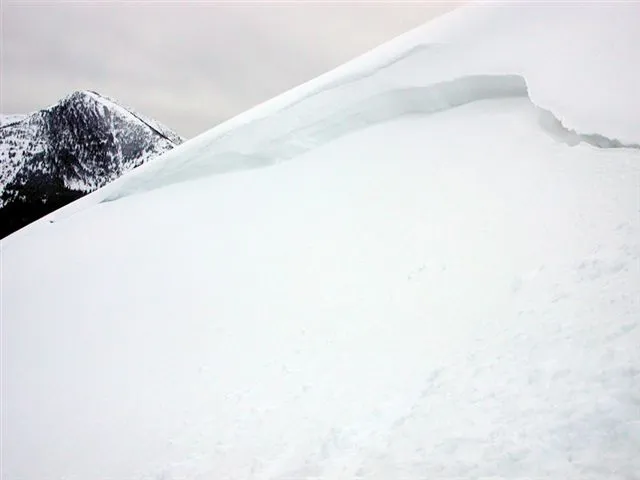 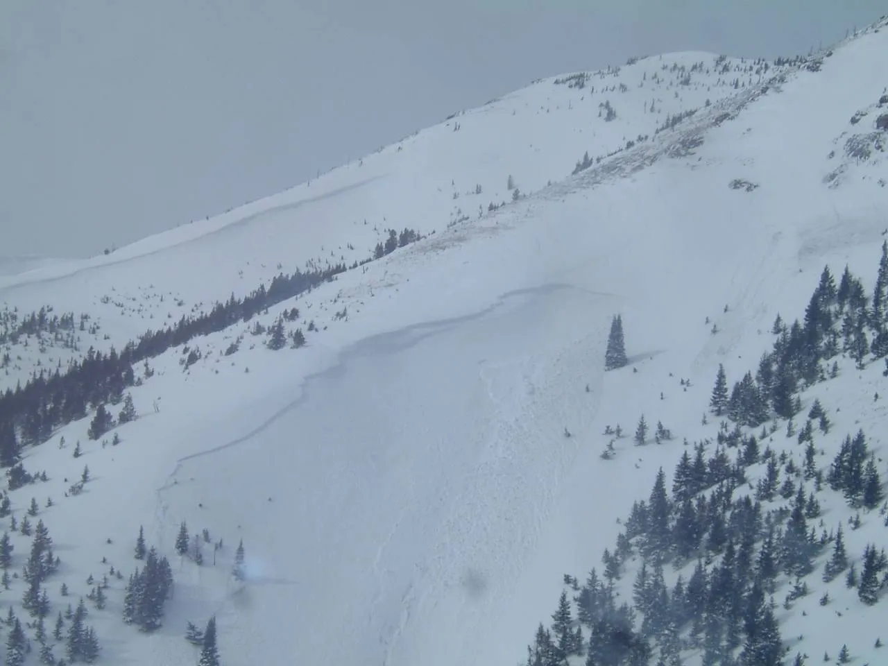 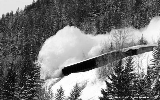 |
|
| 2006-02-25 | 01:10:00 | Path 1163 | Steiner | SS | Artificial : Explosive | - | R3 | - | - | T | C | 0 | 0 | 0 | 0 | 0 | 0 | 0 | 0.00 | MR | - | - | No | 0 | 0 | No | 0 | 0 | - | - | No Image | |||
| 2006-02-24 | 07:30:00 | Jakes (MP 1161.9) | Steiner | SS | Natural | N | R2 | U | U | T | U | 0 | 0 | 0 | 0 | 0 | 0 | 0 | 0.00 | BR | - | U | U | No | 0 | 0 | No | 0 | 0 | - | Debris terminated mid-path | No Image | ||
| 2006-02-24 | 07:30:00 | Path 1163 | Steiner | SS | Natural | N | R2 | - | - | M | - | 0 | 0 | 0 | 0 | 0 | 0 | 0 | 0.00 | BR | - | - | No | 0 | 0 | No | 0 | 0 | - | - | No Image | |||
| 2006-02-24 | 07:30:00 | Shed 8 | Steiner | SS | Natural | N | R1 | - | - | M | L | 0 | 0 | 0 | 0 | 0 | 0 | 0 | 0.00 | TK | - | - | No | 0 | 0 | No | 0 | 0 | - | - | No Image | |||
| 2006-02-24 | 07:30:00 | Shed 9 | Steiner | SS | Natural | N | R1 | - | - | B | R | 0 | 0 | 0 | 0 | 0 | 0 | 0 | 0.00 | TK | - | - | No | 0 | 0 | No | 0 | 0 | - | - | No Image | |||
| 2006-02-23 | 16:00:00 | Infinity | Steiner | SS | Natural | N | R3 | D2 | - | T | - | 0 | 0 | 0 | 0 | 0 | 0 | 0 | 0.00 | BR | - | - | No | 0 | 0 | No | 0 | 0 | - | - | No Image | |||
| 2006-02-14 | 12:00:00 | Second Slide | Steiner | SS | Natural | N | R1 | - | - | T | - | 0 | 0 | 0 | 0 | 0 | 0 | 0 | 0.00 | TR | - | - | No | 0 | 0 | No | 0 | 0 | - | - | No Image | |||
| 2006-02-14 | 11:35:00 | Shed 8 | Steiner | SS | Natural | N | R2 | - | - | T | R | 0 | 0 | 0 | 0 | 0 | 0 | 0 | 0.00 | TR | - | - | No | 0 | 0 | No | 0 | 0 | - | - | No Image | |||
| 2006-02-14 | 11:30:00 | Path 1163 | Steiner | SS | - | - | R2 | - | - | M | R | 0 | 0 | 0 | 0 | 0 | 0 | 0 | 0.00 | BR | - | - | No | 0 | 0 | No | 0 | 0 | - | - | No Image | |||
| 2006-02-08 | 08:00:00 | Shed 10 | Steiner | WL | - | - | R2 | - | - | - | - | 0 | 0 | 0 | 0 | 0 | 0 | 0 | 0.00 | BR | - | - | No | 0 | 0 | No | 0 | 0 | - | - | No Image | |||
| 2006-01-16 | 16:30:00 | Path 1163 | Steiner | - | - | - | - | - | - | - | - | 0 | 0 | 0 | 0 | 0 | 0 | 0 | 0.00 | BR | - | - | No | 0 | 0 | No | 0 | 0 | - | - | No Image | |||
| 2006-01-16 | 14:30:00 | Infinity | Steiner | SS | - | - | R2 | - | - | T | L | 0 | 0 | 0 | 0 | 0 | 0 | 0 | 0.00 | TR | - | - | No | 0 | 0 | No | 0 | 0 | - | - | No Image | |||
| 2006-01-16 | 14:30:00 | Shed 10 | Steiner | - | - | - | - | - | - | - | - | 0 | 0 | 0 | 0 | 0 | 0 | 0 | 0.00 | MR | - | - | No | 0 | 0 | No | 0 | 0 | - | - | No Image | |||
| 2006-01-14 | 14:30:00 | Path 1163 | Steiner | - | - | - | - | - | - | - | - | 0 | 0 | 0 | 0 | 0 | 0 | 0 | 0.00 | MR | - | - | No | 0 | 0 | No | 0 | 0 | - | - | No Image | |||
| 2006-01-14 | 14:30:00 | Shed 8 | Steiner | - | - | - | - | - | - | - | - | 0 | 0 | 0 | 0 | 0 | 0 | 0 | 0.00 | MR | - | - | No | 0 | 0 | No | 0 | 0 | - | - | No Image | |||
| 2006-01-11 | 10:30:00 | Path 1163 | Steiner | - | - | - | - | - | - | - | - | 0 | 0 | 0 | 0 | 0 | 0 | 0 | 0.00 | BR | - | - | No | 0 | 0 | No | 0 | 0 | - | - | No Image | |||
| 2006-01-10 | 16:30:00 | Path 1163 | Steiner | U | Natural | NU | U | U | U | U | U | 0 | 0 | 0 | 0 | 0 | 0 | 0 | 0.00 | TK | - | U | U | No | 0 | 0 | No | 0 | 0 | - | Debris terminated lower-midpath | No Image | ||
| 2006-01-10 | 14:30:00 | Infinity | Steiner | SS | Natural | N | R2 | D2 | U | T | R | 0 | 0 | 0 | 0 | 0 | 0 | 0 | 0.00 | TR | - | U | U | No | 0 | 0 | No | 0 | 0 | - | Terminated in main-upper path | No Image | ||
| 2006-01-10 | 14:30:00 | Jakes (MP 1161.9) | Steiner | L | Natural | NU | U | U | U | U | U | 0 | 0 | 0 | 0 | 0 | 0 | 0 | 0.00 | MR | MP | U | U | No | 0 | 0 | No | 0 | 0 | - | Debris terminated mid-path | No Image | ||
| 2006-01-10 | 14:30:00 | Path 1163 | Steiner | U | Natural | NU | U | U | U | U | U | 0 | 0 | 0 | 0 | 0 | 0 | 0 | 0.00 | MR | - | U | U | No | 0 | 0 | No | 0 | 0 | - | Debris terminated mid-path. | No Image | ||
| 2006-01-10 | 14:30:00 | Shed 9 | Steiner | L | - | - | - | - | - | B | R | 0 | 0 | 0 | 0 | 0 | 0 | 0 | 0.00 | BR | - | - | No | 0 | 0 | No | 0 | 0 | - | - | No Image | |||
| 2005-03-28 | 10:30:00 | Shed 7 West | Steiner | SS | Natural | NU | R2 | D2.5 | U | M | U | 0 | 0 | 0 | 0 | 0 | 0 | 0 | 0.00 | TK | - | U | U | No | 0 | 0 | No | 0 | 0 | - | Debris ran to the Shed 7 East confluence. | No Image | ||
| 2005-03-28 | 10:25:00 | Shed 8 | Steiner | SS | Natural | NU | R2 | D2 | U | T | U | 0 | 0 | 0 | 0 | 0 | 0 | 0 | 0.00 | TK | - | U | U | No | 0 | 0 | No | 0 | 0 | - | Debris terminated above the rail. | No Image | ||
| 2005-03-28 | 10:20:00 | Shed 7 East | Steiner | SS | Natural | NU | R2 | D2 | U | M | U | 0 | 0 | 0 | 0 | 0 | 0 | 0 | 0.00 | TK | - | U | U | No | 0 | 0 | No | 0 | 0 | - | Debris terminated above the rail. | No Image | ||
| 2005-03-28 | 10:00:00 | Path 1163 | Steiner | SS | Natural | NU | R2 | D2 | U | T | U | 0 | 0 | 0 | 0 | 0 | 0 | 0 | 0.00 | TR | - | U | U | No | 0 | 0 | No | 0 | 0 | - | Debris ran to mid-path terminating above the rail under the west-facing lower headwall. | No Image | ||
| 2005-01-19 | 09:55:00 | Java | Steiner | SS | Natural | NU | R4 | D3 | U | T | U | 0 | 0 | 0 | 0 | 0 | 0 | 0 | 0.00 | BR | - | U | U | No | 0 | 0 | No | 0 | 0 | - | Java Mtn. looker's center path, entire path released. | No Image | ||
| 2005-01-19 | 09:30:00 | Java | Steiner | SS | Natural | NU | R2 | D2 | U | T | U | 0 | 0 | 0 | 0 | 0 | 0 | 0 | 0.00 | U | - | U | U | No | 0 | 0 | No | 0 | 0 | - | Java Mtn. path on looker's left side. | No Image | ||
| 2005-01-19 | 09:30:00 | Java | Steiner | SS | Natural | NU | R2 | D2 | U | T | U | 0 | 0 | 0 | 0 | 0 | 0 | 0 | 0.00 | U | - | U | U | No | 0 | 0 | No | 0 | 0 | - | Java Mtn. looker's right side. | No Image | ||
| 2005-01-18 | 11:00:00 | Shed 5 | Steiner | U | Natural | NU | R2 | D2 | U | T | U | 0 | 0 | 0 | 0 | 0 | 0 | 0 | 0.00 | U | - | U | U | No | 0 | 0 | No | 0 | 0 | - | Debris terminated above the rail. | No Image | ||
| 2005-01-18 | 10:52:00 | Shed 7 West | Steiner | SS | Natural | NU | R2 | D3 | U | T | U | 0 | 0 | 0 | 0 | 0 | 0 | 0 | 0.00 | TK | - | U | U | No | 0 | 0 | No | 0 | 0 | - | Debris ran mid-path terminating above the rail. | No Image | ||
| 2005-01-18 | 09:30:00 | Infinity | Steiner | SS | Natural | NU | R2 | D2 | U | U | U | 0 | 0 | 0 | 0 | 0 | 0 | 0 | 0.00 | TR | - | U | U | No | 0 | 0 | No | 0 | 0 | - | Debris ran mid-path terminating above the rail. | No Image | ||
| 2005-01-18 | 09:25:00 | Path 1163 | Steiner | SS | Natural | NU | R2 | D2.5 | U | U | U | 0 | 0 | 0 | 0 | 0 | 0 | 0 | 0.00 | TR | - | U | U | No | 0 | 0 | No | 0 | 0 | - | Debris ran 2/3 path terminating above the rail. | No Image | ||
| 2005-01-18 | 01:10:00 | Shed 10 | Steiner | SS | Natural | NU | R2 | D2.5 | U | T | U | 0 | 0 | 0 | 0 | 0 | 0 | 0 | 0.00 | U | - | U | U | No | 0 | 0 | No | 0 | 0 | - | Debris terminated above the rail. | No Image | ||
| 2005-01-17 | 20:30:00 | Jakes (MP 1161.9) | Steiner | WS | Natural | NU | R2 | D1 | U | U | U | 0 | 0 | 0 | 0 | 0 | 0 | 0 | 0.00 | TR | - | U | U | No | 0 | 0 | No | 0 | 0 | - | Debris terminated above the rail. | No Image | ||
| - | Ukn | - | - | - | - | - | - | - | - | - | - | - | - | - | - | - | - | - | - | - | - | - | - | - | No | 0 | 0 | No | 0 | 0 | - | - | No Image | |
| - | Ukn | - | - | - | - | - | - | - | - | - | - | - | - | - | - | - | - | - | - | - | - | - | - | - | No | 0 | 0 | No | 0 | 0 | - | - | No Image | |
| - | Ukn | - | - | - | - | - | - | - | - | - | - | - | - | - | - | - | - | - | - | - | - | - | - | - | No | 0 | 0 | No | 0 | 0 | - | - | No Image | |
| - | Ukn | - | - | - | - | - | - | - | - | - | - | - | - | - | - | - | - | - | - | - | - | - | - | - | No | 0 | 0 | No | 0 | 0 | - | - | No Image |